
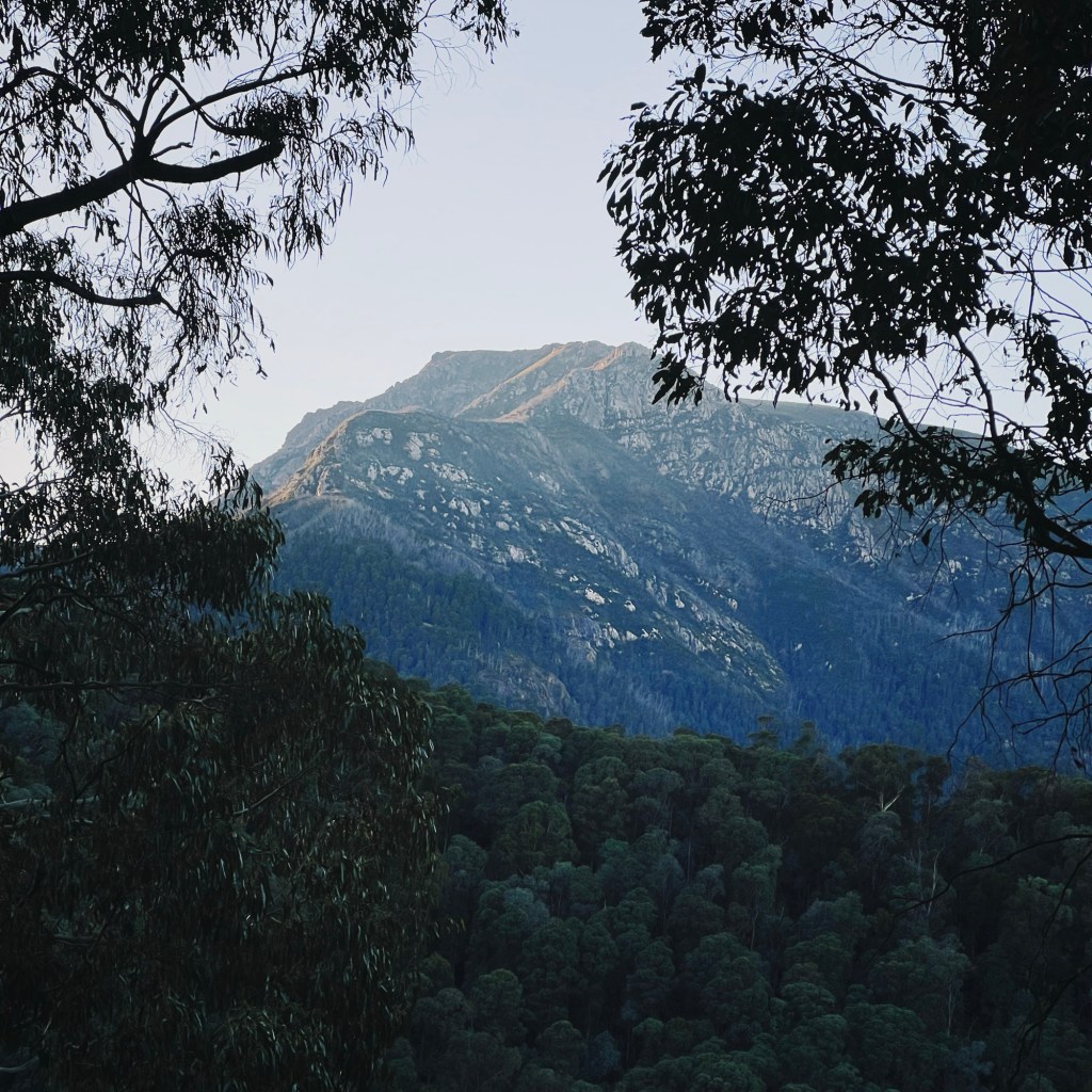
There’s something special about seeing the Main Range from below. Australia’s highest mountains, viewed from the valley floor, look more like something out of Europe than the Snowies. While most rides in Kosciuszko National Park traverse the high plains, this one flips the perspective. With a winding mix of champagne gravel through the ferny forest, a couple of waterfalls, and a deep gorge to explore on foot, it’s hard to believe this loop isn’t better known. Whether tackled as an overnighter or a big day out, the Geehi Reservoir Loop is a hidden gem worth spinning the wheels for.

Skip to:
- Quick Look
- About Kosciuszko National Park
- Where to Start the Geehi Reservoir Loop
- Best Time to Ride the Geehi Reservoir Loop
- Where to Camp Nearby the Geehi Reservoir Loop
- Trip Report
- Tips for Riding the Geehi Reservoir Loop
Quick Look
Distance: 66km
Elevation: 2075m
Duration: 1-2 Days
Surface: 100% Gravel
Skill Level: Intermediate
Location: Kosciuszko National Park, NSW
GPX: https://ridewithgps.com/routes/48916843
About Kosciuszko National Park
Kosciuszko National Park sits on the traditional lands of the Ngarigo People, who have lived on and cared for this country for thousands of years. The arrival of European settlers in the 1820s had a devastating impact on the Ngarigo people and the delicate alpine environment. In 1949, the Snowy Mountains Hydro Scheme began transforming the landscape; introducing the Geehi Dam alongside 15 other dams, 7 power stations, 80 kilometres of aqueducts, 145 kilometres of trans-mountain tunnels, and countless tracks (including this very route).
Where to Start the Geehi Reservoir Loop
The loop begins and ends at the intersection of the Alpine Way and Olsens Road, which is just over a 3-hour drive south from Canberra. The nearest town is Khancoban, just a 30-minute drive away. For anyone coming from Canberra or Sydney, the route passes through Jindabyne before turning onto the Alpine Way, about 1.5 hours from the start of the loop. The Alpine Way is as scenic as it is winding, so take it slow on the bends and keep an eye out for wildlife along the way.
Best Time to Ride the Geehi Reservoir Loop
Geehi Reservoir Road is closed to cars in winter, from the June long weekend (King’s Birthday) through to the October long weekend (Labour Day), making it the perfect time for a quieter ride. I’d aim for late September or early October while the road’s still closed, but the temps start to lift. That said, it’s still the Snowy Mountains, and the valley can get cold, so pack warm gear just in case. Just remember, this is the Snowy Mountains, so always check weather conditions before heading out, as it can snow even this low down.
Where to Stay Nearby the Geehi Reservoir Loop
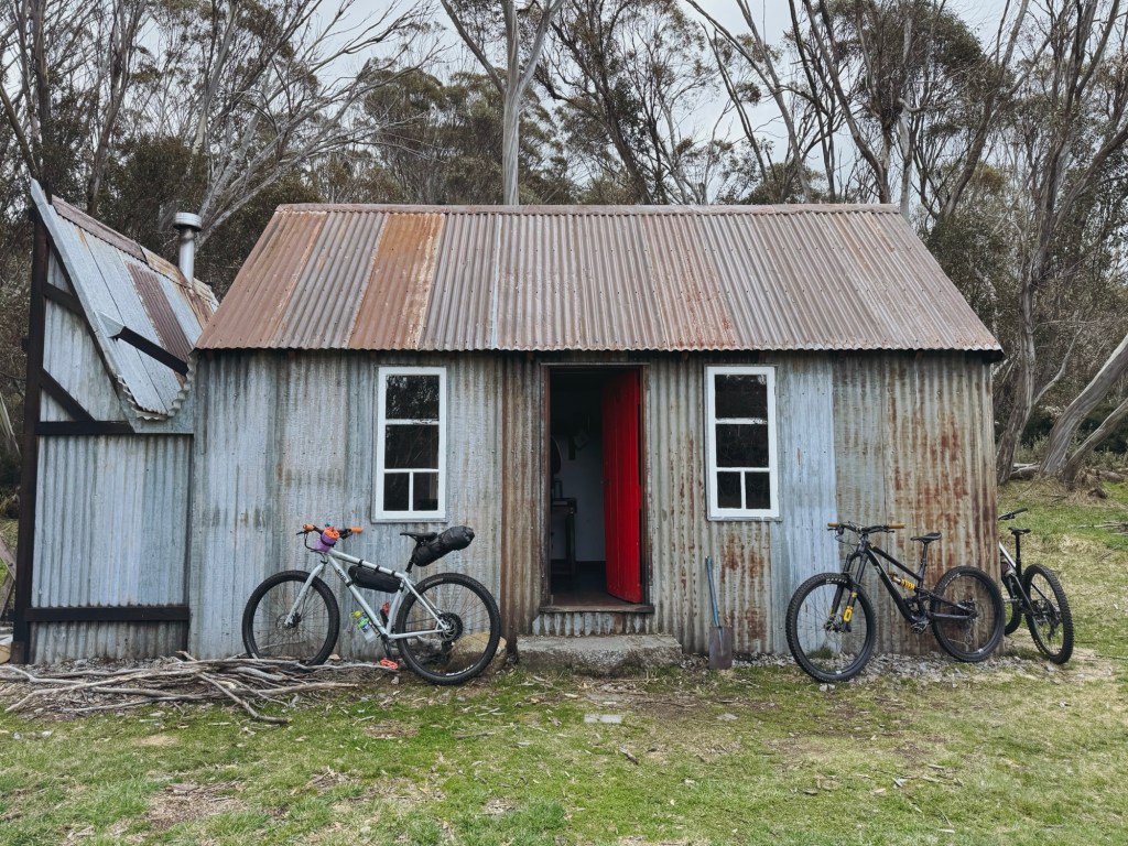
For those coming from further away or keen to turn the ride into a weekend trip, Geehi Flats Campground is nearby. It has long-drop toilets, a cool river stone hut, epic views of the Main Range behind the airstrip and crystal-clear swimming spots all along the Geehi River. Just make sure to book ahead through the National Parks website.
Trip Report
Alpine Way to Olsens Lookout
Parking the car at the intersection of Olsens Road and the Alpine Way, the ride gets straight into it with a gradual 10-kilometer climb. This steep start might raise some eyebrows, but trust me, it’s worth every pedal stroke. Take the short detour to Olsens Lookout, and you’re treated to the best views of the Main Range. With a well-placed picnic table, it’s the perfect spot to rehydrate, and refuel.
Olsens Lookout to Bellavista
With the long climb behind, the trail transitions to a gentler, undulating gradient weaving through dense forest on smooth gravel roads. Soon, Bellavista appears at the intersection of the Geehi Link, a relic from the Snowy Scheme. Once a bustling townsite housing over a thousand workers that were building the nearby dam and aqueducts. All that remains now is a bit of rubble, though it’s a cool historical site worth mentioning.

Bellavista to Geehi Reservoir
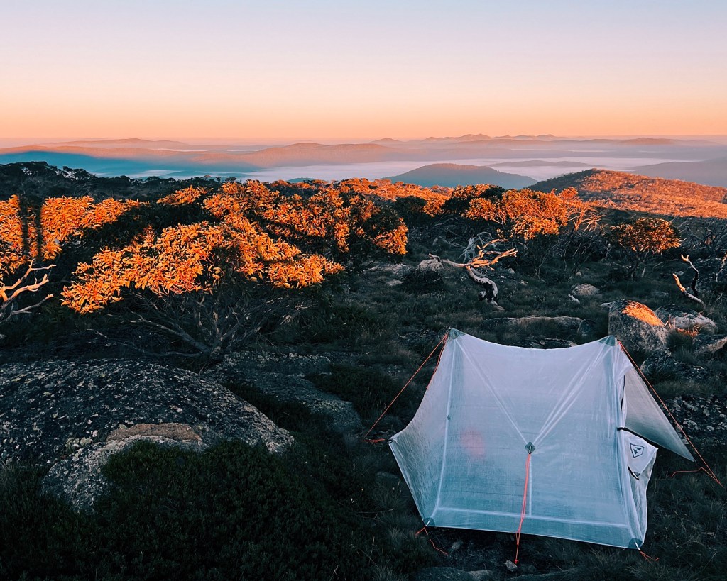
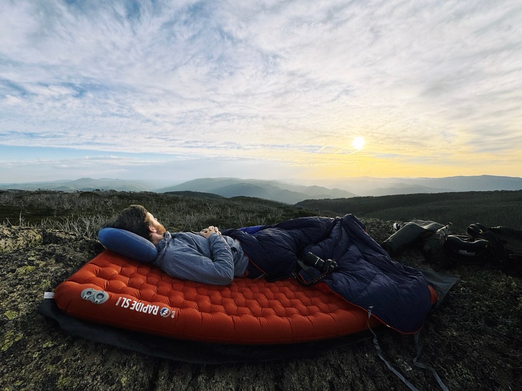
Continuing on, the Geehi Dam comes into view as the descent takes you over Middle Creek Waterfall. This is a great place to camp for those planning an overnight stay, with a small weir nearby and a grassy area perfect for pitching a tent. Just be prepared for the occasional hum of machinery from the (sometimes) active Snowy Hydro Buildings in the area.

Geehi Reservoir to Verandah Camp
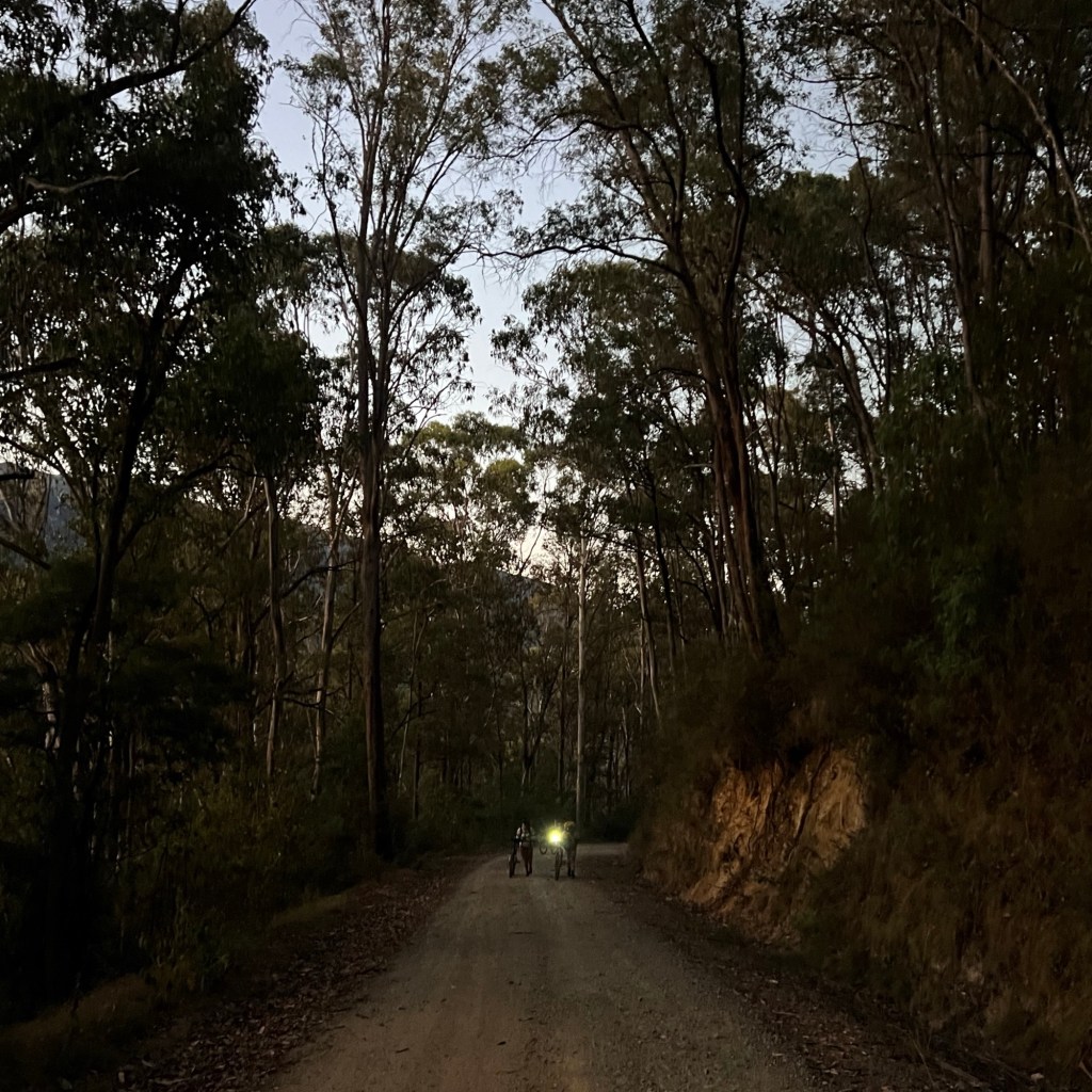
Crossing the dam wall marks the end of the public road, and the adventure really begins. Beyond this point, only National Park and Snowy Hydro vehicles access the Geehi River Aqueduct Track. The route gets rougher, with rugged gravel 4×4 tracks making for a more interesting ride. Little streams feed into the aqueduct, and with some luck, a few lyrebirds might make an appearance.
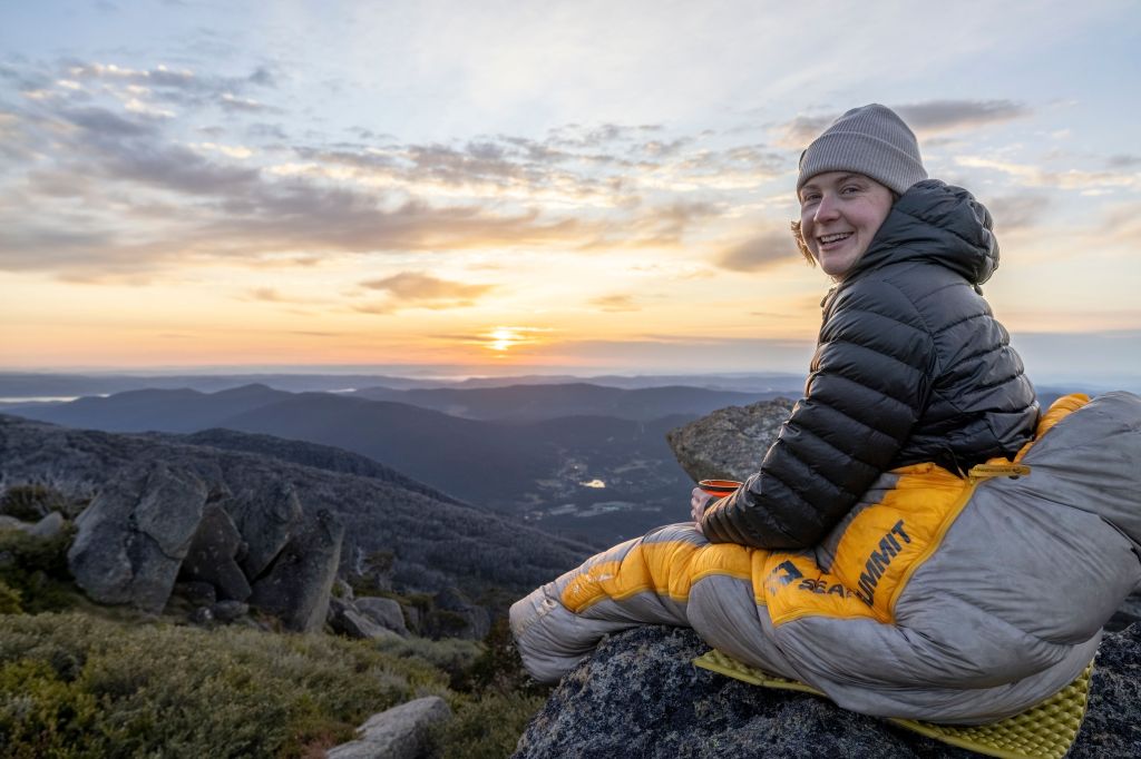
Just past the turnoff for the Geehi Link Road, the trail becomes the Lady Northcote Canyon Track. Here, it ramps up with steep, short pinches that will get the heart rate up. We spotted a large sambar deer strutting through this section, who stopped to honk at us for a little, before running off into the bush. Before long, you’ll pass Verandah Camp, an old Snowy Mountains worksite that saw its final days in the 1970s. This is another nice spot to camp, however water can be unreliable from the nearby Verandah creek, and there are no toilets around.

Watsons Gorge & Siren Song Tunnel
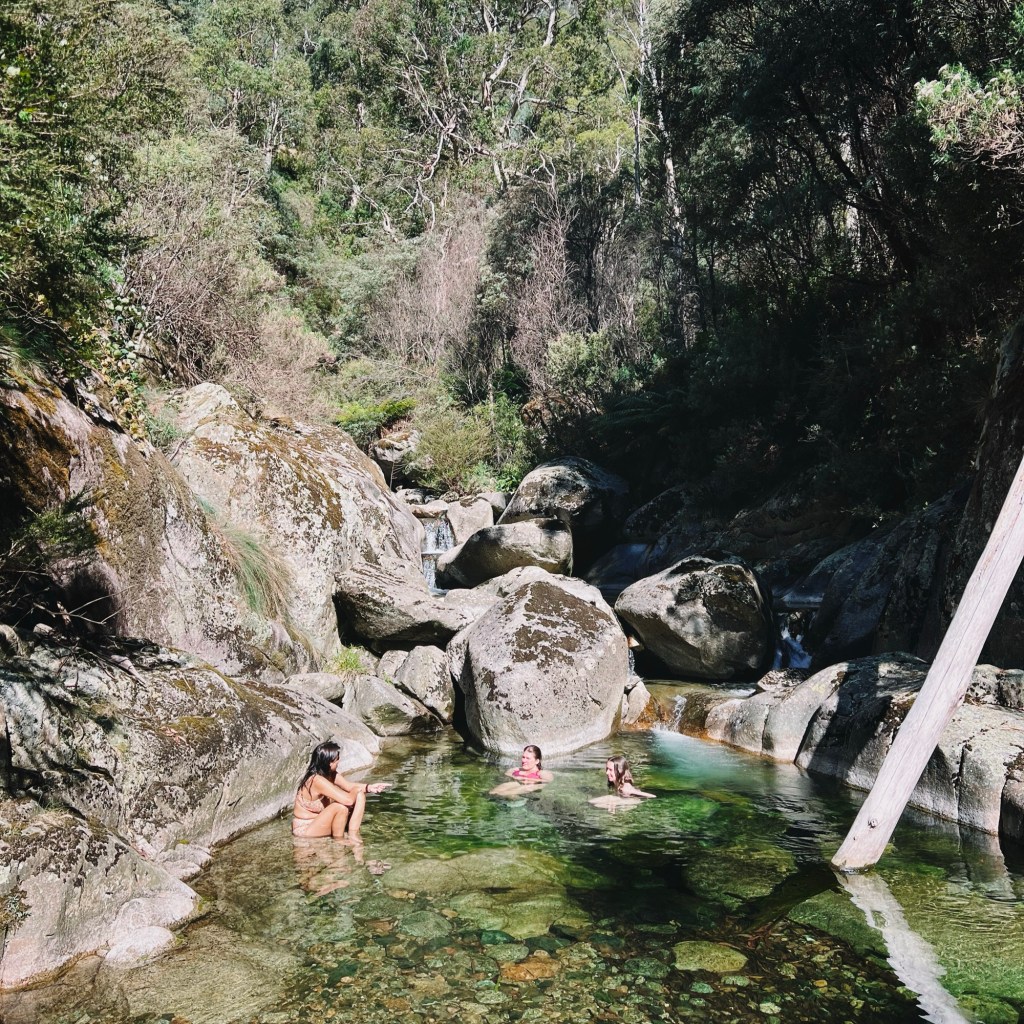
This section is the pièce de résistance of the entire track, with the towering walls of the Main Range mountains reappearing as the trail turns east. Soon, you’ll reach Watsons Gorge: a jaw-dropping feature that begs to be explored. It’s a perfect place to wander through and find a spot for a refreshing dip.
The track eventually ends at the Siren Song Tunnel, a 2.5-kilometer tunnel burrowing under the mountains. While it’s tempting to venture inside, it’s strictly off-limits for safety reasons. Water can surge through unexpectedly (flooding the tunnel), but the waterfall at the entrance is well worth checking out.

Closing the loop
To finish the loop, head back to the Geehi Link Road, which takes you to the other side of the valley and back to Geehi Dam Road. Get ready for a fast descent down to the Geehi River, but don’t celebrate too soon as it’s followed by a steep climb on the other side of the valley. Take a moment to cool off and refill water before bracing for the last push.
Remember that grueling 10-kilometer climb at the start? Now it’s a rewarding, fast descent with stunning landscapes racing by, marking the perfect finale back to the car.
Tips for the Geehi Reservoir Loop
Bike: The track has its share of rough spots, especially on Lady Northcote Canyon Track. A mountain bike or gravel bike with chunky tires will make life a lot easier. Be sure to pack essential bike repair tools (this is remote area with no phone reception after all).
Phone Service: Reception is virtually nonexistent down here. Download offline maps and always carry a form of emergency communication like a satellite phone or PLB
Water: Plenty of creeks and streams are along the way. Make sure to fill-up when you can, and treat or filter water before drinking.
Wildlife: Keep an eye out for wildlife, especially in the early morning or late afternoon. Kangaroos, sambar deer, and the occasional snake call this place home. Make sure to carry a first aid kit with a snake bandage, and know how to use it.
Toilets : Be prepared for a lack of toilets. It’s important to follow Leave No Trace principles and bring a trowel for proper waste disposal if nature calls.
Disclaimer: Content on Path & Pedal is for general information and inspiration only. All route guides and trip reports are based on personal experience and research at the time of writing. Conditions, access, weather, and regulations can change. Always check official sources and use your own judgment. Outdoor adventures carry risk, and Path & Pedal accepts no liability for injury, loss, or damage.

Leave a comment