Every now and then, a trail comes along that truly humbles. One that pushes limits, upends plans, and leaves even the most seasoned hiker questioning their decisions. That was our multi-sport adventure into Hidden Valley: a trip we seriously underestimated but will never forget.
Route Overview
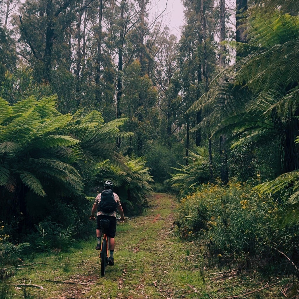
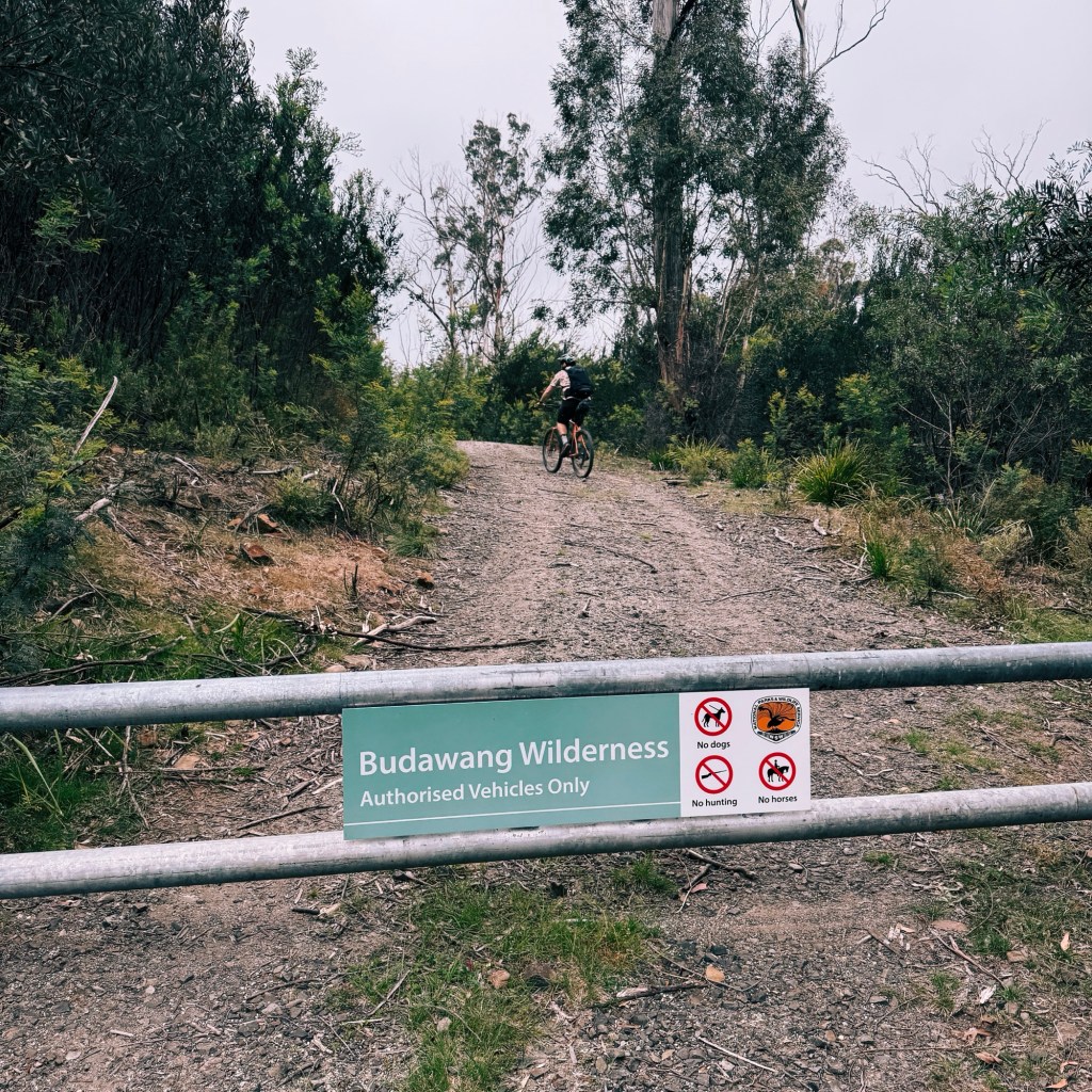
Hidden Valley, tucked away in the Budawang Wilderness of Morton National Park, is as elusive as the name suggests. Since the 2020 bushfires, the area has been overtaken by dense regrowth, with some trails fading into barely a footpad. It’s a 42km return hike, but the first 15km are on a 4×4 track that is a section of the world class bikepacking route, the “Attack of the Buns”. We decided to speed things up by riding our bikes, stashing them when the trail turned into single track, and hiking the remaining kilometres.
Skip to:
- About the Budawang Wilderness
- Where to Start the Hike to Hidden Valley
- Skill Level Needed to Hike to Hidden Valley
- Camping Restrictions in the Budawang Wilderness
- Trip Report
- Tips for Hiking to Hidden Valley
Quick Look
Distance: ~42 km (return)
Elevation: ~1100 m (return)
Duration: 2 Days
Skill Level: Advanced (beginner explained in ‘skill level’)
Location: Budawang Wilderness, Morton National Park, NSW
GPX: https://ridewithgps.com/routes/49431708
About the Budawang Wilderness
The Budawang Wilderness is a place of profound cultural significance, on the traditional lands of the Yuin, Dharawal, and Gundungurra peoples. From rock art, sacred ceremonial grounds, and middens, to the dreamtime stories of the Endrick River, there’s a deep connection to country here.
If national parks had personalities, the Budawang Wilderness would be that effortlessly cool friend. It has the rugged beauty of the Blue Mountains without the tourist crowds, a touch of Kosciuszko’s alpine vibe minus the snow, and a dash of prehistoric charm like the Warrumbungles without the long drive (for me).
Where to Start the Hike to Hidden Valley
There are two nearby access points to Hidden Valley: Sassafras (north) and Nerriga (south). From Canberra, Nerriga is just under a 2-hour drive north, whilst Sassafras is just under a 3-hour drive south from Sydney. We parked at the Morton National Park gate on the Alum Creek Firetrail just off Meangora Road. Be mindful not to block the gate, as it’s also a driveway for landowners who graciously allow hikers and cyclists to pass through their property to access the park.

Skill Level Needed to Hike to Hidden Valley
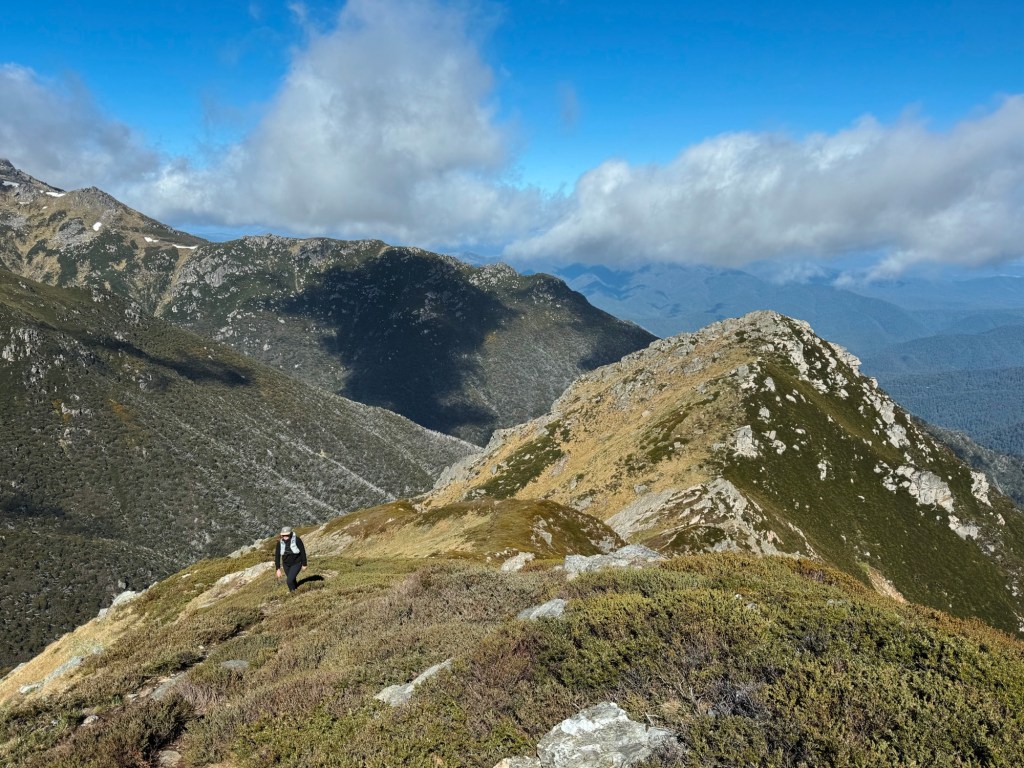
This adventure is for advanced hikers. The first 15 km might lull you into a false sense of security with an easy 4×4 track, but don’t be fooled. The trail deteriorates quickly after the Mount Tarn turnoff, so strong navigational skills are essential.
For beginner hikers looking to experience the area, I recommend hiking (or biking) the first 15 kms of this route and continuing a further 2 km past the Mount Tarn Walking Track turn-off to Camp Rock. The trail is well-defined to this point and it’s an awesome camping spot for an overnight trip.
Camping Restrictions
Camping isn’t permitted in Hidden Valley or other protected areas, including Monolith Valley, Castle Saddle, The Vines rainforest, or along the Two Rivers Track south of Little Forest Walk car park. Cave or overhang camping is allowed only in specific locations (listed here) or in emergencies, such as sudden storms or injuries. To help preserve the Budawangs’ natural beauty, follow Leave No Trace principles, and respect camping guidelines.
Trip Report
Day 1: 21km, 520m Elevation Gain
As Josh had work Saturday morning, we didn’t leave Canberra until 1 pm, rolling up to the trailhead around 3 pm. Mistake #1: starting way too late in the day. The forecast promised a warm 30°C with clear skies, but by the time we arrived, the temperature had dropped to a brisk 18°C. Sure, it was better for riding, but the ominous grey clouds looming in the distance felt like a warning sign.
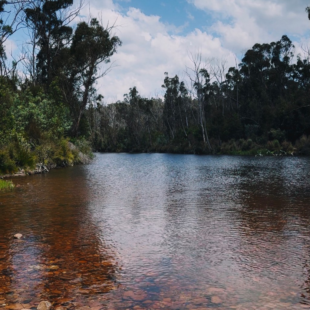
We hopped on our bikes, passed through the gate, and followed the 4×4 track as it curved left onto Red Ground Track. After an easy crossing of the Endrick River, we reached another gate marking the official entrance to the Budawang Wilderness.
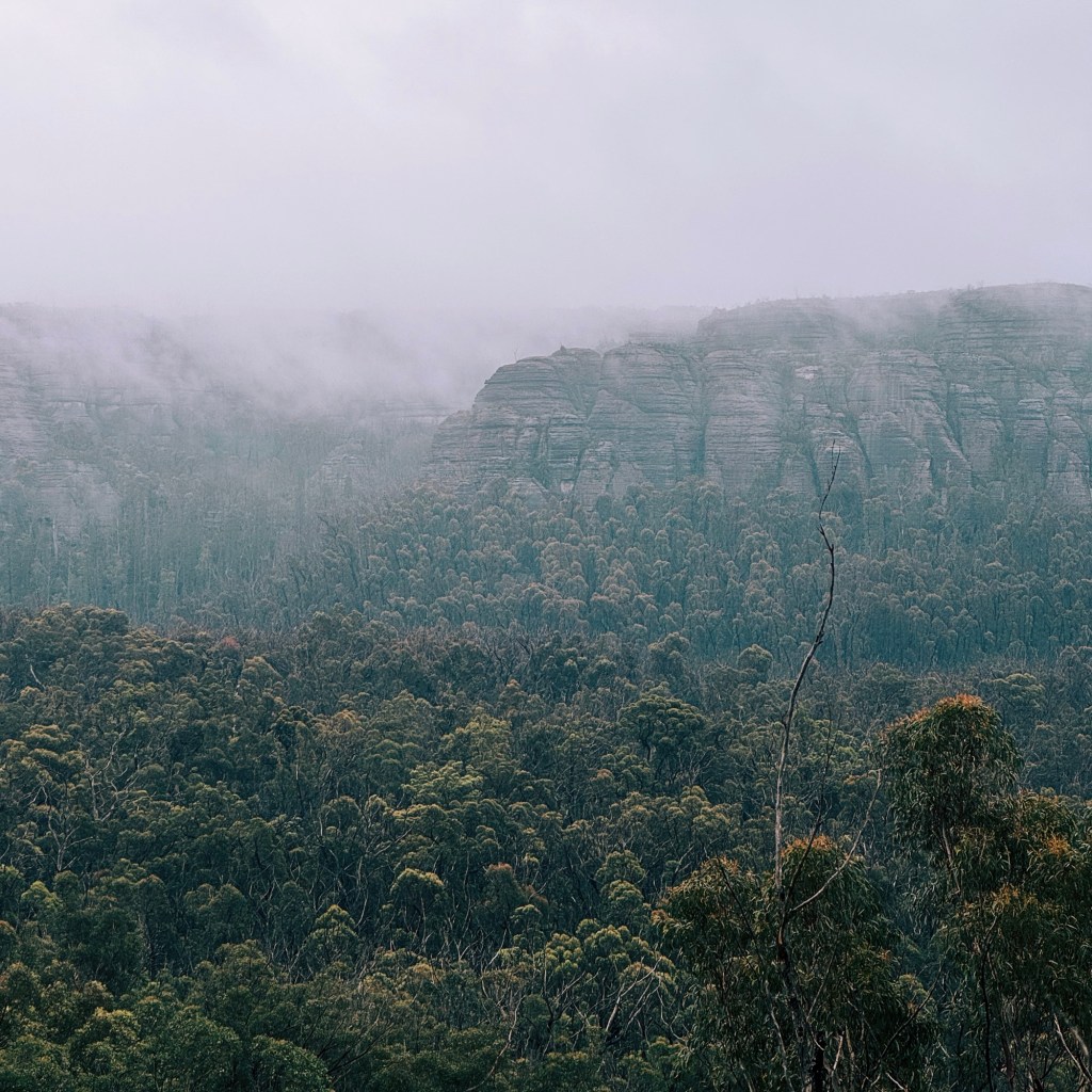
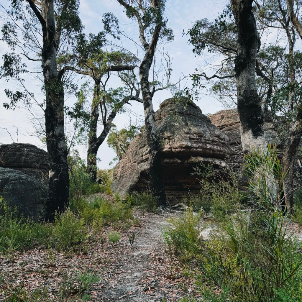
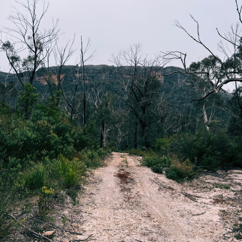
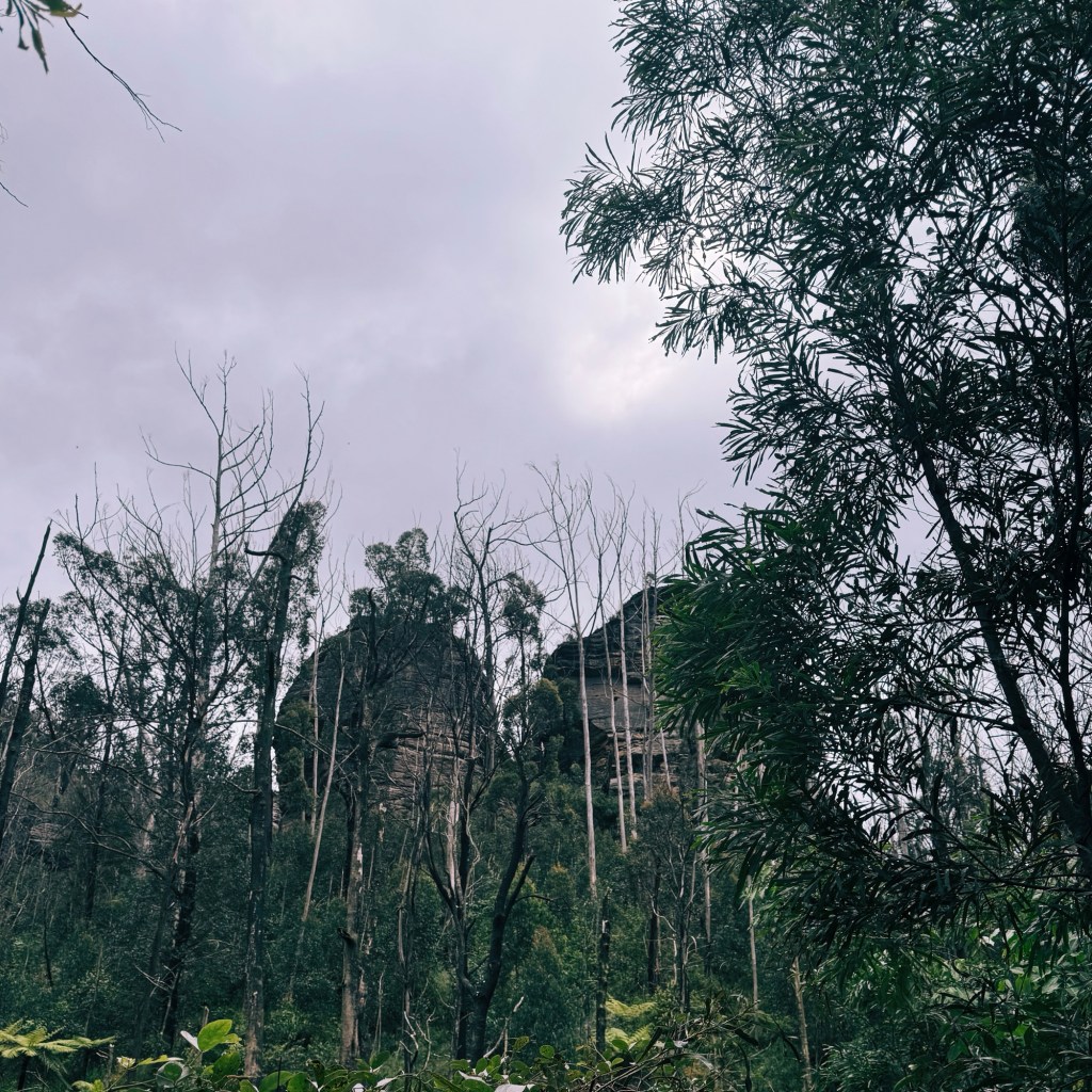
The trail started to climb, and soon we caught our first glimpse of the massive cliffs this area is famous for. With a rough and rocky descent ahead, it was hard to keep my eyes on the trail when the towering walls stole my attention. The path eventually flattened into a grassy valley with breathtaking views, though they were overshadowed by a grey band of rain coming straight toward us. After crossing the Endrick River again, we turned left onto the Endrick River Track.
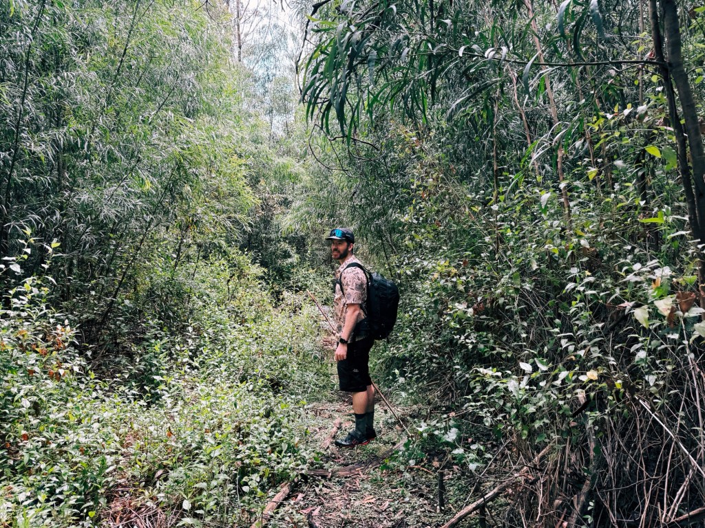
We soon arrived at the turnoff to the Mount Tarn Walking Track, just as the shadowy canopy known as “The Vine” came into view. We stashed the bikes behind some trees, and right on cue, the rain hit. Part of me wanted to call it a day and ride the 2-kilometres further to Camp Rock. But with three hours of daylight left, we convinced ourselves to push on.
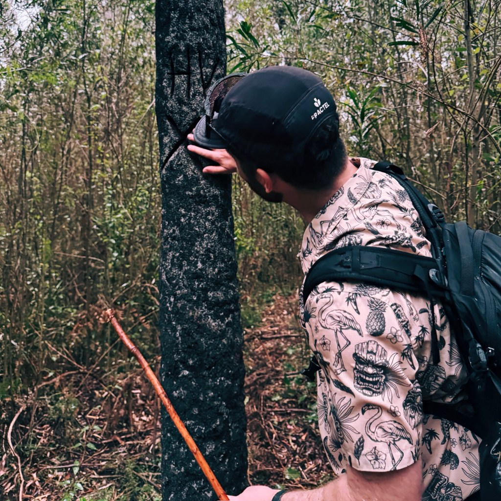
Within minutes, we were drenched with the rain pouring down and wet regrowth brushing against every limb. The trail started off promising, with signs of recent maintenance, but head-high spear grass and tangling vines quickly slowed us down. As the wind picked up, a massive tree fell far too close for comfort, its thunderous crack echoing through the valley. Heart racing, we spotted the “HV” carved into a tree, marking the turnoff to Hidden Valley.
From here, the track was practically non-existent. We bush-bashed our way uphill, choosing the path of least resistance. Eventually, we reached a rock garden at the base of the cliffs, a spot that looked like a decent place to camp. With daylight fading fast, increasing winds, and now lightning strikes signalling the storm was intensifying, we decided our safest option was to camp under a nearby cliff for protection from any falling trees.
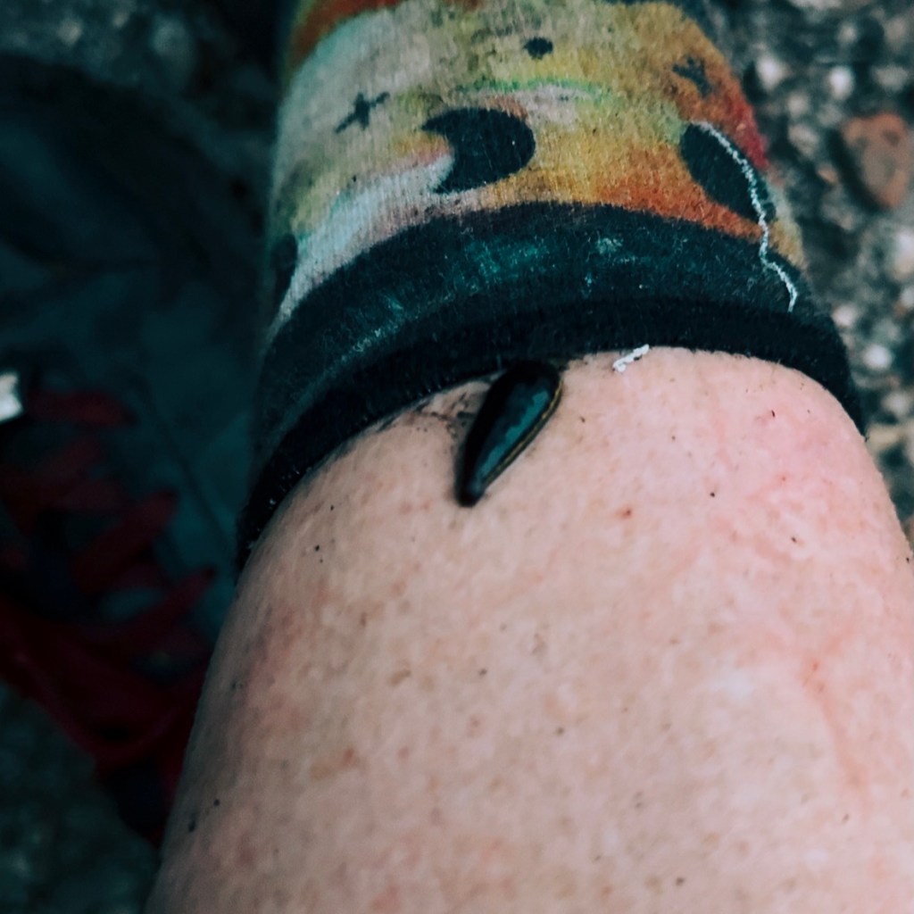
We pitched the tent on a flat-ish rock slab and stripped off our soggy clothes, only to discover fat leeches clinging to our legs. When we checked our shoes, even more of the sneaky bloodsuckers came climbing out. Caught up in the adrenaline of the hike, we hadn’t even thought to check ourselves for these nasty critters.
Day 2: 21km, 530m Elevation Gain
The next morning, we woke to a slightly clearer view. Though some morning fog lingered, it was a treat to finally take in our surroundings. Sitting on a nearby rock, we ate breakfast and watched as clouds drifted in and out of the valley below. Once packed up, we tackled the final kilometre, climbing up and over to enter Hidden Valley.

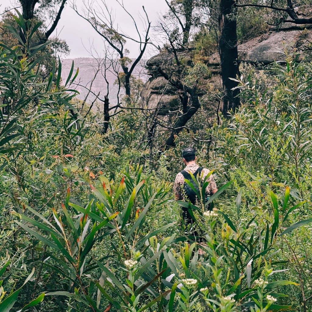
As the trail skirted the base of the cliffs, it became more defined, weaving through a narrow rocky gorge. The excitement built as we were finally about to step into Hidden Valley. Then, just like that, the path abruptly ended. We could see the valley’s centre just ahead, catching glimpses of it through the trees, but dense, impenetrable bush surrounded us on all sides.

We couldn’t leave without at least trying to stand in the heart of the valley. Following the footpad toward Dark Brothers Cave, we hoped to cut in, but the regrowth was unrelenting. Back at the trail’s end, we tried pushing forward along the creek line. It took an hour to slog through just 500 metres. Mentally and physically defeated, we decided to save Dark Brothers Cave and Mt Sturgiss for another trip (one with more time and better weather).

The return trip was much faster, aside from the constant paranoia about leeches. After the overnight rain, we were flicking them off our shoes every few steps. At least the views were clearer this time, though the residual water on the overhanging plants left us just as drenched as before. Finally, reaching the bikes felt like sweet salvation.
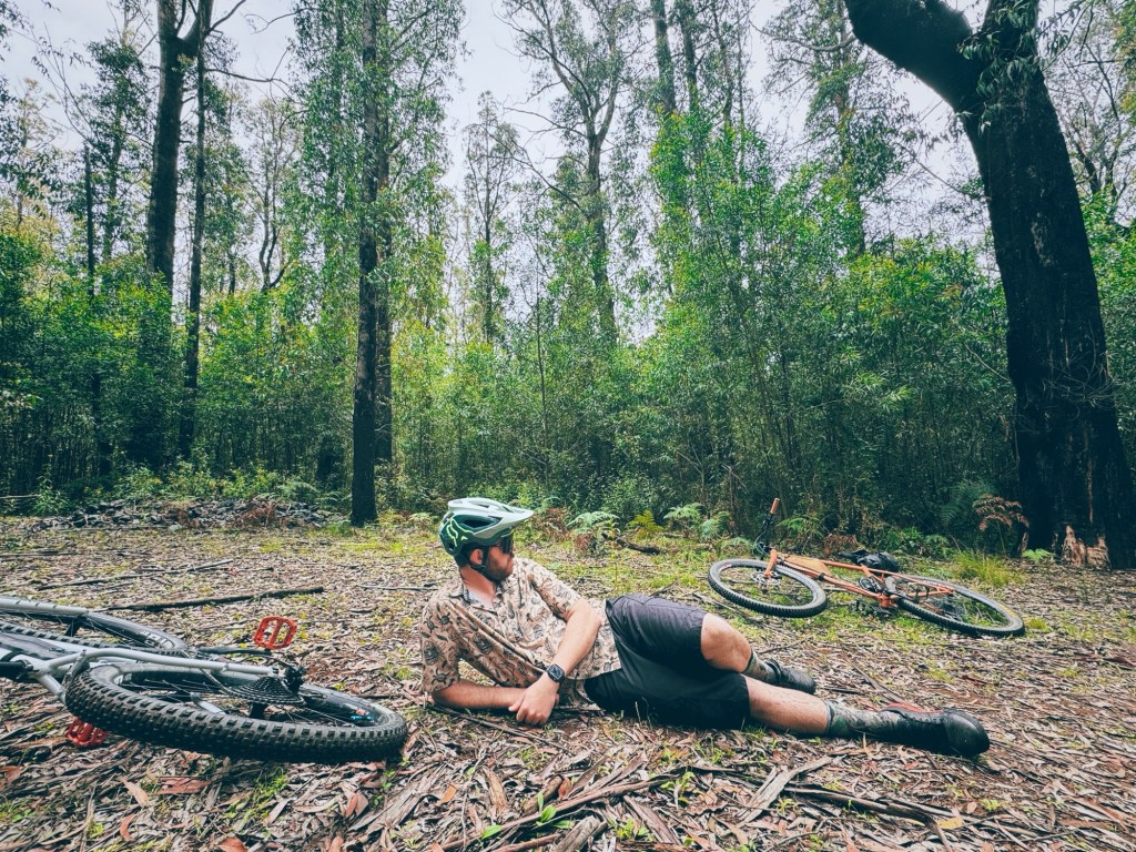
The ride home was cruisy. We passed a snake basking on a warm rock and decided to follow its lead, pausing to soak in our surroundings one last time at the next creek. When we crossed the Endrick River, we couldn’t resist a quick dip. Though “quick” turned to “instant” as soon as leeches started showing up. Water leeches? Sock leeches? Who knows? Either way, we bolted out of there.
The thought of a pub meal at the Nerriga Pub spurred us on for the final stretch. And let me tell you, nothing tastes better than a well-earned pub feed after an adventure like this.

Tips for Hiking to Hidden Valley
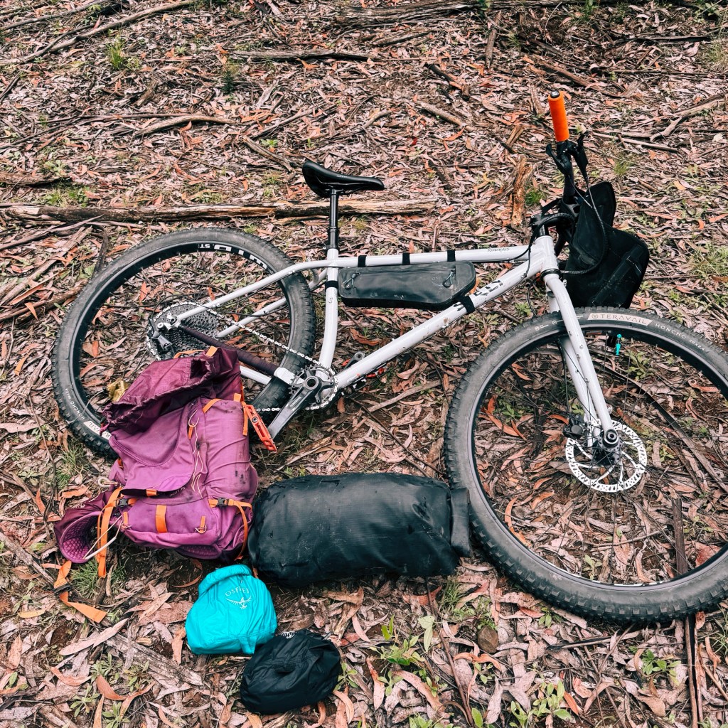
Bike: A mountain bike or sturdy gravel bike is a must for this trip. The 4×4 tracks are very rocky in places, so bring spare tubes or a repair kit.
Phone service: Phone reception is virtually nonexistent in the Budawang Wilderness. Download offline maps and always carry a form of emergency communication like a satellite phone or PLB
Closures: Check the NSW National Parks website for any closures, and warnings including fire danger before you go.
Water: Water is plentiful until the turnoff onto Mount Tarn Walking Track. Make sure fill-up when you can, and treat or filter water before drinking.
Wildlife: Be prepared to share the trail with curious lyrebirds, feral pigs and the occasional snake. Don’t forget to keep an eye out for leeches.
Regrowth: With overgrown bush and head-high spear grass, be ready for some bush-bashing and slower progress (long-sleeves recommended).
Toilets: There are no toilets along this route, so it is essential dispose of human waste correctly by carrying a trowel or poo tube.

Disclaimer: Content on Path & Pedal is for general information and inspiration only. All route guides and trip reports are based on personal experience and research at the time of writing. Conditions, access, weather, and regulations can change. Always check official sources and use your own judgment. Outdoor adventures carry risk, and Path & Pedal accepts no liability for injury, loss, or damage.

Leave a comment