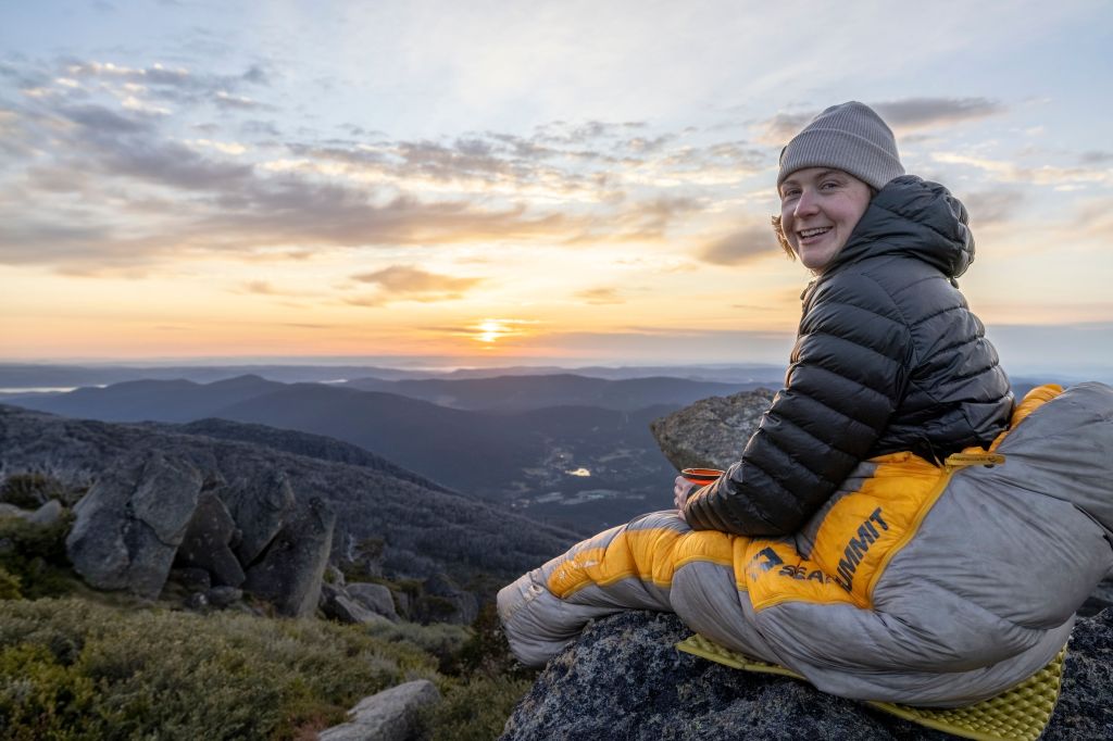
In the mountain bike (MTB) world, trail names often come with over-the-top titles like Hero, Gladiator, Heartbreaker etc (yes, all real trail names). So, when I heard about the Indigo EPIC MTB tail stretching 56km from Beechworth to Yackandandah in Victoria, I didn’t think much of the name. But now, having ridden it, I can confidently say this trail absolutely lives up to the hype. It’s nothing short of EPIC! I’m calling it one of the best intermediate MTB trails I’ve ever ridden.
Skip to:
- Quick Look
- About the Indigo Epic Trail
- Where to Start the Indigo Epic Trail
- Skill Level Needed to Ride the Indigo Epic Trail
- Where to Stay Near the Indigo Epic Trail
- Trip Report
- Tips for Riding the Indigo Epic Trail
Quick Look
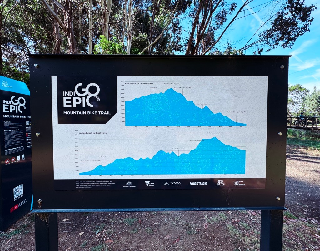
Distance: 56km (loop)
Elevation: ~1100m
Duration: 1 Day
Skill level: Intermediate MTB (no walkers, runners, horseriders or motorbikes)
Location: Beechworth/Yackandandah, Victoria
GPX: https://ridewithgps.com/routes/42190448
About the Indigo Epic Trail
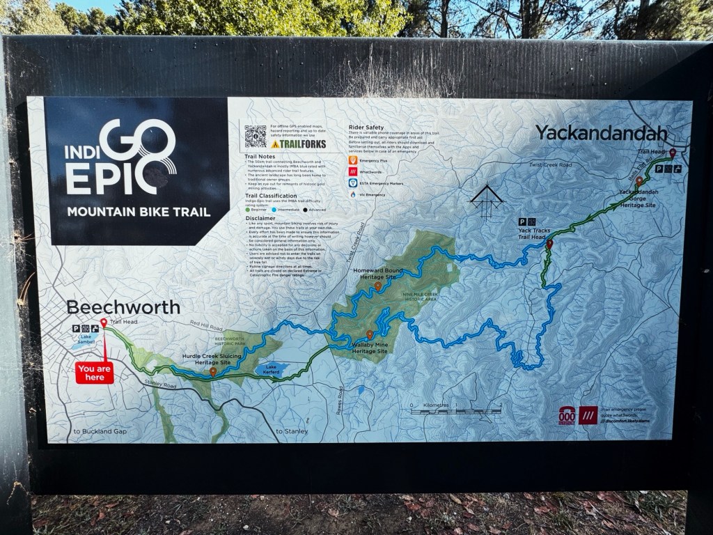
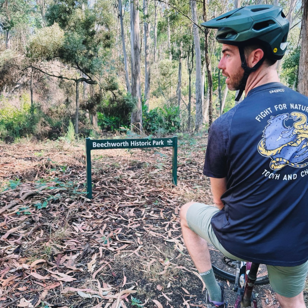
Named after the shire it calls home, the Indigo EPIC trail opened in March 2023 and offers 56km of all-mountain singletrack designed for year-round riding. Its figure-eight, one-direction loop can be tackled in a few different ways: the full 56km ride connecting Beechworth and Yackandandah (and back), a 39km out-and-back loop from Yackandandah, or a 17km out-and-back loop from Beechworth. With a mix of hand-built and machine-built trail sections, it’s rated as a blue trail, perfect for intermediate riders but still has enough side hits to keep advanced riders grinning. The trail passes through areas rich in gold rush history, including the Stanley State Forest, Beechworth Historic National Park, and the Nine Mile Creek Historic area; blending stunning natural scenery with a touch of history.
Where to Start the Indigo Epic Trail
The trail is a loop that can be started in either Beechworth or Yackandandah. Beechworth is approximately 3-hours drive north from Melbourne, whilst Yackandandah is another 20-minutes drive in a north-easterly direction. Parking at Beechworth is on Wallace street. Parking at Yackandandah is in town, on Wellsford street. If you’re looking to shave off a few kilometres and bypass the ride into Yackandandah, consider parking at the Yack Tracks trailhead. Keep in mind, this option requires you to be self-sufficient so bring your own food, a way to filter water, and you’ll miss out on the awesome pies at Gum Tree Pies in Yack.
Skill Level Needed to Ride the Indigo Epic Trail
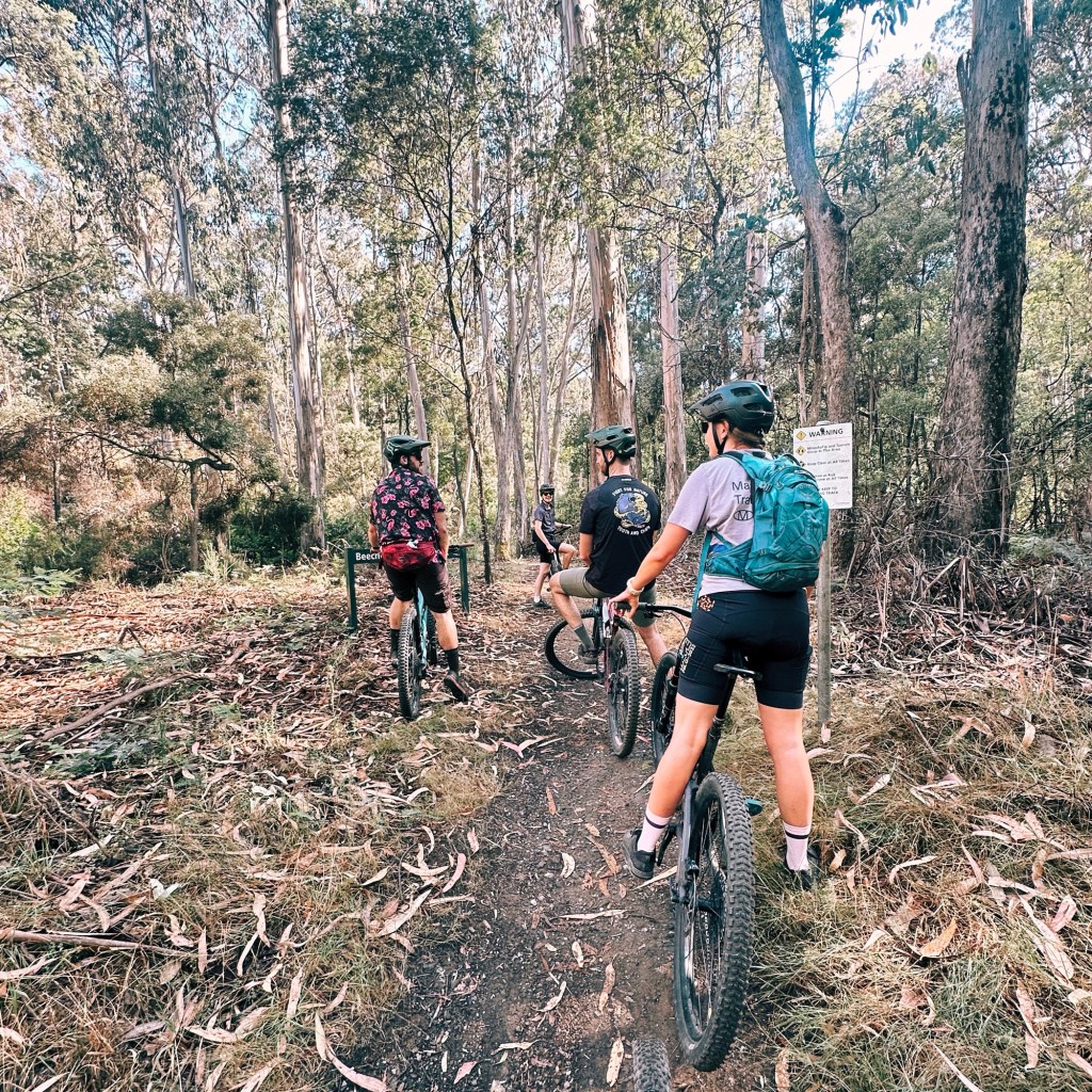
While the first few kilometres in and out of town on both ends are easy green trails, the rest of the Indigo EPIC is rated blue (intermediate). If you’re a strong beginner, I’d suggest tackling the smaller loop from Beechworth, which goes past Lake Kerferd and around. The trail is well signposted, with clear markers for A and B lines, so navigation is a breeze. Just don’t do what I did and zoom past the signs only to miss a turn!
If you’re not up for the return journey, there are other options. The paved rail trail from Yackandandah to Beechworth is a more relaxed alternative, or organize a car shuttle as it’s only a 40-minute round trip between the two towns.
Where to Stay Near the Indigo Epic Trail
If you’re after an early start or want to split the ride into two days, Beechworth Lake Sambell Caravan Park is literally at the Beechworth Trailhead. We didn’t stay there, but I did wander through to use the bathrooms and can report it’s a pretty gorgeous spot, right on the lake. At the other end of the trail in Yackandandah, there are free campsites in Stanley State Forest where the trail comes through at the Yack Track Trailhead.
Trip Report
Beechworth to Yackandandah
The ride from Beechworth starts off easy, cruising alongside the creek on a multi-directional singletrack, so be sure to watch out for walkers and bikers coming the other way. Before long, you’re surrounded by a stunning forest, with a wide path to Lake Kerferd. While the lake’s serene waters might tempt a dip, it’s Beechworth’s water reserve so swimming is a no-go.
After soaking in the views, the trail transforms into winding singletrack through lush forest along the valley floor. This section is pure magic, with greenery so vibrant it feels like the forest is alive. Eventually, the trail transitions to a 4×4 track, skirting farmland with rolling hills in the background. It then enters the Nine Mile Creek Historic Area, where a short but manageable climb awaits. It’s enough to get the heart pumping but won’t leave you gasping for air (just yet).
At the next intersection, you face a choice: head back to Beechworth or take on the second loop toward Yackandandah. This is where the real fun begins! The descent kicks off, and it’s some of the best flow trail I’ve ever ridden. We lucked out with rain the night before, leaving the dirt in perfect condition (hero dirt at its finest). The trail is loaded with features: plenty of side hits, flowing berms, and optional A and B lines to spice things up. The speed feels just right, keeping you grinning ear to ear, rolling almost entirely downhill to the Yack Tracks trailhead.

The trail flattens out after the downhill flow, giving the thighs a nice break. From here, it’s just a short ride into town to refuel, just be sure to keep an eye out for a couple of sudden road crossings. It’s also worth stopping at the Yackandandah Gorge Heritage Site. The bridge offers a fantastic view of the gorge, and if it’s a warm day, it’s the perfect spot for a quick dip in the small swimming hole.
Yackandandah to Beechworth
Once you’re loaded with pies and gelato, the trail retraces its flat-ish route past the gorge to the Yack Tracks trailhead. Prepare yourself for this climb. Tackling it in the heat of the day, we were huffing, puffing, and sweating our way up. The first climb is the steepest and toughest, with a few pinchy switchbacks near the top. My tired legs couldn’t handle all of them, and I had to hop off and push a few times.
Now past the steepest section, the trail starts skirting the hillside on a narrow path. The ups and downs are much gentler here. You’ll hear the sound of water below, and start wishing to be in the cool water of the gorge below. Don’t worry, you will be soon enough.
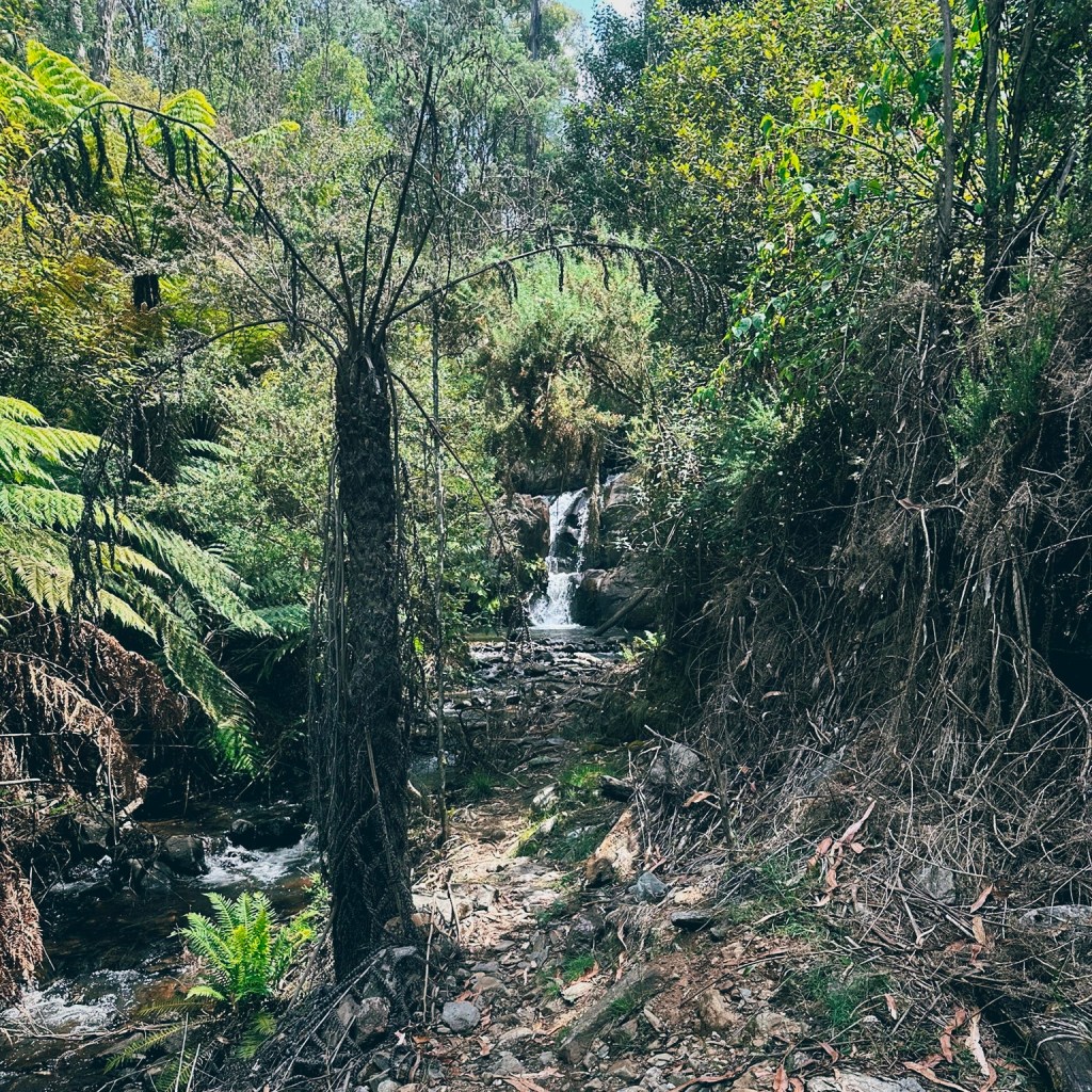
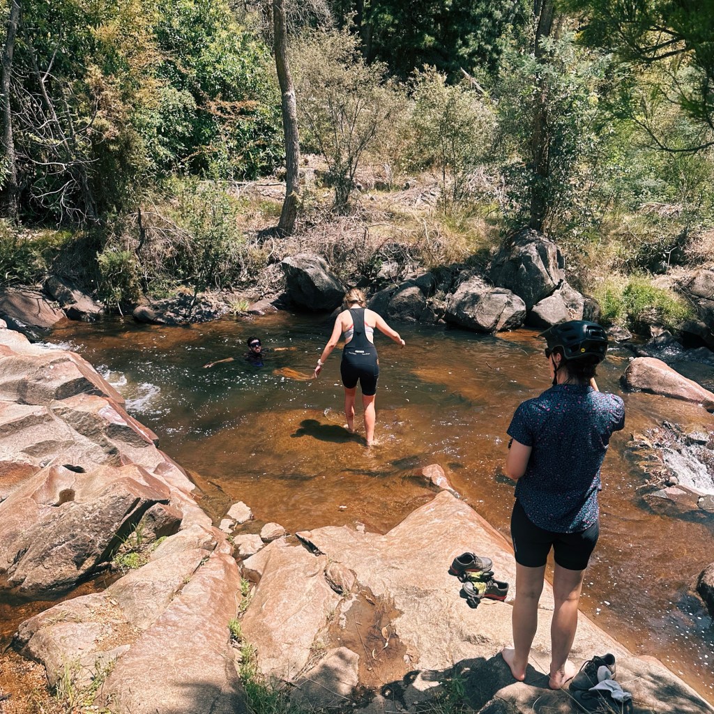
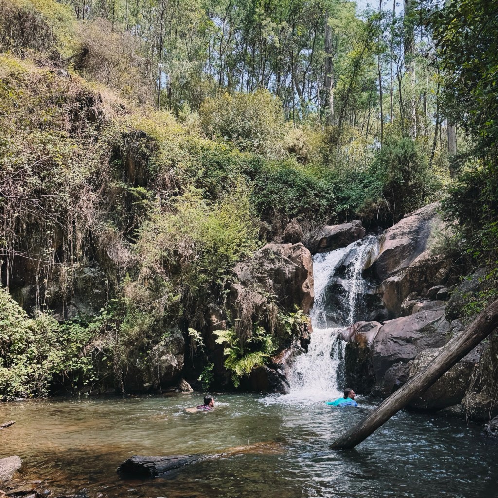
A few tight bermed descents, including one with a rock roll in the middle of a corner, bring you to a gorgeous wooden bridge. Look for a foot pad immediately after the bridge, just a short 50m detour up the track lies a pristine swimming hole and a cascading waterfall. With 14km left to Beechworth, it’s the perfect spot to pause and cool off before tackling the final push.
Immediately after the gorge, is another short pinch, that had me off the bike and walking for a couple of corners, before entering a beautiful undulating forest track. You might start to recognize the scenery, and realize you’re on the slight overlap at the center of the figure-eight loop.
Arriving at the intersection to turn off to Beechworth or Yackandandah (once again), take the trail to Beechworth this time. It’s now almost entirely downhill, with some of the best flowy turns of the entire trail. On the approach to Beechworth, the trail merges back onto the multi-directional section it started on, so keep an eye out for walkers and other riders.
By the time you roll into Beechworth, you’ll be ready to demolish a feed. A beer and pizza at the Bridge Road Brewery are the perfect way to cap off an epic day on the Indigo trail.

Tips for Riding the Indigo Epic Trail
- Bike: A dual suspension or hardtail is essential. If the full 56km feels like a bit much: hire an e-bike from either Beechworth or Yackandandah to take the edge off those climbs.
- Phone Service: Surprisingly decent through most of the trail, but there are some valleys where it drops out. I recommend carrying a PLB or satellite phone just in case.
- Closures: Always check for trail closures before heading out. Let’s keep these trails in great shape by avoiding them during or just after heavy rainfall.
- Water: Make sure to carry plenty of water. There are a few streams along the way, but not all are flowing all year round. I’d filter anything you plan to drink, and top up in town before heading out.
- Wildlife: We didn’t see any snakes, but they’re definitely out there. Pack a snake bandage and make sure to know how to use it.
- Toilets: Facilities are limited, with toilets only available at the beginning and end of the trail. Plan accordingly!
Disclaimer: Content on Path & Pedal is for general information and inspiration only. All route guides and trip reports are based on personal experience and research at the time of writing. Conditions, access, weather, and regulations can change. Always check official sources and use your own judgment. Outdoor adventures carry risk, and Path & Pedal accepts no liability for injury, loss, or damage.

Leave a comment