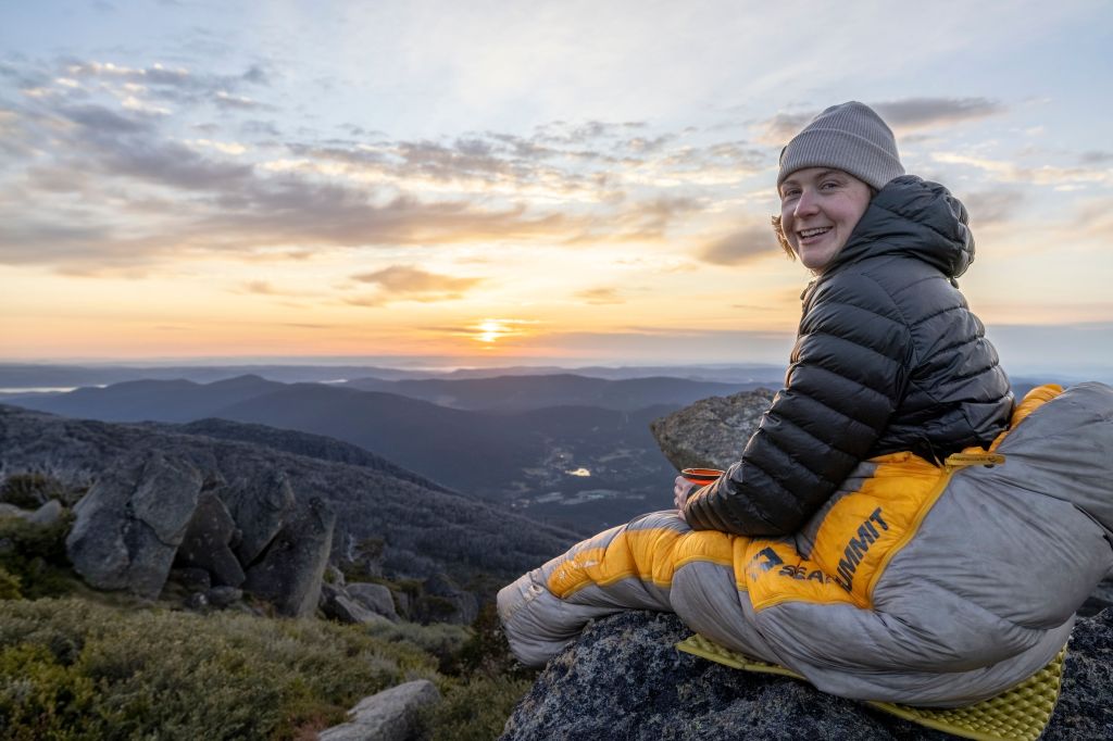
“This isn’t just a hike, it’s a rite of passage for anyone that wants to earn every metre to the summit of Australia’s highest peak”
Some trails draw you in with a promise of gentle gradients and meandering boardwalks. Hannels Spur is not one of them. This trail holds the title for the most vertical ascent in a single climb in Australia; gaining nearly two vertical kilometres of elevation in one go. In December 2024, it made headlines for the wrong reasons when a hiker, Hadi Nazari, went missing along its path for 13-days. To provide a little clarity, and make sure you’re fully prepped for the hike, this is my guide to the Hannels Spur Track in Kosciuszko National Park.
Skip to
- Quick Look
- History of Hannels Spur Track
- Skill Level Needed for Hannels Spur Track
- Where to Start Hannels Spur Track
- Where to Finish Hannels Spur Track
- Where to Stay Near Hannels Spur Track
- Best Time to Hike Hannels Spur Track
- Trip Report
- Tips for Hiking Hannels Spur Track
Quick Look
Distance: ≈22km (one way to Thredbo top station)
Elevation: ≈2,000m
Duration: 1-2 days
Skill Level: Advanced
Location: Kosciuszko National Park, NSW
GPX: https://www.strava.com/routes/3344544382220310208
History of Hannels Spur Track
The Snowy Mountains have been home to the Ngarigo people for thousands of years. Each summer, they’d journey into the high country for ceremonies and to harvest bogong moths, before returning to the valleys for warmth and shelter when temperatures dropped. In 1840, Polish explorer Paul Strzelecki, guided by two Aboriginal men, Charlie Tarra and Jackey, became the first European to summit Mount Kosciuszko, following what we now know as Hannels Spur. By the late 1800s, graziers were using the same rugged route to drive cattle into the high country. Imagine hauling livestock up that climb!
Skill Level Needed for Hannels Spur
Hannels Spur is considered a Grade 5 hike, meaning it’s for experienced hikers with strong navigation skills. The main climb that ascends 1,800-metre over 17 km is seriously tough, with steep, and relentless gradients that’ll put the legs to the test. It can be tackled as an overnight or multi-day mission, but be warned: a heavy pack makes the grind even spicier.
This isn’t just a hike, it’s a rite of passage for anyone keen to earn every metre to the summit of Australia’s highest peak. If you don’t have the skills quiet yet, but keen to put your fitness to the test, hire a guide. I hiked this trail with my friends at K7 Adventures, who run guided trips to Hannels Spur in both summer and winter.
Where to Start Hannels Spur Track
The official starting point sits across from the Geehi Flats Campground, about 3.5-hours drive south of Canberra, or right in the middle of Melbourne and Sydney (6-hours drive from each). For Canberra and Sydney, the last resupply stop is Jindabyne, about 1.5-hours drive before the trailhead. Whilst Melbournians will pass through Khancoban, 30-minutes before Geehi, but this town is fairly small so resupply options are limited.
Personally, I prefer starting just before the Geehi River bridge (coming from Jindabyne), at an unmarked dirt road, as the first section of the trail can be hard to follow (especially in the dark). Google Maps calls this road Dr Forbes Hut Acc. It is marked as a dry weather road, so just make sure your car can make it in/out of there.

Where to Finish Hannels Spur Track
The trail officially ends at the summit of Mount Kosciuszko, Australia’s highest peak, where you’ll be rewarded with views so good they’ll steal whatever breath you have left. But don’t be fooled, this isn’t the end of the hike. From the top, there’s a few options to get home: retrace your steps down Hannels Spur (brace your knees), or continue on to Dead Horse Gap, Thredbo, or Charlotte Pass, all of which need a prearranged car shuttle.
Where to Stay Near Hannels Spur
If you’re tackling Hannels Spur, do yourself a favour and spend the night before at the Geehi Flats Campground. Waking up right at the trailhead means you can start early and squeeze the most out of the day. It’s also the perfect base if you’re doing it as a one-day mission; leave a car at Thredbo on the drive through, smash out the hike to the village, then drive back to Geehi for a well-earned night by the river. Just don’t forget to book ahead and sort park entry (it’s required in Kosciuszko National Park year-round).

Best Time to Hike Hannels Spur
From late May to early October, the Main Range is blanketed in snow. While that’s the core snow season, flakes can fall year-round up here, so it’s best be prepared for cold temps any time of the year. The top of the trail is seriously exposed, and the wind can be wild. Days of 100km winds across top of the Snowy Mountains are not unheard of. Personally, I think late spring or early autumn is the sweet spot. The trail’s clear of snow, the temps are milder, and you’re less likely to melt halfway up, than in the peak of summer.
Trip Report
Doctor Forbes Hut to Hannels Spur Track
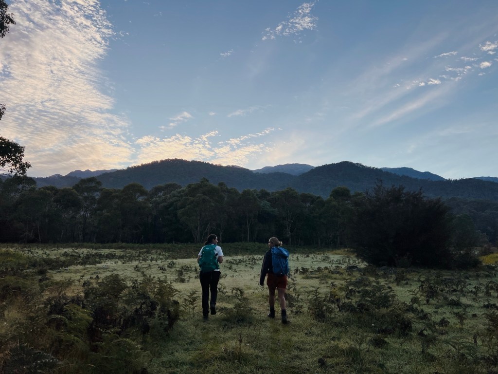
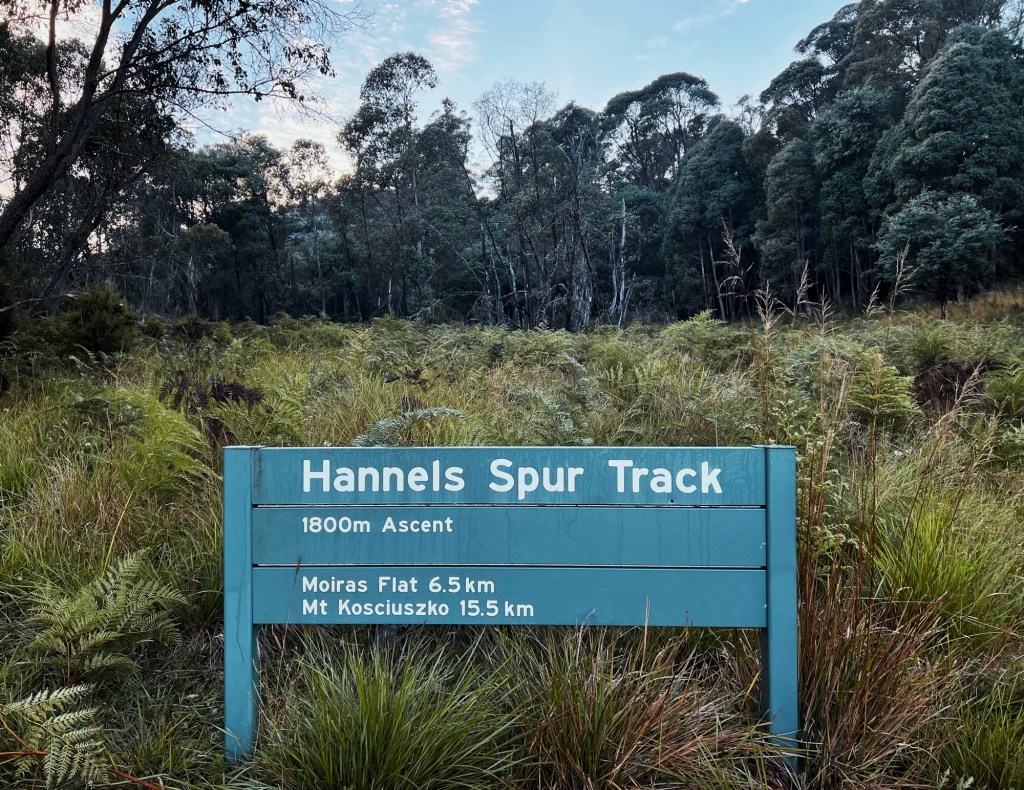
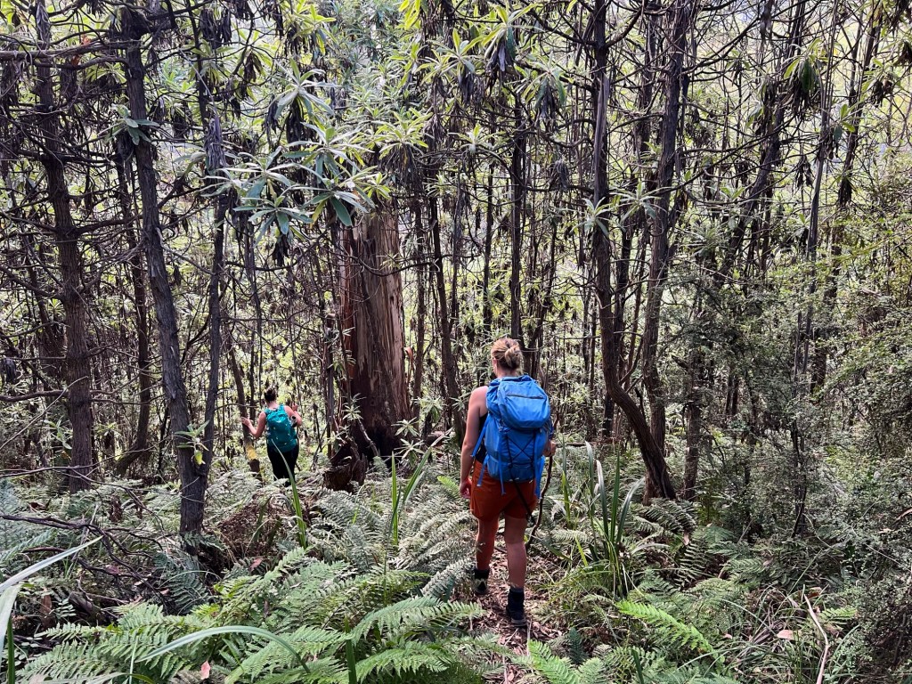
Waking up before sunrise at Geehi Flats Campground, we drove the car to the Doctor Forbes Hut access road to start our hike. A faint track drops down to the Swampy Plains River, where the chilly river crossing to Doctor Forbes Hut woke us right up. The trail starts out deceptively cruisy, weaving through the open grasslands of Geehi Flats. Roos bounced lazily across our path as we wandered the overgrown 4WD track, scanning the field until we finally spotted it: the weathered Hannels Spur sign, marking the official start of the climb.

To Moira’s Flat
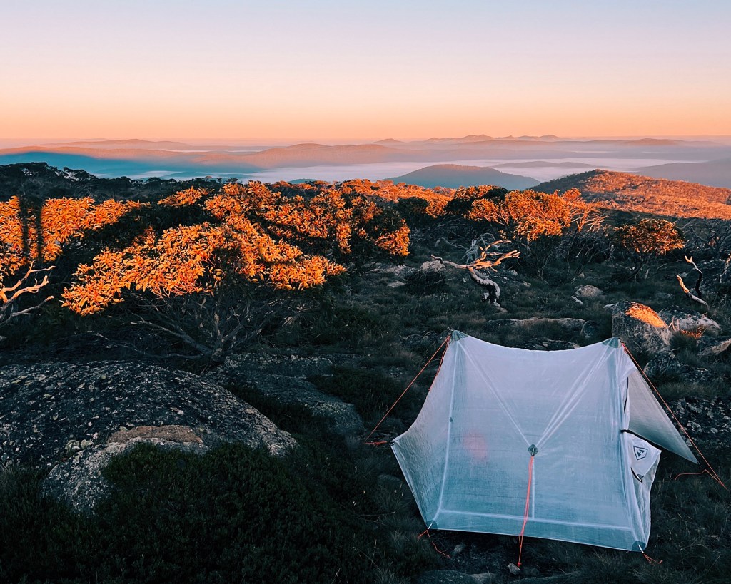
It ducks into thick eucalypt forest and starts climbing immediately. Tree roots tangled across the trail, and the track was barely marked, most signs long since swallowed by trees. Every now and then, the bush would part just long enough to offer a teasing glimpse of the valley we’d left behind. The gradient stayed brutal, and we crawled along at a pace of about one kilometre every half hour. Moira’s Flat was the perfect snack break, just a small grassy clearing big enough to set-up 3 tents. There’s water if you’re willing to scramble down for it, but we had enough to keep going. The climb, of course, was far from done.
To Byatt’s Camp
Past Moira’s, the forest shifted with towering trees slowly turning to the skeletal shadows of the snow gums as we gained altitude. Their gnarled branches twist into shapes molded by years of exposure to harsh winds and heavy snow. Eventually, the trees began to thin, and sunlight started to break through. The ground flattened just a little as we rolled into Byatt’s Camp; a stunning spot with wide-open views and a real sense that we’d reached the alpine. It felt like we were nearly there, but Kosciuszko still wasn’t in sight.
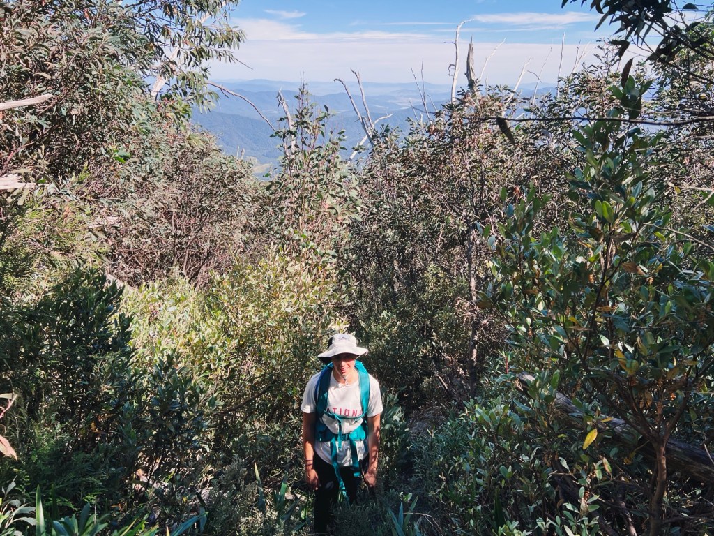
To Wilkinson Creek
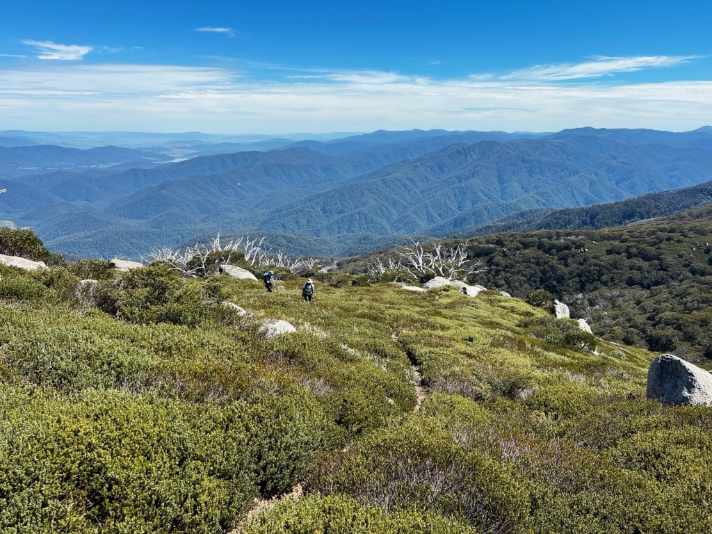
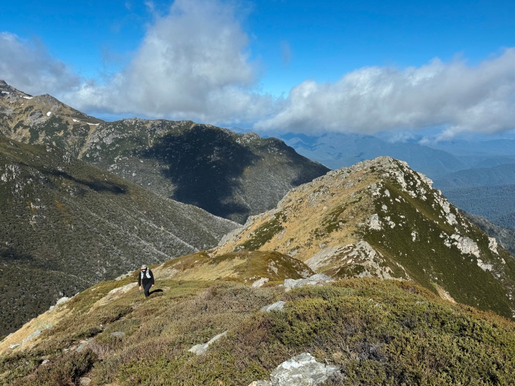
Granite outcrops and moss-covered boulders dominated the landscape, while alpine wildflowers added burst of colour on the ground. The trail faded to a suggestion, marked only by the occasional cairn. Our boots were soon soaked thanks to sneaky little bogs and streams despite our best efforts to avoid them. Abbott Peak rose ahead, and we skirted around its base, climbing through dense, scratchy scrubs that clawed at our legs (gaiters or long pants would have been a good idea). Eventually, Wilkinsons Creek came into view (the official campsite of the Main Range) nestled amongst giant boulders. We dunked our stinging legs in the icy water to cool them down before the final slog.

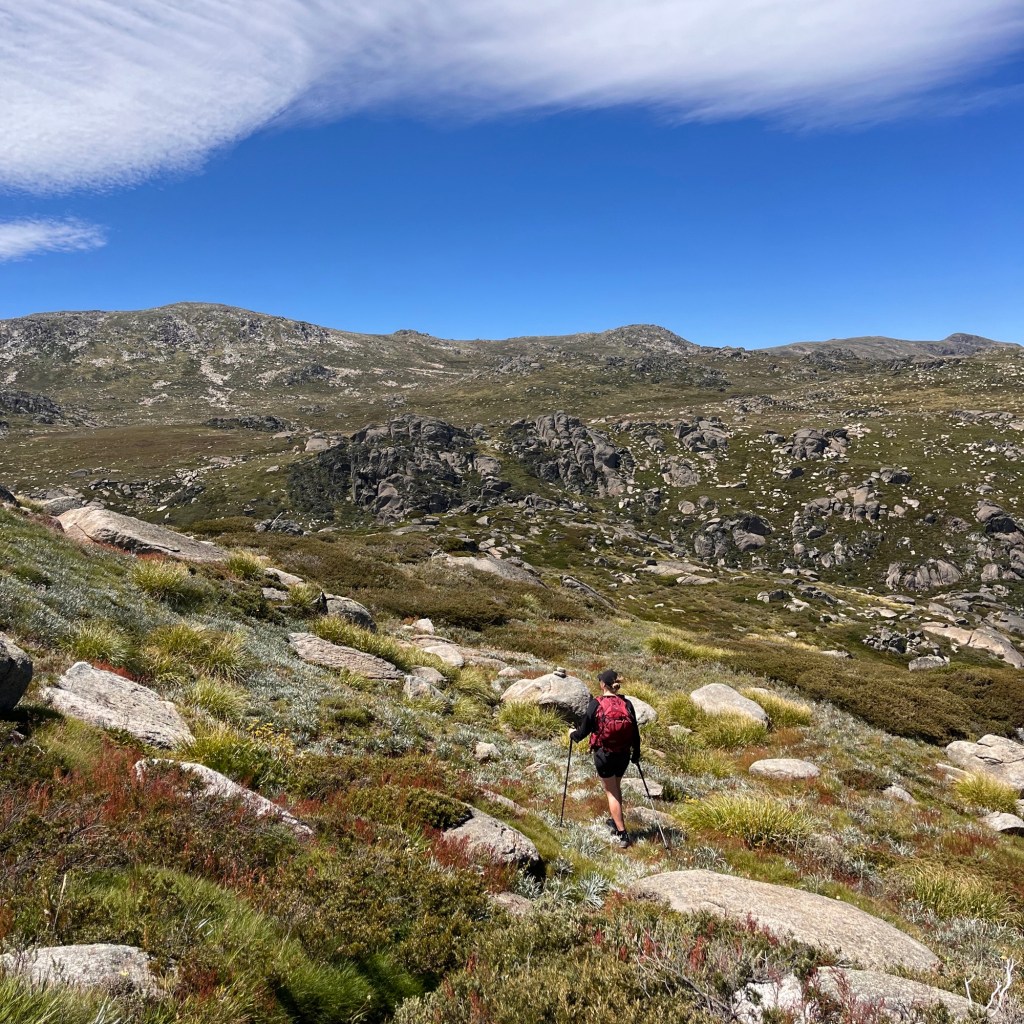
To Mount Kosciuszko
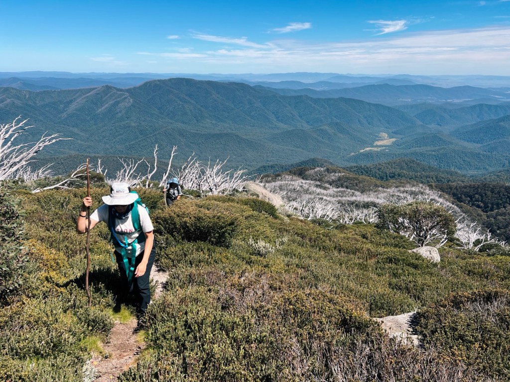
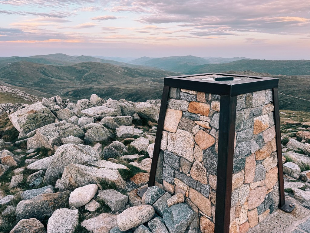
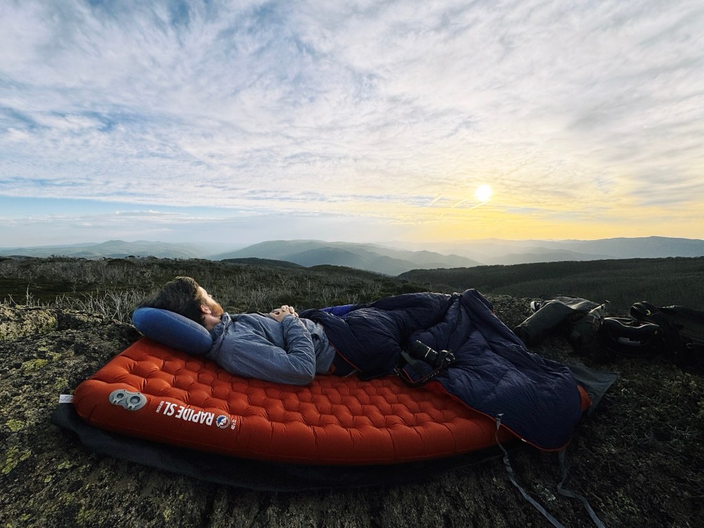
Our legs were weary, but the sight of the summit pulled us forward. Suddenly we were on the Main Range Walk, surrounded by more people than we’d seen all day. It was a strange change, after so many hours of solitude and sweat, we were dodging day hikers in jeans and thongs. Still, the summit felt bloody good. We found a quiet rock to sit on, took in the endless layers of mountains, and gave ourselves a moment to soak it all in. We’d earned every step.

One Final Push
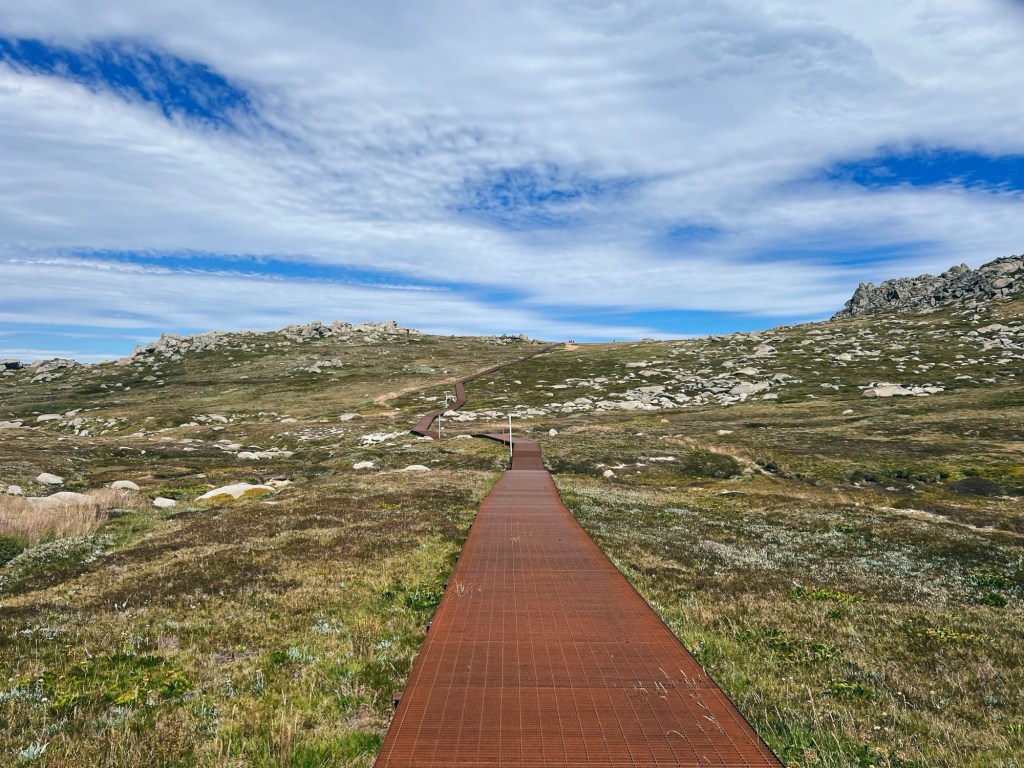
For this trip, we’d planned the path of least resistance for the way out. We followed the cheese grater (aka metal boardwalk of the Kosciuszko Walk) toward Thredbo, legs on autopilot. Just in time, we caught the last chairlift down to the village, where our car was waiting to cart us back to Geehi. Tired, dirty, but grinning.
Tips for Hiking Hannels Spur Track
Plan Ahead: Always check for park closures, fire bans, and weather conditions before starting ANY hike. Be ready for anything: snow fall, extreme heat, high winds or all three in a day. Don’t be afraid to cancel the trip, or turn-around if things get unmanageable.
Phone Service: Phone service is patchy at best, but gets better on the climb. Let someone know your plans and carry a satellite phone or PLB (Personal Locator Beacon) for emergencies.
Water: There are very few streams on the climb itself, other than near the campsites. Carry enough for the ascent and bring a filter or purification tablets for water collected along the way
Leave No Trace: Hannels Spur still feels wild and untouched. To preserve its beauty, pack out everything brought in, leaving the landscape as pristine as you found it.
Safety First: Given recent incidents, extra precautions are essential. Hannels Spur is a demanding and remote trail. Always prepare with proper gear, navigation tools, and communication devices. If hiking solo, let someone know the expected route and return time.
Disclaimer: Content on Path & Pedal is for general information and inspiration only. All route guides and trip reports are based on personal experience and research at the time of writing. Conditions, access, weather, and regulations can change. Always check official sources and use your own judgment. Outdoor adventures carry risk, and Path & Pedal accepts no liability for injury, loss, or damage.

Leave a comment