The first time I hiked to Blue Waterholes, I had no idea what I was stepping into. By the time I’d walked through Clarke Gorge to Cooleman Falls, my shoes were soaked and a grin was plastered across my face. I’d found my new favourite corner of Kosciuszko National Park. Then I realised, you can turn this scenic hike into an unforgettable overnight bikepacking trip. The ‘Blue Waterholes Gravel Ride’ offers a beginner-friendly distance, smooth dirt roads, quiet 4WD tracks, and a stack of backcountry huts that are not to be missed.
Skip to:
- Quick Look
- About Northern Kosciuszko National Park
- Where to Start & End the Blue Waterholes Gravel Ride
- Skill Level Needed for the Blue Waterholes Gravel Ride
- Best Time to do the Blue Waterholes Gravel Ride
- Where to Stay Near the Blue Waterholes Gravel Ride
- Trip Report
- Want a Longer Ride?
- Tips for the Blue Waterholes Gravel Ride
Quick Look
Distance: ~61km
Elevation Gain: ~1000m
Duration: 1-2 Days
Skill level: Confident Beginner/Intermediate
Location: Northern Kosciuszko National Park, NSW
GPX: link here
About Northern Kosciuszko National Park
For thousands of years, the high country has been a meeting place for Aboriginal people, with the Walgalu, Ngarigo, and Ngunnawal Nations connected to these alpine plains. They travelled seasonally into the mountains to harvest bogong moths, take part in gatherings, and perform ceremonies.
The Blue Waterholes area sits on the edge of the Cooleman Plain karst, where rainwater and snowmelt have seeped into the limestone for thousands of years, carving out caves, underground streams, and gorges.
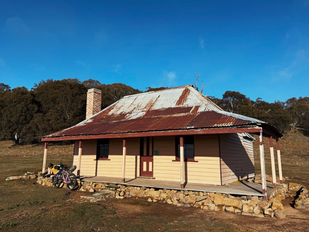
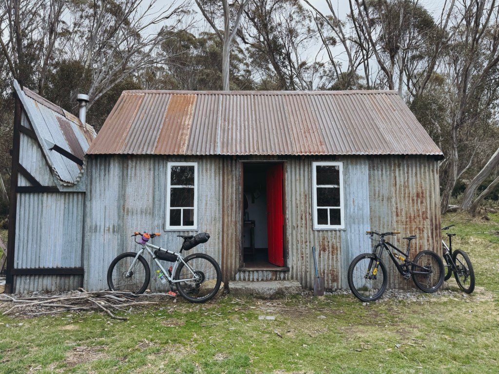
Scattered along the route are some of Kosciusko National Park’s most charming huts, including Coolamine Homestead, Bill Jones Hut, and Old Currango Homestead. Built between the late 1800s and early 1900s, they were once used by stockmen, graziers, and park workers.
Where to Start & End the Blue Waterholes Gravel Ride
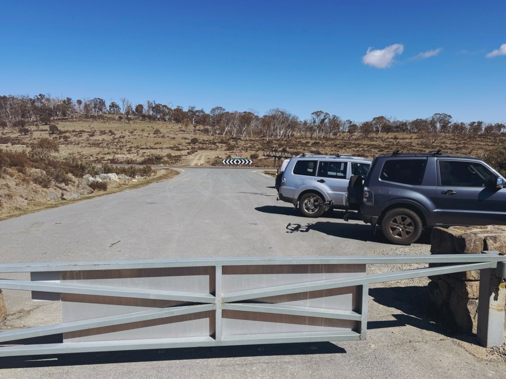
This is a loop, that starts and finishes at the gate and information sign on Long Plain Road at its intersection with the Snowy Mountains Highway. It’s about 2.5-hours south of Canberra or 5.5-hours south of Sydney. The closest town is Talbingo, roughly a 30-minute drive away, though there aren’t many services there. For a full resupply, Tumut or Cooma are your best options, both are around an hours drive from the start of the route.
Skill Level Needed for the Blue Waterholes Gravel Ride
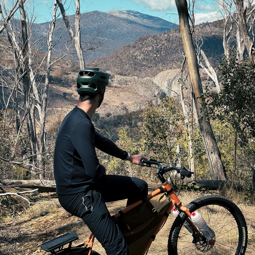
I’d call this a confident-beginner bikepacking route. It’s probably not for someone who’s never ridden off the tarmac before, as it’s remote and a little rough in parts. But if you’ve spent some time on gravel, this makes a perfect first overnight bikepacking trip. The route serves up gentle gradients, smooth dirt roads, a few short climbs, and just enough rugged 4WD track to keep it interesting. I recommend riding it clockwise to make the most of the flowing gravel descents.

Best Time to do the Blue Waterholes Gravel Ride
From the June long weekend to the October long weekend, Long Plain Road is closed to cars but open to cyclists and hikers. This is hands-down the best time to ride. Be aware, there might be snow on the track during peak winter, but through the shoulder seasons it’s often just cold mornings and nights, with pleasant temps during the day. Just be sure not to block the locked gate for emergency service and park management use.
In summer, the road reopens to vehicles and can get busy, especially on weekends and school holidays. It also can be pretty hot, dusty and exposed, so hydrate well and keep an eye out for snakes.
Where to Stay Near the Blue Waterholes Gravel Ride
If you’re planning to camp before or after the ride, Yarrangobilly Village Campground is a great base. It’s right on the Yarrangobilly River, and sits next to Cotterill Cottage, a cute historic hut. You’ll need to book your campsite ahead of time through the NSW National Parks website for a small fee, but there’s heaps of space. If you haven’t visited the area before, make time for the Yarrangobilly Caves and Hot Springs.
Trip Report
Day 1: Long Plain Road Gate to Old Currango Homestead
41 km, 688 m vertical gain
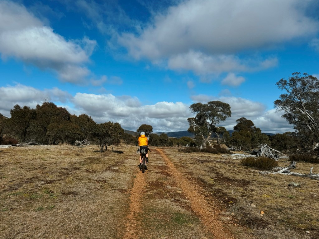
We rolled out of the locked national park gate on Long Plain Road with fresh legs and high stoke. The first section is exactly what you want on a bikepacking trip: smooth champagne gravel, virtually flat gradients, and views that stretch forever across the plains. There are two optional side trips to Long Plain Hut and Coonibil Hut here, but we decided to skip them since we started the day a bit late.
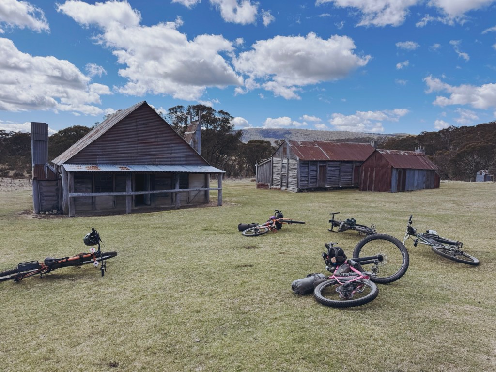
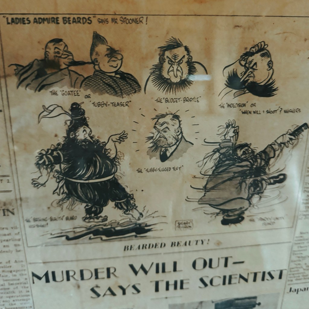
The track eventually reaches a large intersection with another information sign and we turned on to Blue Waterholes Fire Trail. It winds through open plains and light forest, gradually climbing toward Mount Cooleman. The descent down to Coolamine Homestead is a blast, but we paused the fun to take a look around. With newspapers on the walls, hilarious old ads and comics, we could have easily stayed for longer.
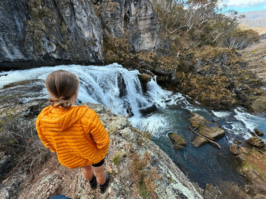
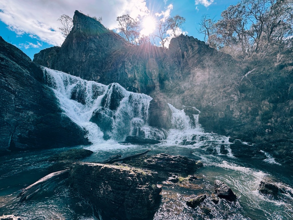
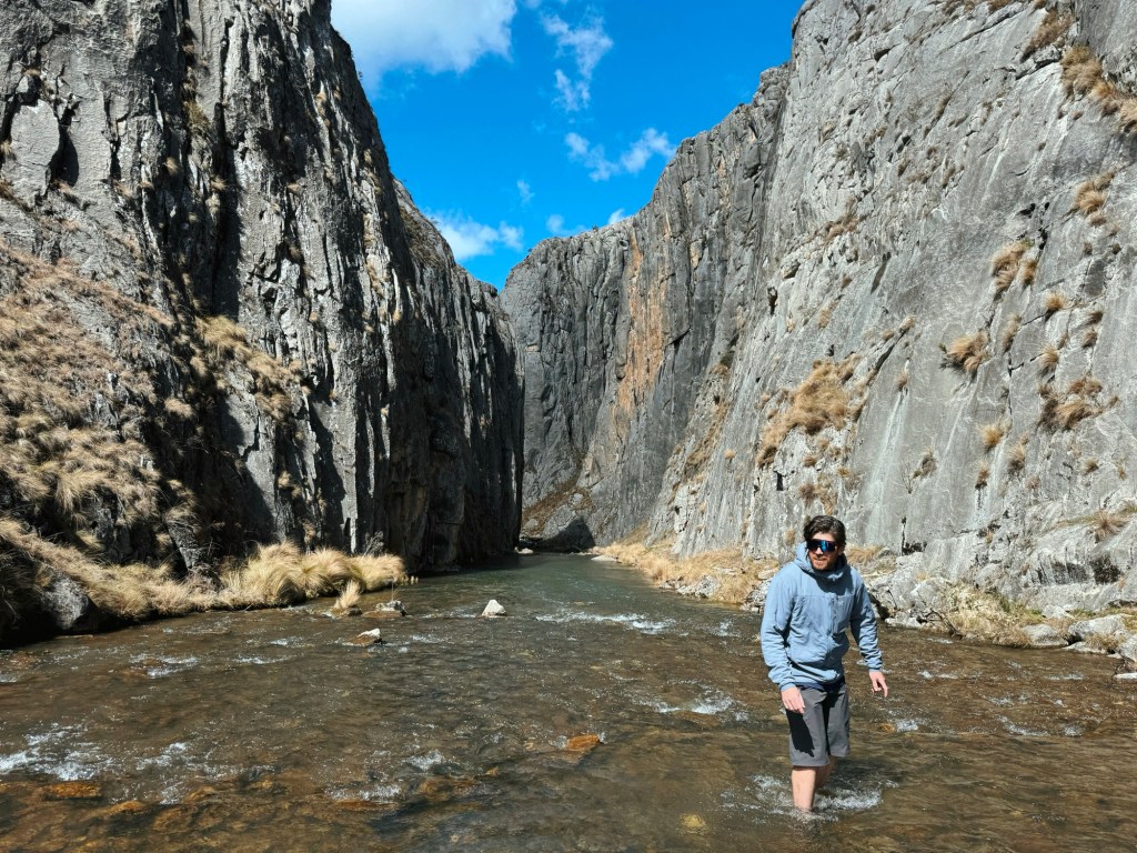
Continuing on the decline, we spotted the huge rock walls of Clark Gorge in the distance and the excitement among the group built with every pedal stroke. Blue Waterholes Campground was blissfully empty, a huge perk of riding when the road is closed to vehicles. We left the bikes in plain sight and set off on foot for the real highlight of the trip.
Side Trip: Hike to Clarke Gorge & Cooleman Falls
This 4 km sidetrip must be walked but is worth every soggy step. It took us about 1.5-hours return; partly because icy creek crossings slowed us down, and partly because we kept stopping to gape at our surrounds. After about 500 m, the walls close in, rising high on either side into Clarke Gorge. If you’re short on time, you can turn around here, but I highly recommend pushing on to the waterfalls.
Back at the bikes, we headed out along the gravel road beside the toilet block (also called Blue Waterholes Track, yes, confusing!). What we didn’t expect were the next three creek crossings. The water was low enough to ride through, but our feet somehow got even wetter. A short, punchy climb had a few of us off the bike, but it was over before we’d really started complaining.
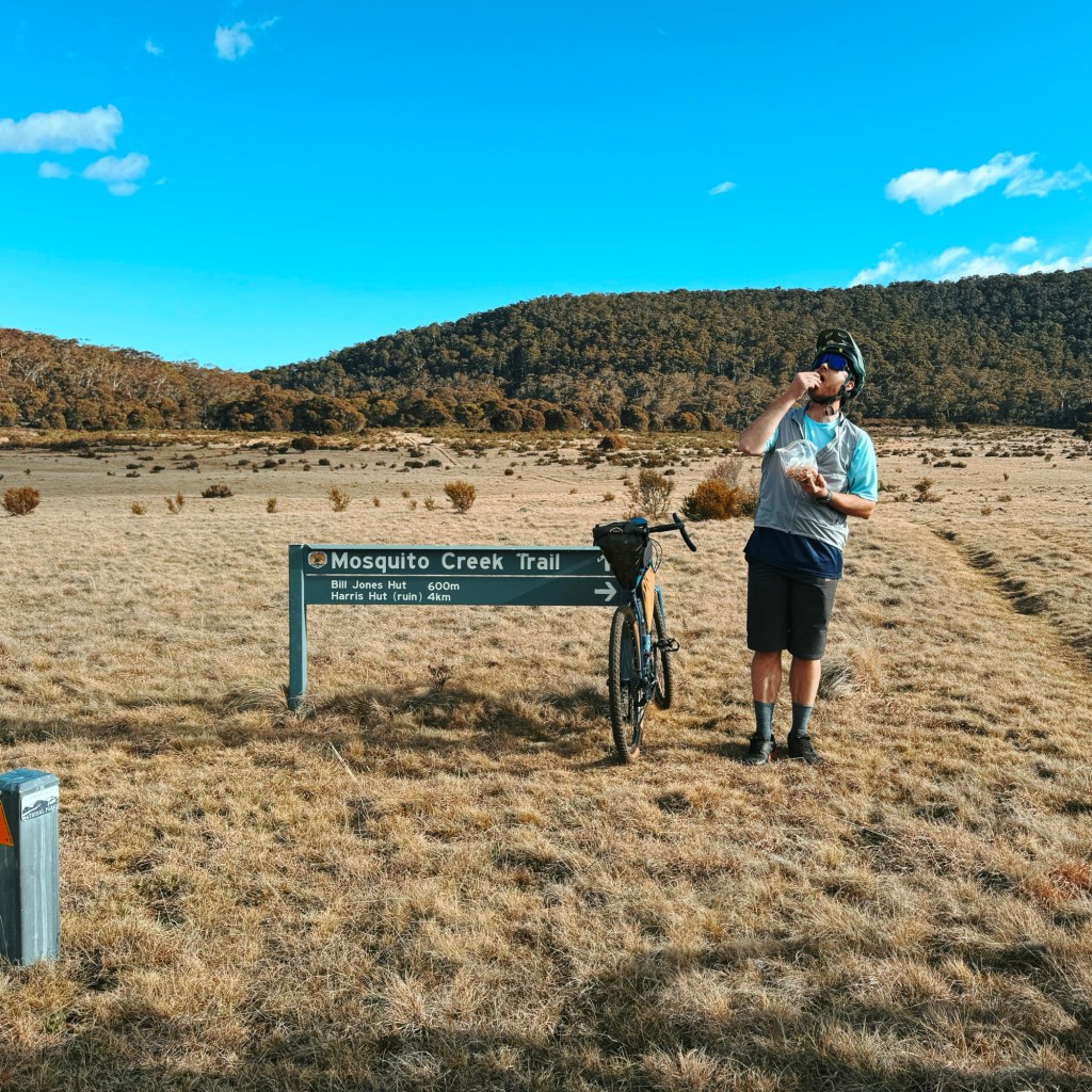
On the plains, the route turns onto the grassy Mosquito Creek Fire Trail, joining the Australian Alps Walking Track (AAWT). There’s a quick detour to Bill Jones Hut for a snack and a sticky beak, if you have time. After that, the trail meanders through the gums, with a few fallen trees to navigate around/over.
Soon we reached the turn-off to Old Currango Homestead, our camp for the night. I’ve never seen this section so wet. Mosquito Creek had spilled over, turning the 4×4 track into a stream of its own. We filled our bottles from the flowing rapids to avoid doubling back later.
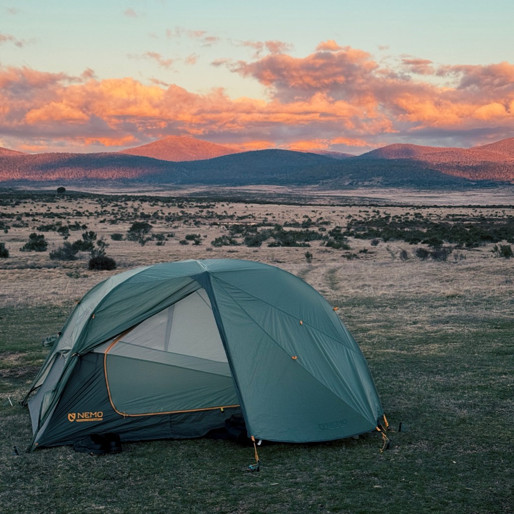
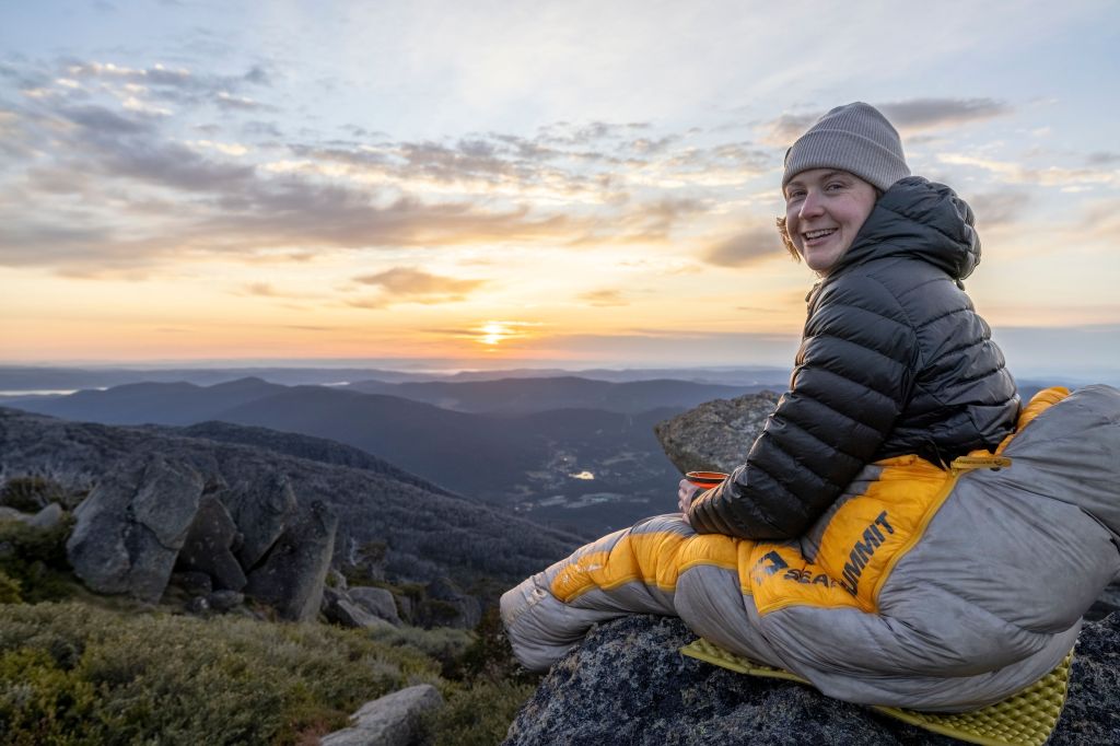
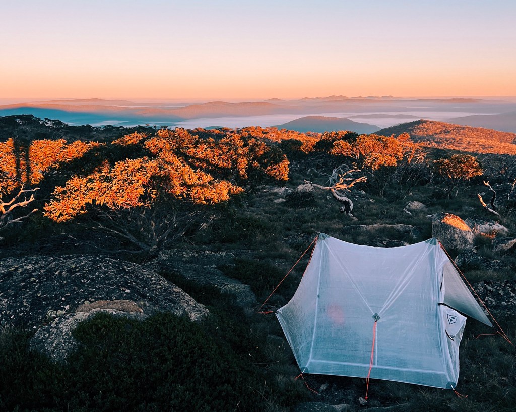
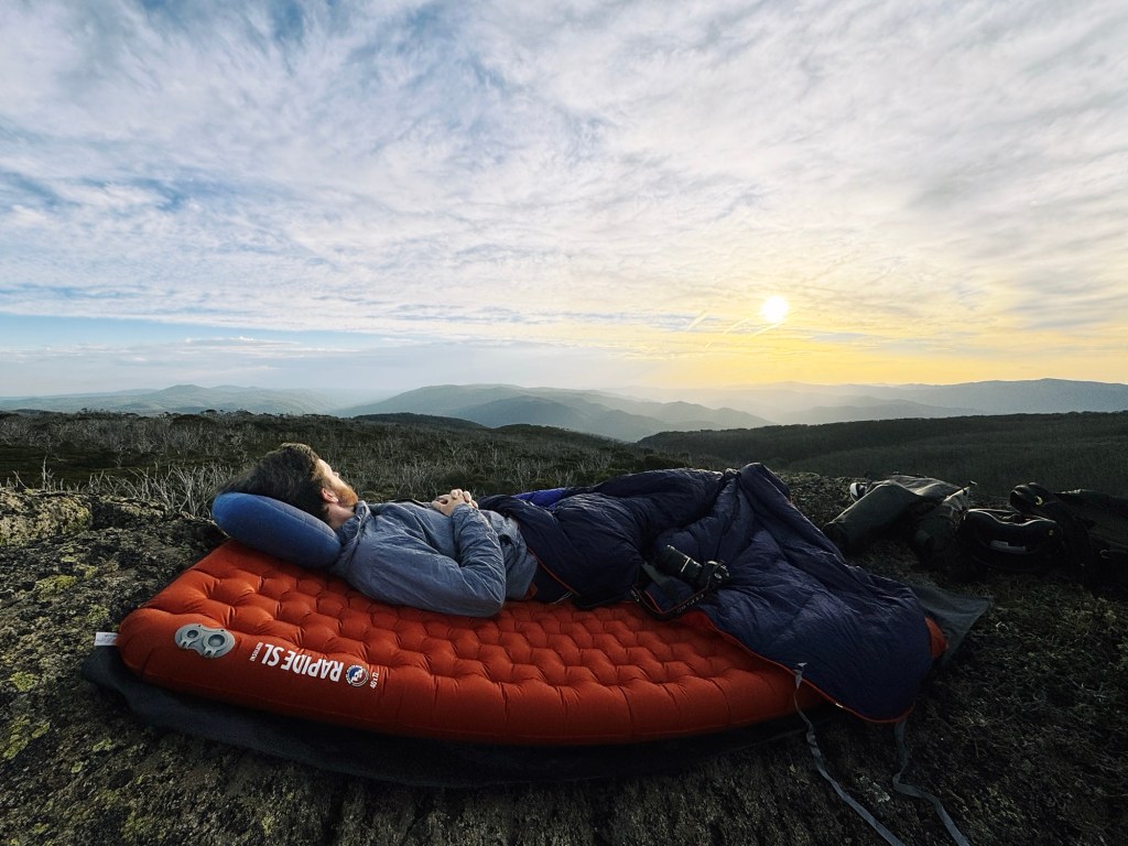
Old Currango is a fan favourite, not just for its architecture but its location. Perched high on the hill, it offers huge views across the plain, with Mount Bimberi and Murrays Gap on the horizon. We pitched our tents and watched the sky change colours on the veranda, as the air grew frosty around us.

Day 2: Old Currango Homestead to Long Plain Road Gate
20 km, 402 m vertical gain
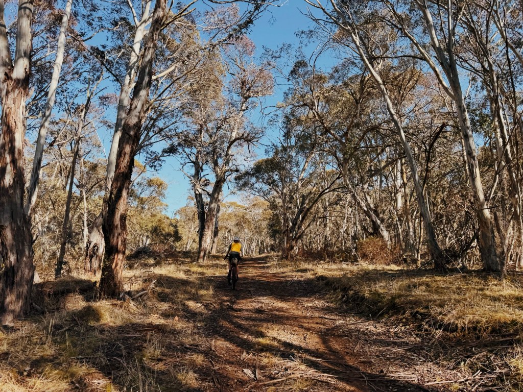
We woke up to everything frozen solid: tent, water bottles, even our shoelaces were crunchy. After some questionable coffee with dregs of dinner floating in it, we hit Mosquito Creek Trail again. The climb out from Old Currango is steady but nothing brutal. We warmed up fast, shedding layers as we rode.

The gravel road winds through high country scenery: rolling hills and gumtree woodlands. The descents down to Hainsworth Hut were pure fun, with the occasional rut keeping us holding on tight.
Soon, we linked onto Port Phillip Trail at Ghost Gully Campsite. There’s one last crossing of the Murrumbidgee River (thankfully, it has a bridge), where we spotted our first people in two days; a group of packrafters just about to head out on the water.
The final stretch feels familiar as you turn onto Long Plain Road. Spotting the powerlines, we knew we weren’t far from the car, and a pie at the Adaminaby bakery on the way home.
Want a Longer Ride?
You can extend this loop by continuing onto Blue Waterholes Trail (rather than turning onto Mosquito Creek Trail on Day 1) and taking the Port Phillip Trail to Old Currango Homestead. I’d recommend staying at Pockets Hut instead, to make the distance a little more even on both days. This creates a bigger ride of ~91 km with ~1,600m elevation gain (GPX link here).
Tips for the Blue Waterholes Gravel Ride
Phone service: I’m with optus, and I had none. Make sure to download your maps offline and always bring a form of emergency communication.
Bike: Gravel or MTB only. I rode it on my Salsa Cutthroat, a rigid gravel bike with 29 x 2.2” tyres, and it handled the mix of gravel and janky 4WD track just fine.
Closures: Always check before heading out. Fire danger, aerial shooting, or track maintenance closures can affect access.
Water: There is a heap of water on the track, with multiple creek crossings. Feral animals like horses and pigs are common around Long Plain area, so always filter anything you drink.
Hut etiquette: Sad to even have to say this, but respect the huts. Head to the Kosciuszko Hut Association (KHA) website for more information.
Wildlife: Snakes in summer, funnel-webs if you’re unlucky, plenty of kangaroos, wallabies, brumbies, the odd feral pig and wild dogs. Keep an eye out on the fast descent as the wallabies love to dart across at the worst times.
Toilets: Plenty! There’s almost one every 5 kms, so just bring your own toilet paper and hand sanitiser.

Disclaimer: Content on Path & Pedal is for general information and inspiration only. All route guides and trip reports are based on personal experience and research at the time of writing. Conditions, access, weather, and regulations can change. Always check official sources and use your own judgment. Outdoor adventures carry risk, and Path & Pedal accepts no liability for injury, loss, or damage.

Leave a comment