I spend a lot of time trawling through maps looking for places I can take my dog. They’re not always easy to find when you live in the Australian High Country, where most of it sits inside national parks that don’t allow dogs. So when I spotted this pocket of state forest tucked between Kosciuszko and Alpine National Parks, I knew Bowie and I were in for a good time.
This little corner turned out to be hiding one of the best dogpacking trips we’ve ever done. Big mountain views over Australia’s highest peaks, a cascading waterfall, and just the right amount of janky dirt riding to keep things interesting. Usually, I’m ready to “compromise” my adventure when Bowie comes along, but this was nothing short of epic. Welcome to dogpacking in the Victorian High Country.

Skip to:
- Quick Look
- About Tom Groggin State Forest
- Rules for Dogs in Victorian State Forests
- Where to Start & End the Dogpacking in the High Country Route
- Skill Level Needed for Dogpacking in the High Country
- Best Time to Go Dogpacking in the High Country
- Where to Stay Near the Dogpacking in the High Country Route
- Trip Report
- Tips for Dogpacking in the High Country
Quick Look
Distance: ≈43km
Elevation Gain: ≈1150m
Elevation Loss: ≈1120m
Duration: 1-2 Days
Skill level: Advanced
Location: Tom Groggin State Forest:
GPX: click here
About Tom Groggin State Forest
This route sits inside Tom Groggin State Forest, on the lands of the Dhudhuroa, Gunaikurnai, Jaithmathang, Mitambuta, Monero-Ngarigo, Ngarigu-Currawong, Taungurung, Waywurru, and Wurundjeri peoples, the Traditional Custodians of the mountains and rivers of the Victorian Alps. While it might sound like the name Tom Groggin has European origins, it’s actually derived from the mispronunciation of the Aboriginal word tomarogin, meaning water spider.
The 2020 bushfires hit this area hard, and while the scars are still visible, the fires uncovered places that had been hidden for decades like Thowgla Falls and long-lost views of Mount Kosciuszko.

Rules for Dogs in Victorian State Forests
Dogs are allowed in Victorian State Forests as long as they’re on a lead or under your immediate control, especially at recreation sites like campgrounds and lookouts. These roads are shared with cars, motorbikes, and hunters, so keep your pooch close at all times.
This area borders national park, where dogs aren’t permitted, so it’s important to know exactly where you are. Head too far up Mount Pinnibar and you’ll be in a no-dog zone.
Always check the latest dog access info before heading out: read here
Where to Start & End the Dogpacking in the High Country Route
This is a loop that starts and ends at Ski Hut on the Ski Hut Track, which is just under 5-hours drive from Canberra or 6-hours drive from Melbourne. The closest town is Corryong, roughly 20-minutes away. I recommend driving in via Dunstans Road, rather than following the google map instructions to Ski Hut. This is a well-graded dirt road suited to 2WD in dry weather and 4WD year-round.
Skill Level Needed for Dogpacking in the High Country
This is NOT a beginner route. It’s steep, remote, and loose under tyre so I would recommend it to advanced riders only. Even with years of mountain biking behind me, there were descents I chose to walk. On paper it looks short, but it packs a punch.
It’s a fun mix of champagne gravel and rough 4WD tracks. If you’ve got solid handling skills and don’t mind a bit of hike-a-bike, you’ll love it. You can also drive (4WD only) or hike the loop; though I reckon hiking can feel a bit monotonous on the wider roads.
Only bring dogs that are comfortable with long distances (20 km+), or use a dog trailer or carrier for rest breaks.
Tips for overnight hiking and biking with a dog: read this

Best Time to Go Dogpacking in the High Country
During winter, these roads are much quieter since many close to vehicles. However, snow can fall in this area, so I would recommend shoulder season. We rode in early spring and had perfect weather, plenty of water, and saw only one other group of people. Avoid hiking or riding this route in the peak of summer, it’s too hot for dogs with limited shade.
Where to Stay Near the Dogpacking in the High Country Route
If you want a comfy base before or after your ride, I have to plug Colac Colac Caravan Park, just outside Corryong. My family camped there every Christmas since I was two months old, so it’s a nostalgic place for me. It has shady riverside sites, clean facilities, and most importantly, it’s dog-friendly (both cabins and campsites).

Trip Report
Day 1: Ski Hut to Pinnibar Gibson Hut via Thowgla Waterfall
Distance: 21 km | Elevation Gain: 530 m | Elevation Loss: 584 m
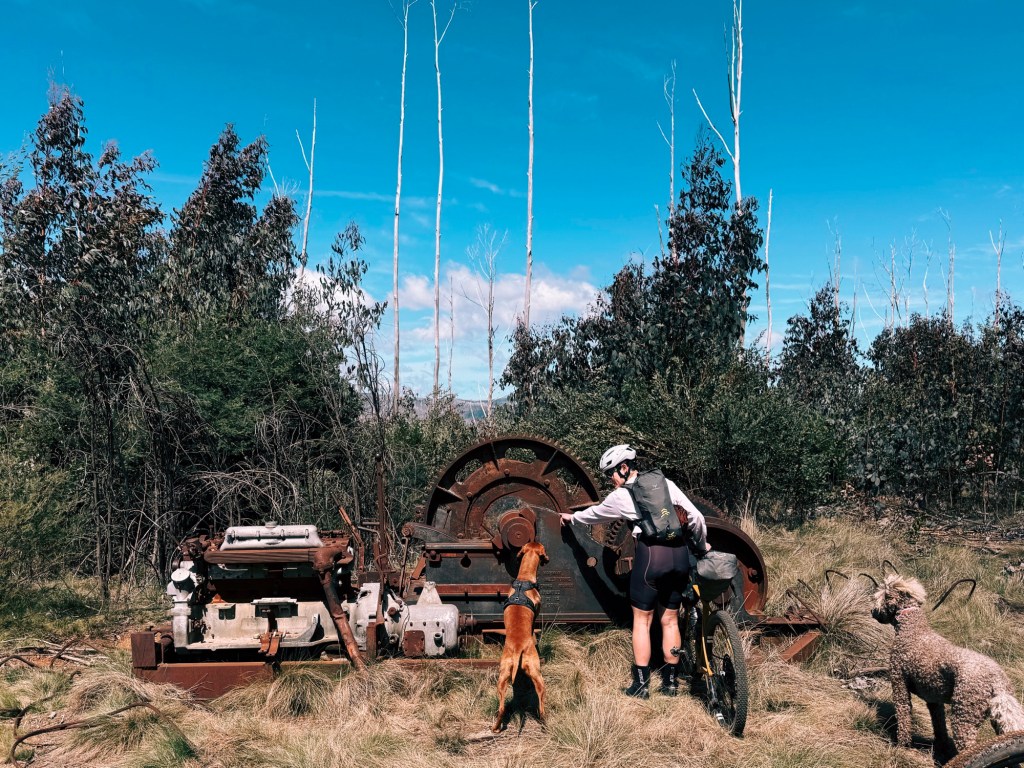
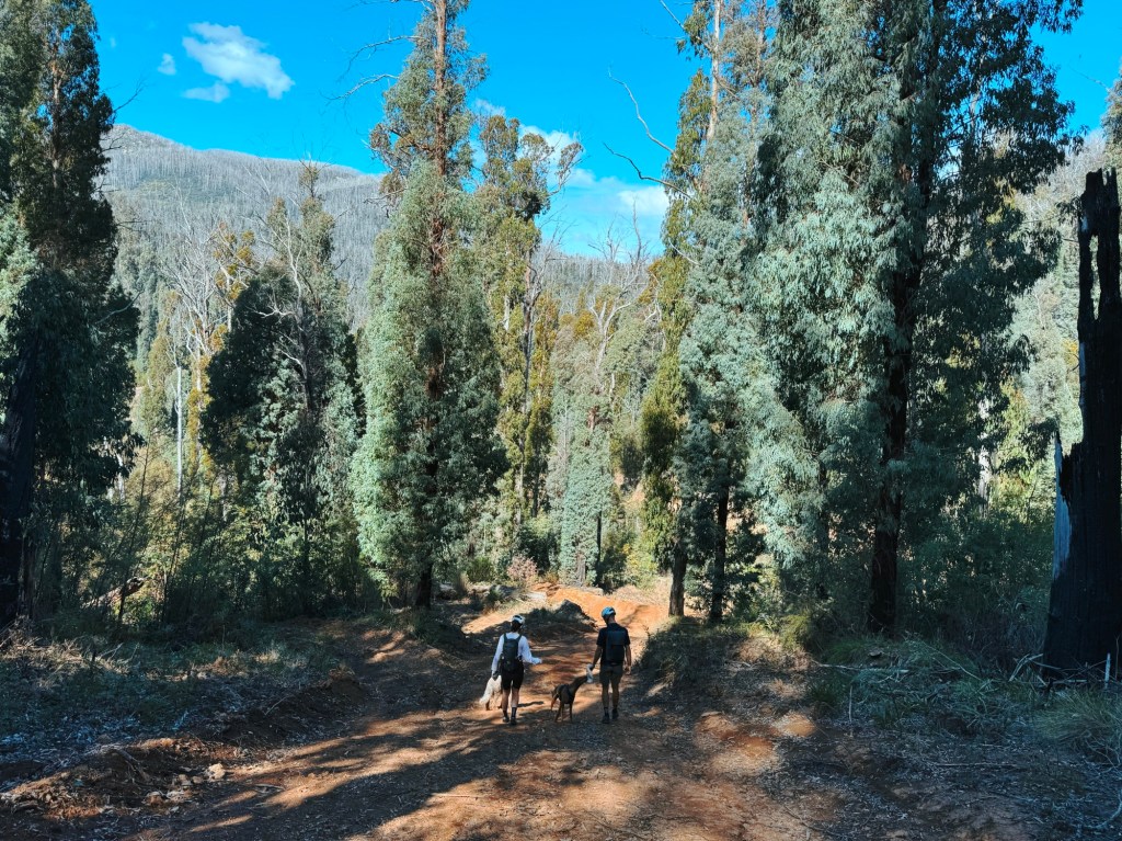
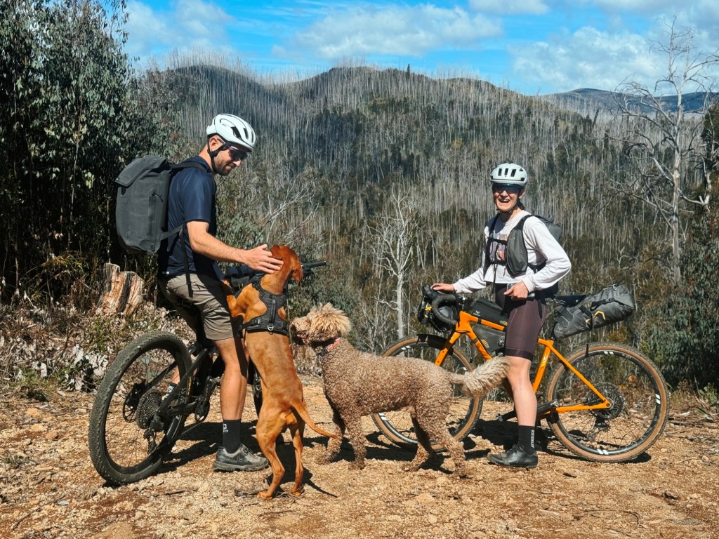
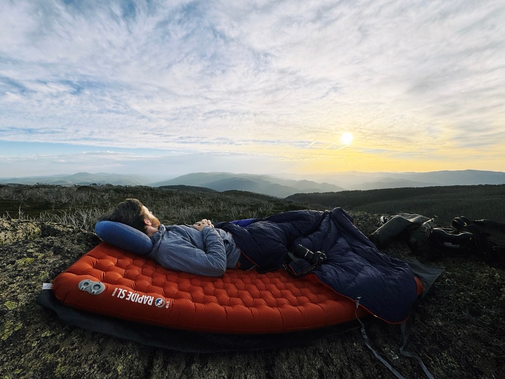
We rolled out of Ski Hut around midday, grinning from ear to ear with the sun shining, wildflowers blooming, and the dogs running beside us. The track gently undulated before turning onto Six Mile Ridge Track. At the junction with Dunstan Road, a few old relics were half-buried in the grass, so we took it as a good excuse to look around and let the dogs rest. From here the ride joined what we considered the ‘main’ road. We clipped the dogs on-lead and rode in a pack, expecting the odd car or two.
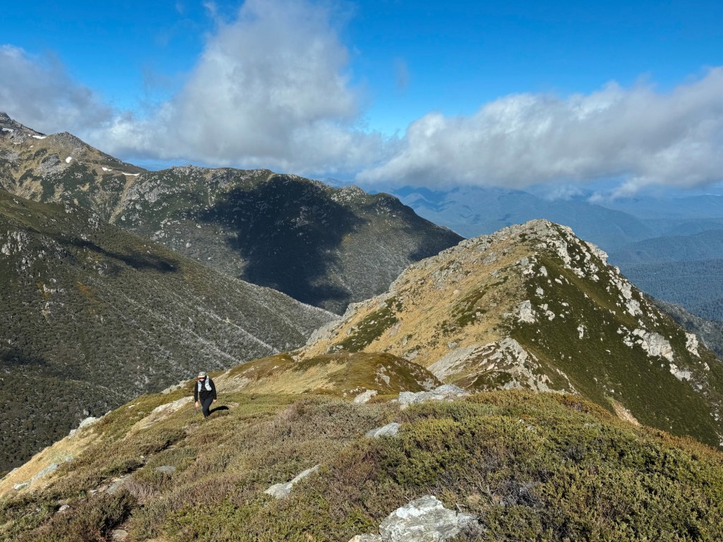
The views opened wide across the mountains and we couldn’t believe dogs were allowed here. This could have been a fast descent, but we took it slow to save the dogs’ legs for the big day ahead. We passed a group of hunters with their dogs (the only people we saw all trip) before reaching a fork where we had the option to take Marginal Road (longer but smoother) or stay on Dunstan Road and cut onto Upper Papes. We chose the shorter route for the dogs, but in hindsight, Marginal Road looked like the nicer ride. A short, steep climb and an equally sketchy descent followed, but we were rewarded with views of snow still clinging to the Main Range for our efforts.
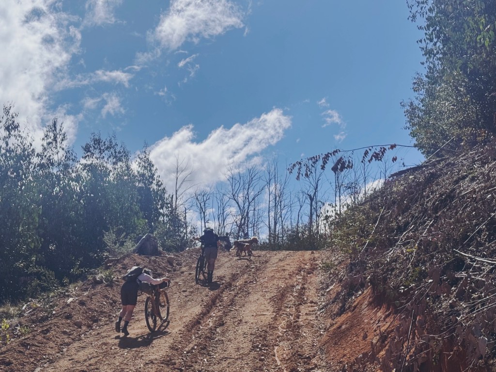
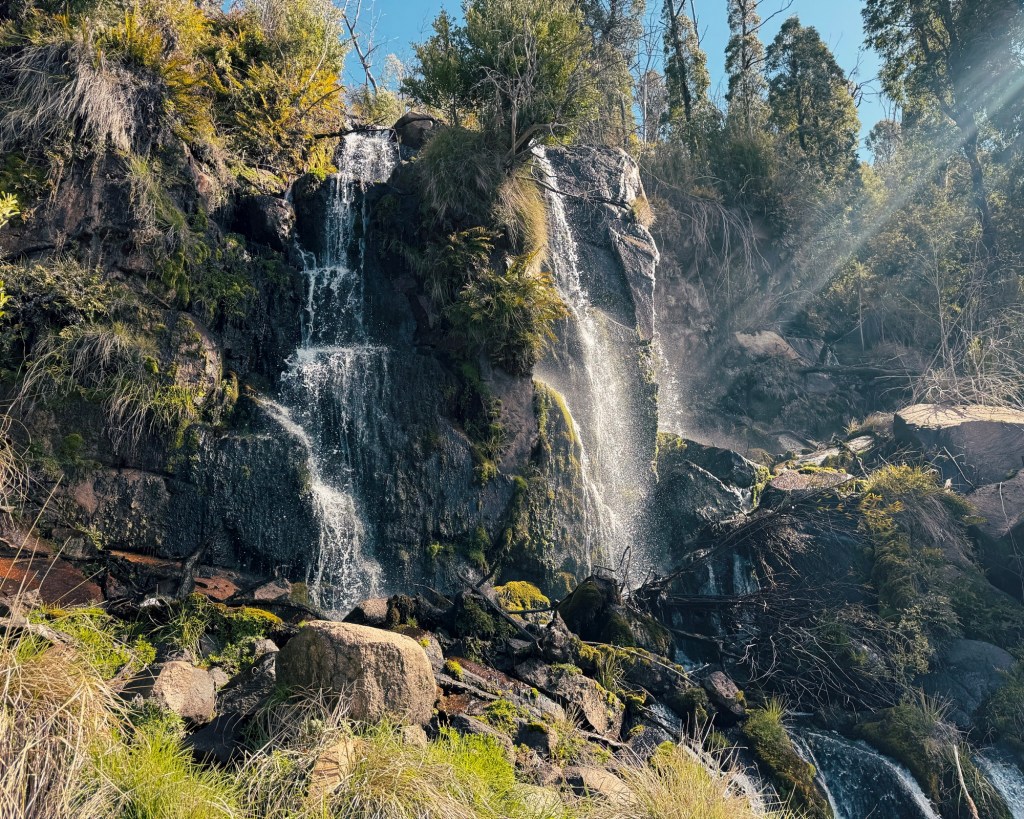
Soon after, we turned onto Scrub Track, which dropped sharply downhill. We ditched the bikes halfway and walked the rest, already anticipating the push back up. At the junction with Marginal Road, we spotted Thowgla Waterfall just up the hill. The track was upgraded after the 2020 bushfires and leads right to the top of the falls. It’s absolutely worth the detour.
Back on Scrub Track, after the inevitable hike-a-bike, the riding mellowed out through native forest with gentle climbs. It felt wild and quiet, and we kept commenting on how nice it was to be in a State Forest that wasn’t a pine plantation.
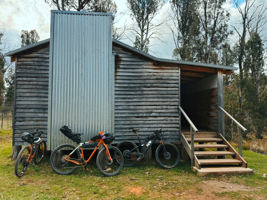
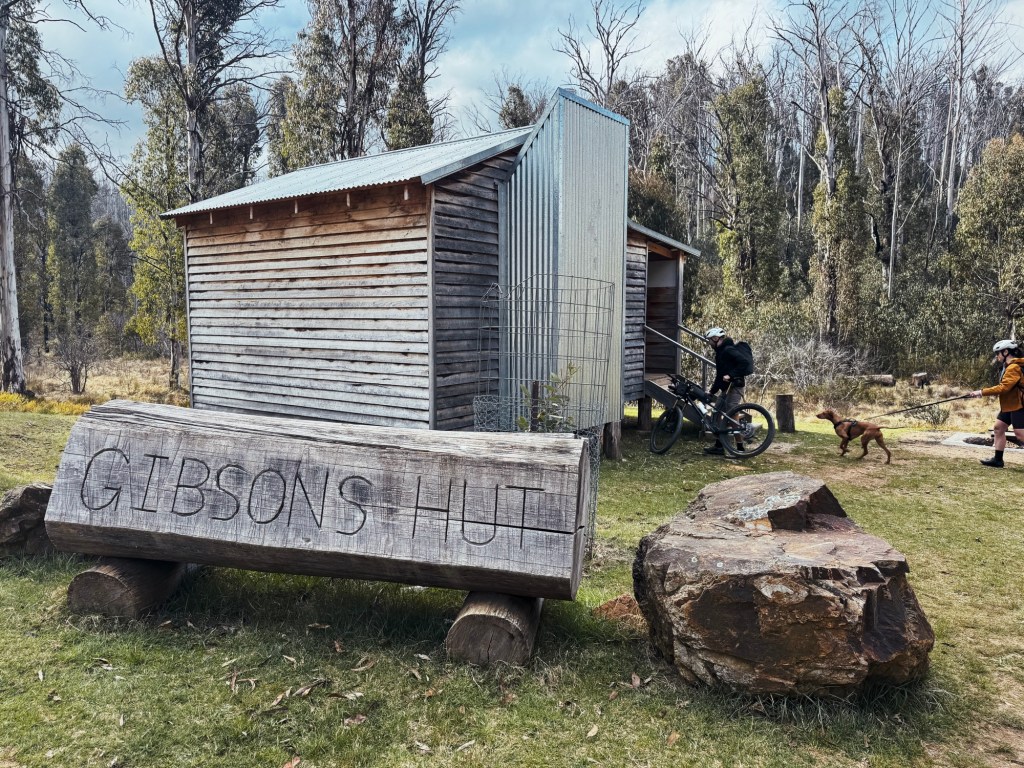
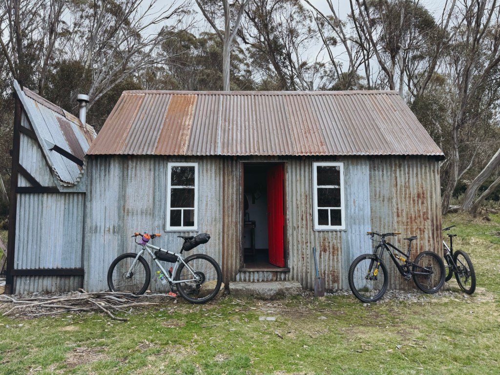
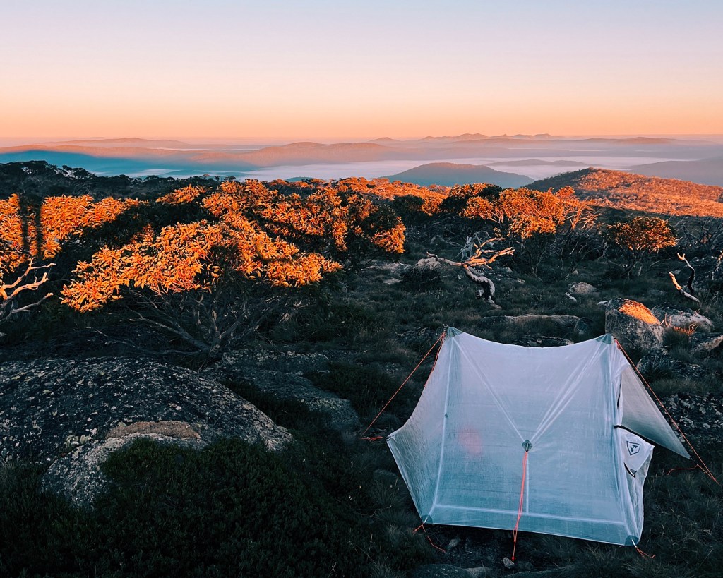
A few turns later we rejoined Dunstan Road and rolled into Pinnibar Gibson Hut just as the sun dipped behind the ridge. The hunters we’d seen earlier had already set up camp, but there was easily enough space for everyone. The rebuilt hut is gorgeous, with a creek nearby and plenty of flat grassy spots for tents. We settled in for the night with tired legs and happy dogs.
Day 2: Pinnibar Gibson Hut to Ski Hut via Wheelers Creek Hut
Distance: 22 km | Elevation Gain: 620 m | Elevation Loss: 535 m
We set off along Shady Creek Lower Track, passing through a locked gate, a promising sign there’d be no vehicles on this section. The day began with a rocky descent that had us testing our skills. Roh was on a mountain bike and definitely had the better setup here, but once the champagne gravel returned, Steph and I were glad to be on our gravel bikes.

Back on the main drag, Cattlemans Creek Track, we decided to skip the extra detour to Wheelers Creek Hut (another 10 km return) as dark clouds were closing in. Instead, we followed the winding gravel back toward Ski Hut, keeping the dogs close on blind corners. The route rejoined with yesterday’s track at Marginal Road junction, making it a cruisy ride home without needing to check the map.
On the drive out, I swung by Wheelers Creek Hut to take a look. It’s a stunner, tucked beside the flowing river with ample space for camping. If your dogs still have energy in the tank, it’s worth adding to your route or stopping in on the way home.

Tips for Dogpacking in the High Country
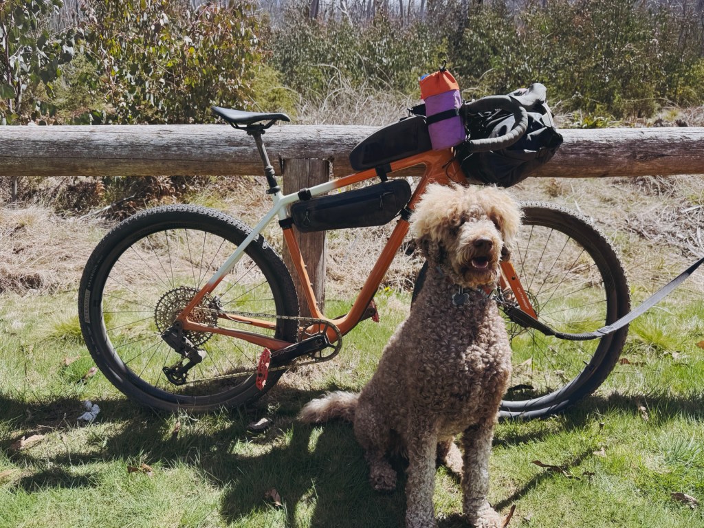
Bike: Gravel or MTB only. I rode my Salsa Cutthroat, a rigid gravel bike with 29 x 2.2” tyres, and it handled the mix of smooth gravel and janky 4WD track surprisingly well.
Phone service: I’m with Optus and had no reception the entire trip. Plan as if you’ll be completely out of reach, bringing a form of emergency communication like a satellite phone or personal locator beacon (PLB).
Hut etiquette: Hard to believe it needs saying, but please respect the huts.
Track closures: Always check Victorian State Forest alerts before heading out. Fire danger, logging, or maintenance can close sections without much notice.
Baiting: 1080 baiting is sometimes used in State Forests, so keep dogs close and avoid letting them wander.
Emergencies: Have a plan in case your dog gets hurt, as you can’t call an ambulance for them. Steph also saved the number for the emergency vet in Corryong, which is a brilliant idea.
Water: In spring we found plenty along the way, but this route can dry up fast in summer. Bring extra for your pup and filter anything you drink, as feral deer and pigs are common out here. There’s a reliable water source at Pinnibar Gibson Hut and Wheelers Creek Hut, but not at Ski Hut.
Wildlife: This area is popular with hunters, so stay alert, especially at dawn and dusk. Snakes are about too, so keep an eye out for both you and your dog.
Toilets: Plenty! Each hut has one, even the Thowgla Waterfall picnic area does. Just make sure to bring your own toilet paper and hand sanitiser.
Disclaimer: Content on Path & Pedal is for general information and inspiration only. All route guides and trip reports are based on personal experience and research at the time of writing. Conditions, access, weather, and regulations can change. Always check official sources and use your own judgment. Outdoor adventures carry risk, and Path & Pedal accepts no liability for injury, loss, or damage.

Leave a comment