Mt Townsend might be Australia’s second highest peak, but it’s far from being second best. Stepping off the ‘highway’ of the Main Range Track in Kosciuszko National Park, the crowds instantly thin out. Weaving between granite boulders and faint footpads, each step pulling you closer to the rocky summit ahead. The hike may be a little more challenging, but the reward of a quieter peak with uninterrupted 360 degree views makes Mt Kosciuszko feel a little underwhelming.
Skip to:
- Quick Look
- About Mt Townsend
- Where to Start & End the Hike to Mt Townsend
- Skill Level Needed to Hike to Mt Townsend
- Best Time to Hike to Mt Townsend
- Where to Camp Nearby Mt Townsend
- Trip Report
- Tips for the Hike to Mt Townsend
Quick Look
Distance: 19.5km return
Elevation gain: 700m return
Duration: 1-2 days
Skill level: Intermediate
Location: Kosciuszko National Park, NSW
GPX: click here
About Mt Townsend
Mt Townsend sits within the traditional lands of the Ngarigo and Wolgalu people, who travelled through the Snowy Mountains with the seasons. During summer, groups moved into the high country for the Bogong moth harvest. These critters shelter in cool rock crevices across the alpine peaks, including the enormous granite piles that form the summit of Mt Townsend.
In 1840 explorer Pauł Strzelecki, guided by two Aboriginal men, Charlie Tarra and Jackey, first stood on Mt Townsend while searching for Australia’s highest peak. They soon realised the neighbouring mountain, now known as Mt Kosciuszko, was slightly taller, with only 19 metres between them. The peak was officially named Mt Townsend in 1885 after surveyor Thomas Scott Townsend.
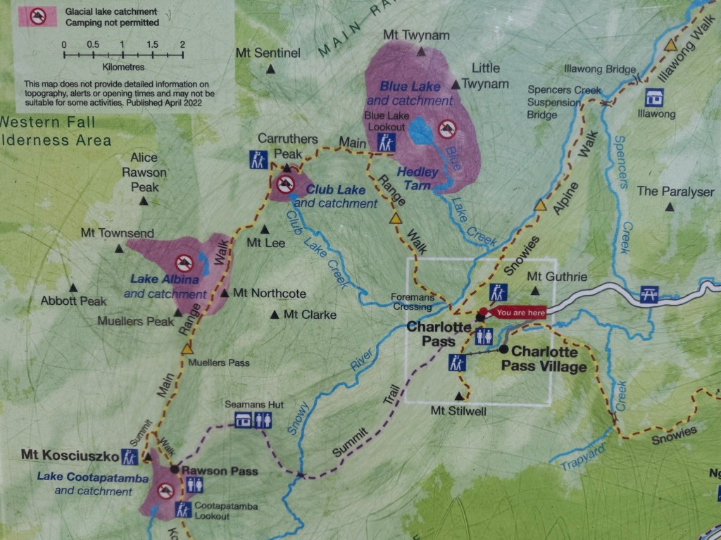
Where to Start & End the Hike to Mt Townsend
This hike can start from either Charlotte Pass or Thredbo Village. On this trip, we took the shorter option and started from Thredbo, which requires a lift pass (we had summer season passes) or hiking up the steep Merritts Nature Track.
Thredbo is about 2.5 hours drive south of Canberra or around 5.5 hours from Sydney. While the village has a few restaurants and basic supermarket, the closest major town is Jindabyne, just over 30 minutes away. From Jindy, the road winds up into the alpine, so drive to the conditions and keep an eye out for wildlife.
You’ll need a valid NSW National Parks pass to enter Kosciuszko National Park. These can be purchased at the Jindabyne Visitor Centre, or at the park entry stations during operating hours.
Skill Level Needed to Hike to Mt Townsend
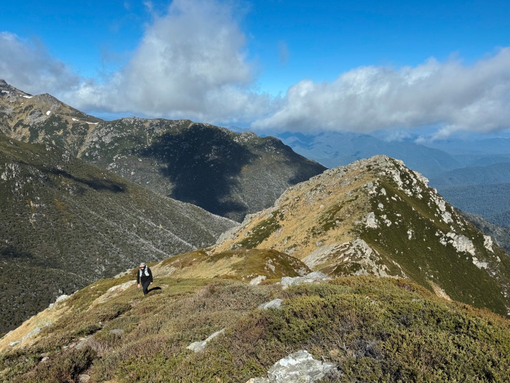
Hiking to Mt Townsend is not a beginner friendly walk. Once you leave the Main Range Track the route becomes entirely off track, with no signage and only occasional footpads to follow. This hike is best suited to intermediate hikers comfortable with navigation and remote terrain. Expect plenty of boulder hopping, and a particularly sketchy rock scramble to the summit.
Weather can add an extra layer of difficulty. This is the true alpine and conditions can change quickly, with strong winds, lightning, snow and hail possible year round. Always check the forecast before leaving home, be prepared for anything, and turn around early if need be.
Best Time to Hike to Mt Townsend
Late spring to early autumn is when this hike really shines. Snowmelt feeds waterfalls, alpine wildflowers carpet the plains, and the high country comes alive with insects. Be aware, snow can still linger on shaded slopes well into summer. In winter the route becomes a much more serious objective. Avalanches are possible on the surrounding slopes and summiting requires extensive winter experience.
Where to Stay Nearby Mt Townsend
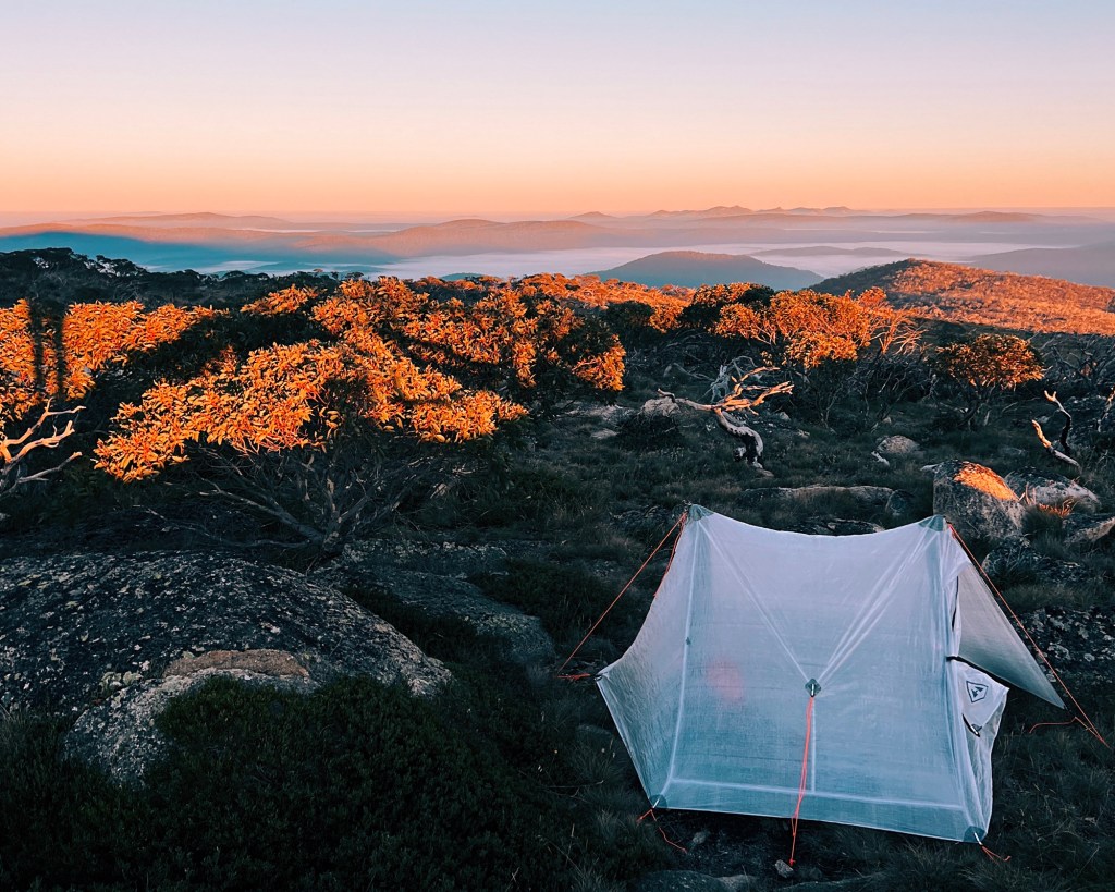
Wilkinson Creek is the official camping area on the Main Range Track and a good sheltered option if the wind picks up. The summit of Mt Townsend is far too rocky to camp on, but my favourite spot is what I call Townsend’s Shelf, a flat alpine bench on the western side of the mountain, just outside the Lake Albina catchment zone. If you choose to wild camp, make sure to follow Leave No Trace principles to keep the area and water system clean for everyone to use. For more information on wild camping in Kosciuszko National Park, see the NSW National Parks website.
Alternatively, this can be hiked in a day, and stay in the Thredbo Valley for the night. Thredbo has plenty of accommodation options ranging from lodges to apartments. The Thredbo Diggings and Ngarigo Campground are the closest National Parks campgrounds, both located along the Thredbo River on the Alpine Way (bookings required).
Trip Report
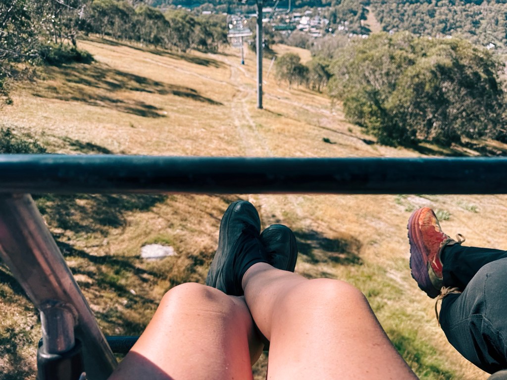
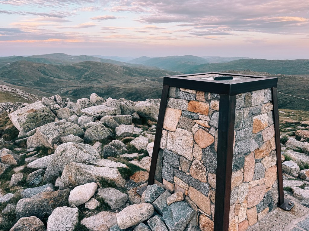
We started from Thredbo Village, jumping on the Kosciuszko Chairlift to cheat a bit of elevation and get straight up onto the Main Range. From Eagles Nest, the walking feels almost too easy, cruising along the metal boardwalk past Signature Hill and out towards the Kosciuszko lookout.
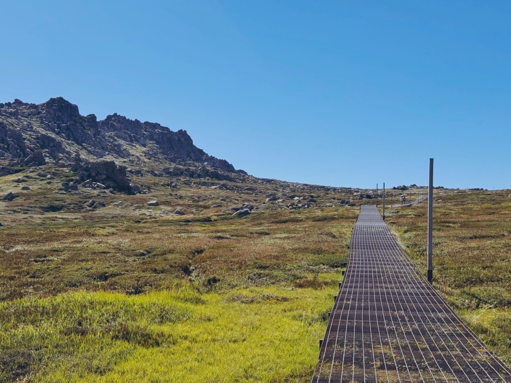
At Cootapatamba Lookout we stopped to spot the bright red hut tucked far below. I’m so used to seeing this lake frozen over in winter while ski touring, that it felt strangely unfamiliar like this. Not long after, a cyclist popped up behind us on the boardwalk. Considering this section definitely isn’t open to bikes, he got a few stern words from us as he tried to sneak past.
We skipped the summit of Kosciuszko and kept heading south towards Muellers Pass. The winds had dropped and the sky was perfectly clear, so instead of descending to Wilkinson Creek, we stayed high and aimed for a camp out on Townsend’s Shelf.
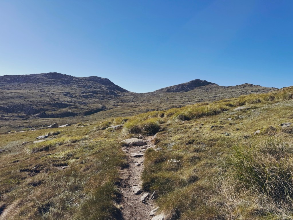
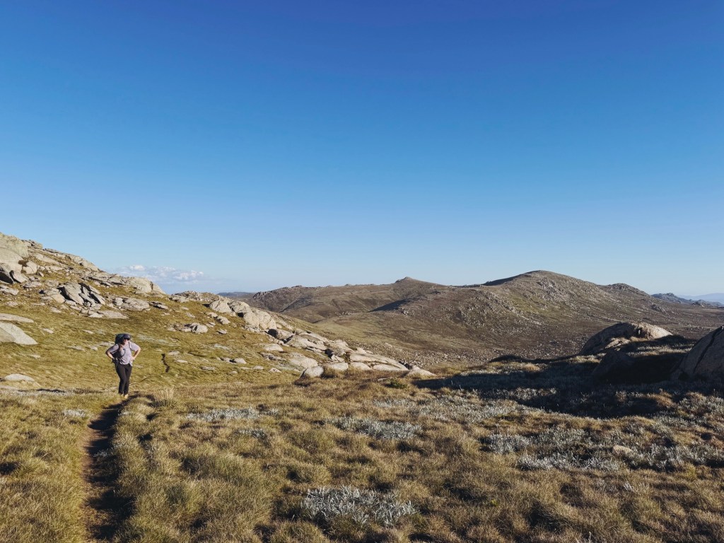
The route weaves through a maze of faint footpads, coming and going across alpine grass and granite slabs. Eventually, a more defined trail appears, skirting around the side of Muellers Peak and slowly drawing closer to Townsend.
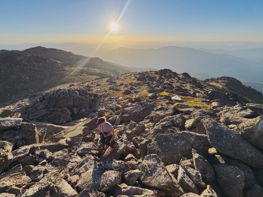
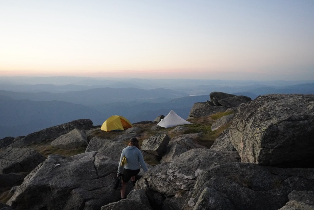
We crossed a few dry creek beds before finding one with a small trickle, just enough to fill up for the night. From there, the land flattens briefly before rising again towards the chaotic stack of boulders that makes the summit. We found a few nice camp spots just below it, but pushed a little further around to the western side, where the land drops away towards Victoria and everything feels a little more removed from the rest of the range.
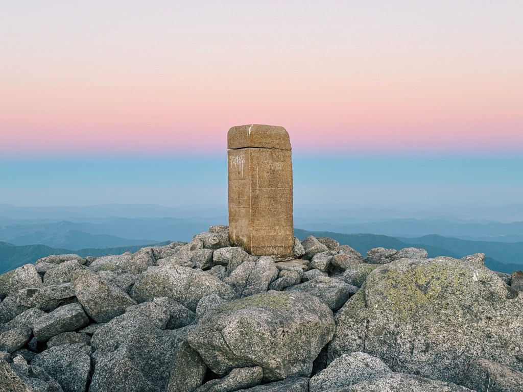
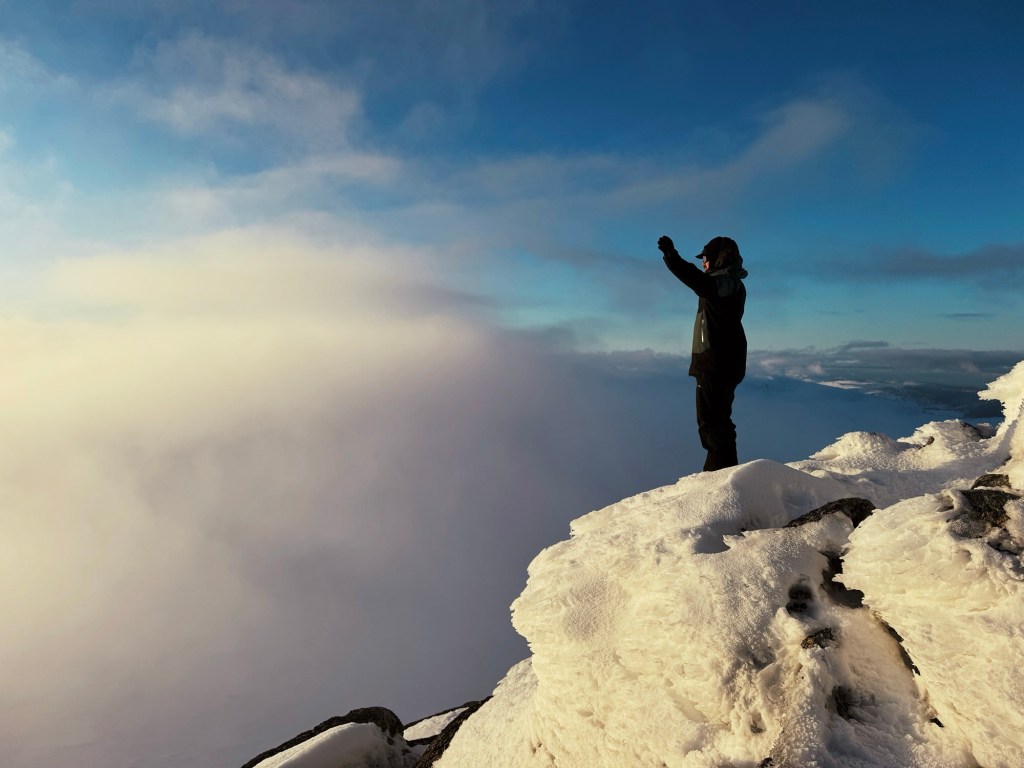
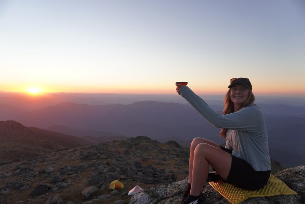
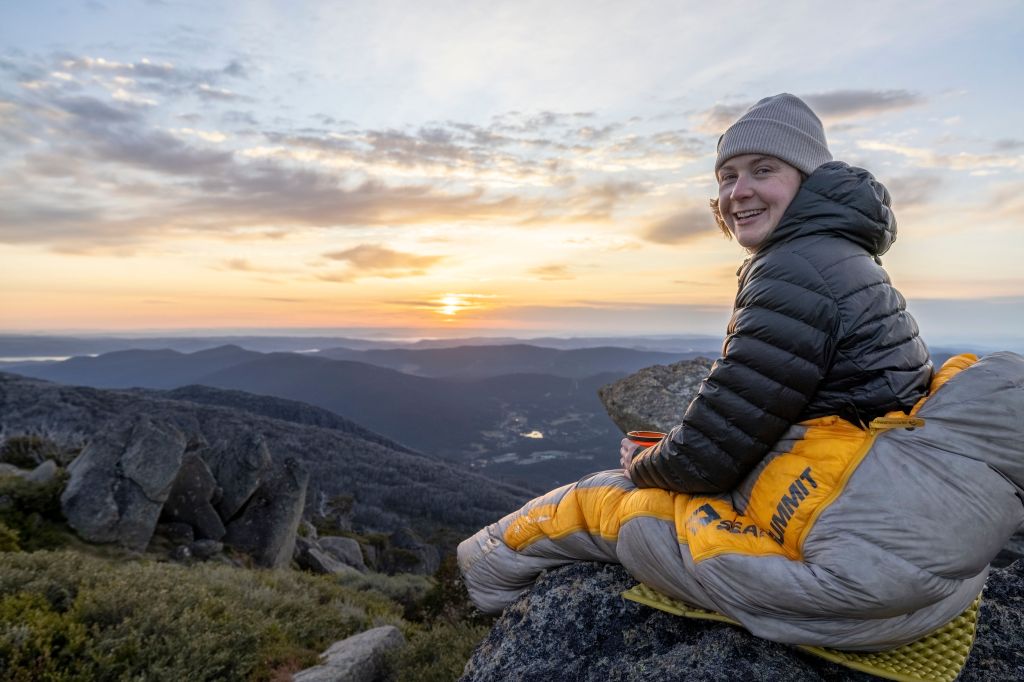
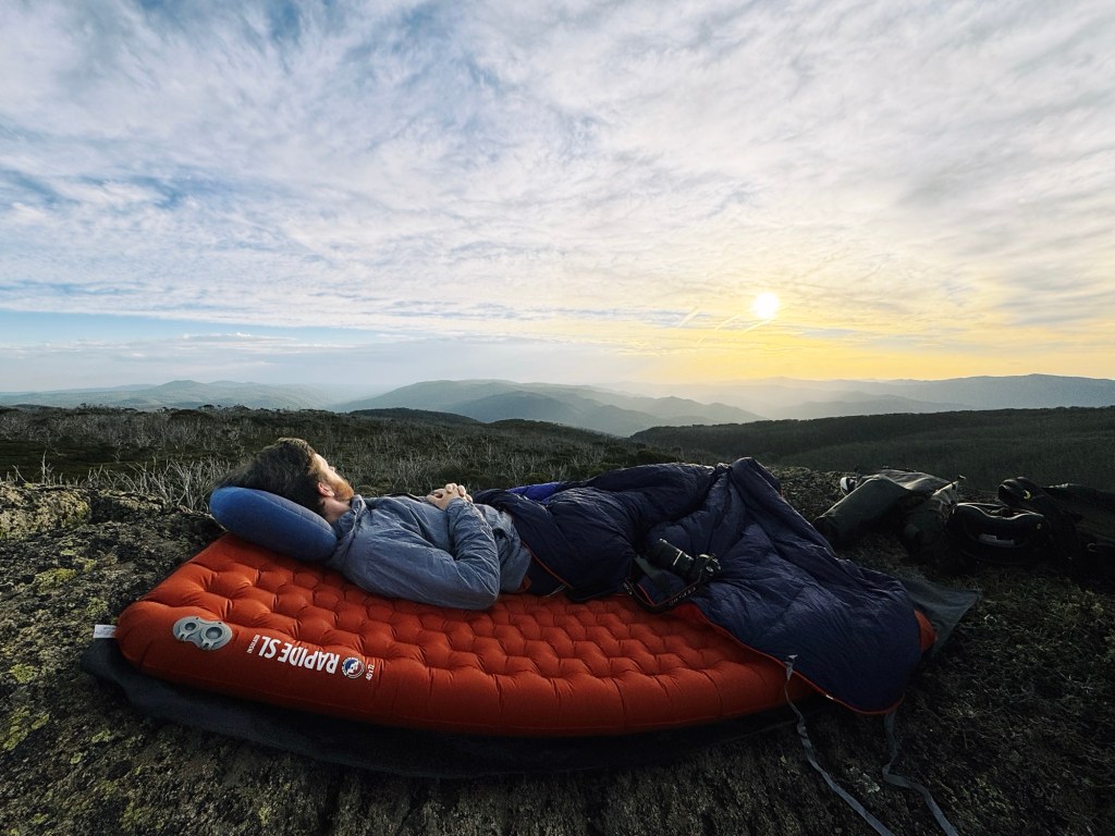
The final scramble to the top is short but loose, with rocks shifting underfoot as you pick your way up. It was completely still by the time we reached the summit, so we carried dinner up and sat there as the sun dropped, watching the entire Main Range light up in orange.
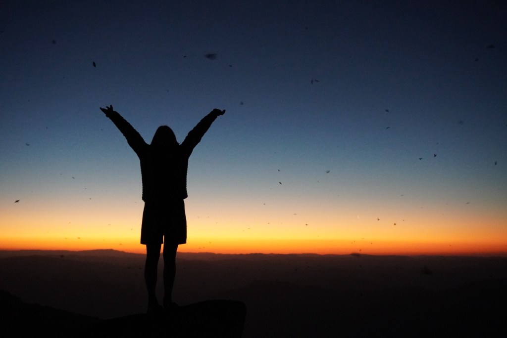
As soon as the light faded, the Bogong moths came out in swarms, fluttering through the rocks and around our tents. It felt surreal, lying on the grass watching thousands of them flying above us.
The next morning we packed up, retraced our steps, and caught one of the first chairlifts back down into Thredbo.
Tips for the Hike to Mt Townsend
Can I ride my bike to Mt Townsend? Sadly, bikes are not permitted on this trail from Thredbo.
Will I have phone service at Mt Townsend? Reception is surprisingly decent along much of the route (I’m with Optus), but it can drop out in valleys. A PLB is a good backup and can be hired from NSW National Parks in Jindabyne.
Does the track to Mt Townsend close? Always check NSW National Parks alerts before heading out. Fire danger, aerial shooting, and maintenance closures are common in this region.
Where can I get water at Mt Townsend? Wilkinsons creek is the most reliable source on this route. Keep it mind, streams may look pristine but traffic in the area is high. I’ve been sick from untreated water from the Snowy River, so I always use a water filter now.
Is there any dangerous animals at Mt Townsend? Snakes and funnel web spiders live throughout the park. Stay alert during warmer months, carry a snake bandage and know how to use it.
Is there toilets at Mt Townsend? The only toilets on this route are at Thredbo (bottom of kozsciuszko chair and top of Kosciuszko chair at Eagles Nest) and Rawsons Pass. Once you leave Rawsons Pass you’re fully in the backcountry, so follow Leave No Trace principles and carry out any waste.
Disclaimer: Content on Path & Pedal is for general information and inspiration only. All route guides and trip reports are based on personal experience and research at the time of writing. Conditions, access, weather, and regulations can change. Always check official sources and use your own judgment. Outdoor adventures carry risk, and Path & Pedal accepts no liability for injury, loss, or damage.

Leave a comment