“His ghost is said to return looking for it, or maybe that’s just the resident possum that lives in the hut now.”
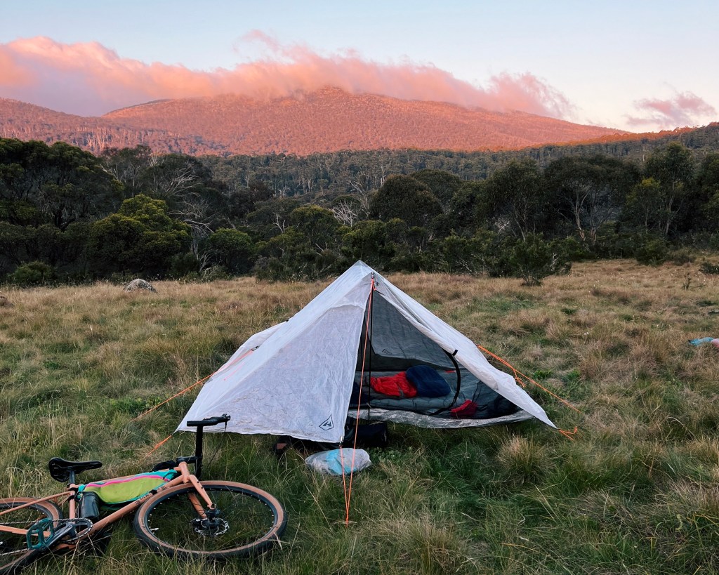
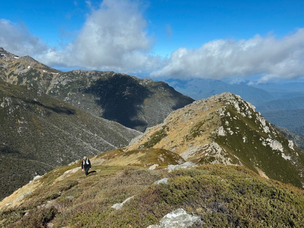
I’ve always had a soft spot for a good hut. There’s something about arriving at an old shack in the middle of nowhere, legs weary, stomach grumbling, and watching the last light fade from the porch. This bikepacking route in northern Kosciuszko National Park links together some of the lesser-known huts with a mix of smooth fire trails, some tough climbs, and a couple of swimming spots along the way. The gravel ride has options for every skill level: a shorter beginner loop, an extended intermediate route, and a detour for advanced riders keen to add a little spice. If that sounds like your sort of weekend adventure, then keep reading.
Skip to:
- Quick Look
- History of Northern Kosciuszko National Park
- How to Get to Tantangara Plains
- Skill Level Needed to Bikepack Tantangara Plains
- Best Time to Go to Tantangara Plains
- Where to Stay Near Tantangara Plains
- Trip Report
- Tips for Bikepacking Tantangara Plains
Quick Look
Distance: 38 – 72km (loop)
Elevation Gain: 670m – 1700m
Duration: 1-2 days
Surface: 100% Gravel
Skill level: Beginner/Intermediate/Advanced options
Location: Kosciuszko National Park, NSW
GPX: https://ridewithgps.com/routes/50620879
History of Northern Kosciuszko National Park
For thousands of years, the Tantangara Plains and wider northern Kosciuszko region are the traditional lands of the Walgal people, whilst the nearby highlands is home to the Ngarigo people. They moved through the area seasonally, gathering for ceremonies, trade, and to feast during the annual bogong moth migration. These wanderings likely shaped the path of some of the trails we ride today.
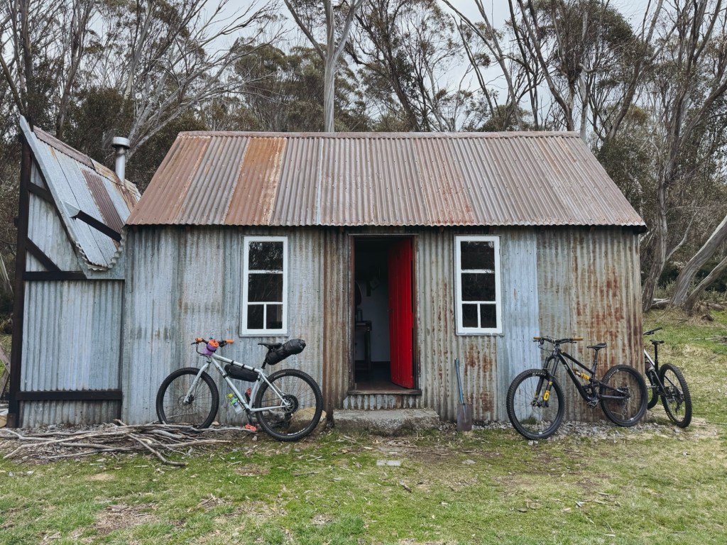
European graziers arrived in the 1830s, running cattle across the plains and building huts that stand there today. This loop visits five of them: Schofields, Circuits, Townsend, Pedens, and Oldfields Hut. Kosciuszko National Park was declared in 1944 and is now co-managed with the Ngarigo people to recognise and protect the deep cultural and environmental significance of this alpine landscape.
How to Get to Tantangara Plains
This loop starts on the Schofield Trail, just off Tantangara Road in Kosciuszko National Park. It’s just over 2-hours drive south of Canberra, or 5-hours from Sydney. The closest town is Adaminaby (30-mins) but it’s only good for a fuel refill. Cooma (1-hour) is the place to go for a proper resupply. I highly recommend a post-ride Bahn Mi at Cisne on the way home.
Skill Level Needed to Bikepack Tantangara Plains
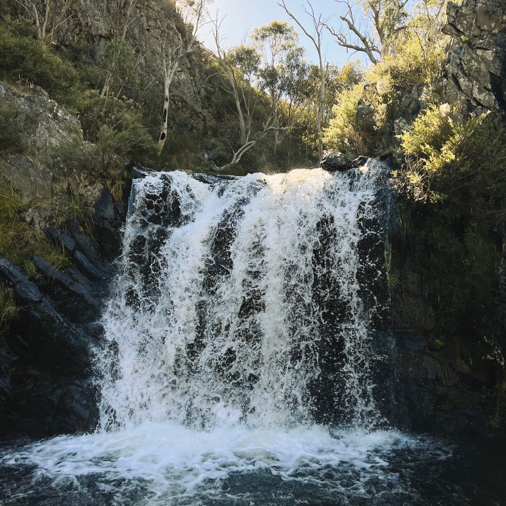
There’s something here for every gravel rider. The beginner-friendly loop (38km with 670m elevation gain) is mostly smooth riding with gentle inclines, and a great option if you’re new to bikepacking or just want a cruisy overnighter. The intermediate route (68km with 1600m elevation gain) adds a few extra climbs, including two that are particularly steep and might be a hike-a-bike for some. For those chasing more of a challenge, the advanced detour (total 72km with 1700m elevation gain) climbs Leura Gap Firetrail. It’s steeper, rougher, and more technical in parts, but it rewards the effort with an epic waterfall. As for bike choice; gravel, hardtail, or full-suspension will all get the job done.
Best Time to Go to Tantangara Plains
Winter brings snow, and mid-summer means relentless blowflies (horseflies) and dry heat. Neither makes for the most enjoyable time on trail. The sweet spot is late spring or early autumn, when the temps are cooler, the wildflowers are out, and the flies haven’t declared war just yet. It’s still the high country though, so conditions can change fast. Pack for four seasons, even if it looks clear when leaving the car.
Where to Stay Near Tantangara Plains
Just before Schofields Trail, off Tantangara Road, you’ll find Wares Yards Campground (the closest camp to the trailhead for anyone wanting an early start). It’s pretty basic, with a drop toilet and not much else, but it does the job. Bookings are required online, with a $6AUD booking fee standard for all NSW National Park campsites. The access road is usually fine for 2WD vehicles in dry weather, but can get a bit sketchy after rain.
Trip Report
Day 1: 41km, 889m elevation gain
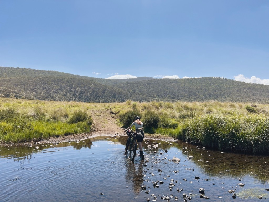
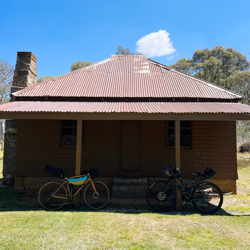
Parking the car on Schofields Trail, the ride begins along a 4×4 track that follows Nungar Creek. Not far in, we hit a locked park gate followed by a creek crossing. The water was low enough to rock-hop across, but in wetter months, it could easily be a shoes-off situation. The trail rolled gently beside the open plains, hugging the treeline until Schofields Hut appeared about 6km in. It’s not the flashiest tin hut, but it’s got charm.
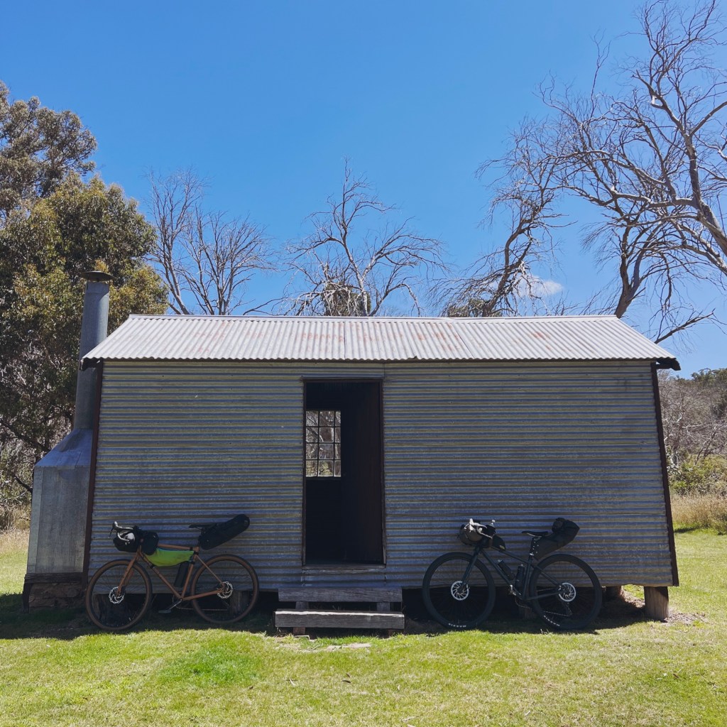
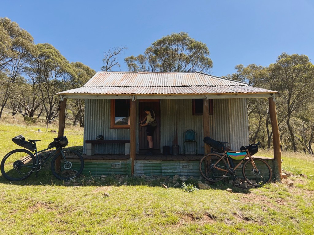
Not long after, we turned left onto Circuit Trail, where the track started weaving into the hills. Somewhere along this stretch, a wild dog trotted across the road, giving me a bit of a fright, but it vanished just as quickly. Circuit Hut is 4km on. More like a house than a hut with it’s four rooms, it made for a solid snack spot. Rumour has it, local legend Jimmy Gavel died in a snow drift here one winter, and his beard was nailed to the mantlepiece. His ghost is said to return looking for it, or maybe that’s just the resident possum living in the roof now.
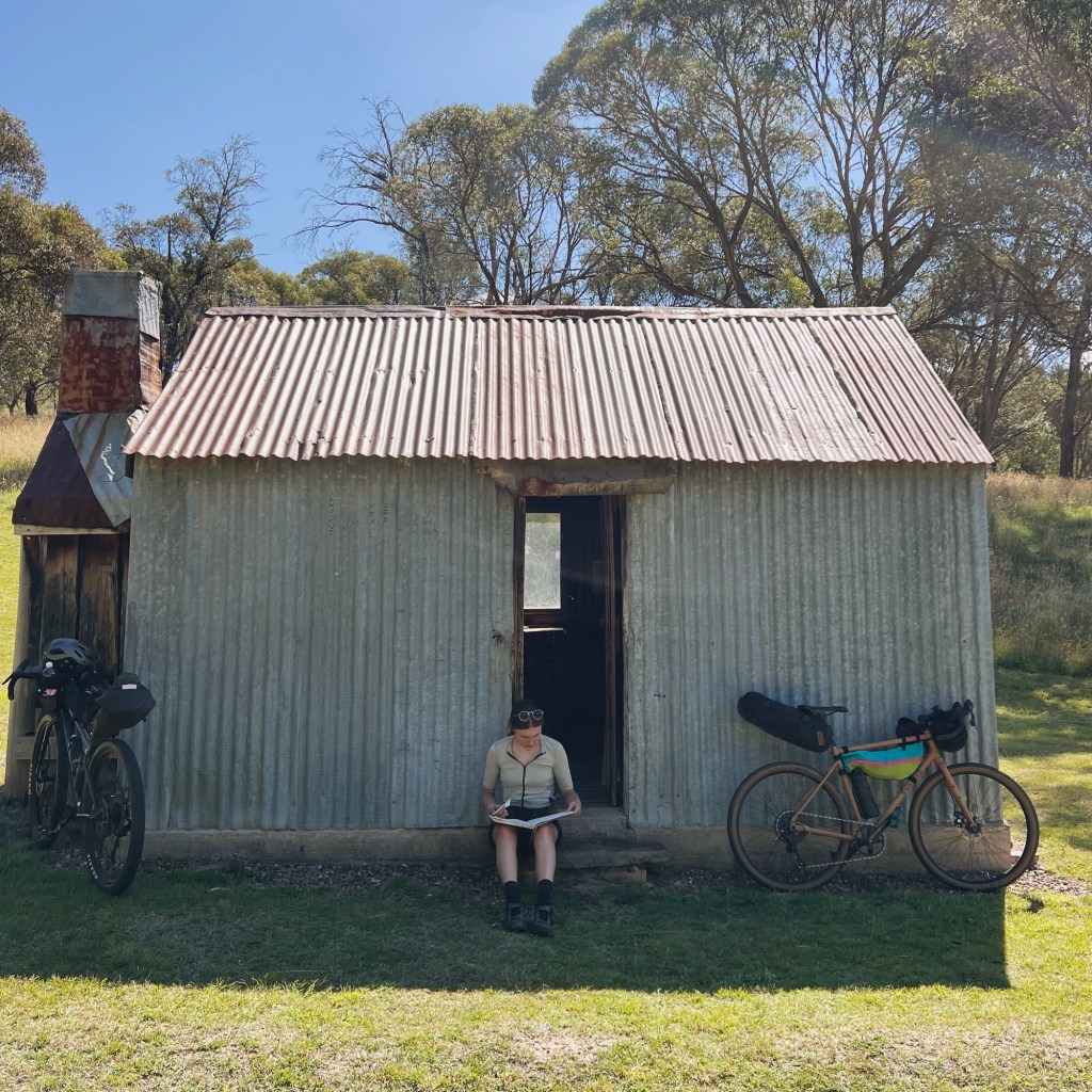
Continuing on Circuits trail, the route turns right onto Pedens Trail. The wide, hard-packed dirt gives way to a narrower grassy track. Just before dropping to Gulf Plains Creek, we took a left onto Townsend Trail for a quick detour. There’s a river crossing over the Murrumbidgee and a short hill to climb, but Townsend Hut is worth the effort. A proper little mountain hideaway, and my favourite hut on this loop.
Backtracking to Pedens Trail, we continued on. The track undulated through gums and wildflowers before arriving at the turn-off to Pedens Hut.
Beginner Option: Pedens Hut Camp
For a shorter, easier ride, Pedens or Townsend make a great place to camp for the night. The next morning, retrace your steps to Circuit Road, but instead of turning left the way you came, turn right and follow the road down to the Murrumbidgee River and Tantangara Road. It’s a steep, rocky descent, so don’t be afraid to hop off and hike-a-bike. From the river, turn left onto Tantangara Road to close the loop. This short-cut takes out the bigger climbs to Oldfields Hut, but still gives a solid taste of the area
Back on the main loop, the trail dropped steeply to the Murrumbidgee. A proper brake-squeezer of a descent. The clear water at the bottom was a welcome sight. Cold, clean, and perfect for a swim before the next big climb. Love Nest (in the Salees) is about 200m off the track here, but I’ve never gone looking for it. The story behind it gives me the creeps (a family secret of some sort of adultery), and I’ve heard it’s in pretty rough shape anyway.
Now for the grunt. The next climb along the Murrumbidgee National Trail (a section of the Bicentennial National Trail) is a beast: 5 kilometres with about 300 metres of vert. It’s a slow, steady grind, and with a loaded bike, so it’s definitely hike-a-bike territory for some. At the top, the trail intersects with Tantangara Road, and things get much easier.
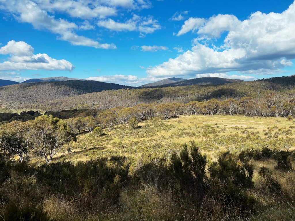
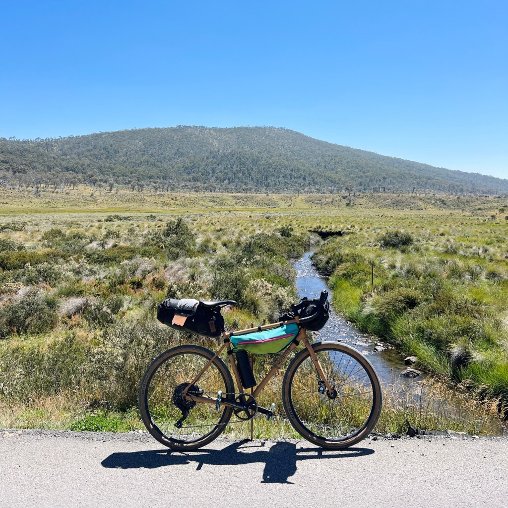
Tantangara Road is wide and smooth (with the occasional vehicle), so it’s a good chance to rest the legs. There’s a section along here that absolutely rips; perfect champagne gravel, fast descent and huge views across the plain.
After crossing through a park gate, the track becomes Pocket Saddle Road. Not long after, the turn-off to Murray Gap Trail will appear, for the final push to camp. But if there’s still some fuel in the tank, there’s a spicy detour available…
Advanced Option: Waterfall Detour
Instead of taking the Murray Gap turnoff, we stayed on Pocket Saddle Road and turned onto Leura Gap Fire Trail. This section follows an old aqueduct and gets punchy. Short, steep climbs and fast drops that had gears shifting and legs burning. The trail runs close to the Goodradigbee River, with glimpses of a distant waterfall. We kept going and found a second waterfall closer in, though the descent to reach it was sketchy. If that’s not your thing, there’s a weir a bit further along that makes for a great swim spot. The climb back out of Leura Gap is savage. We walked almost the whole thing.
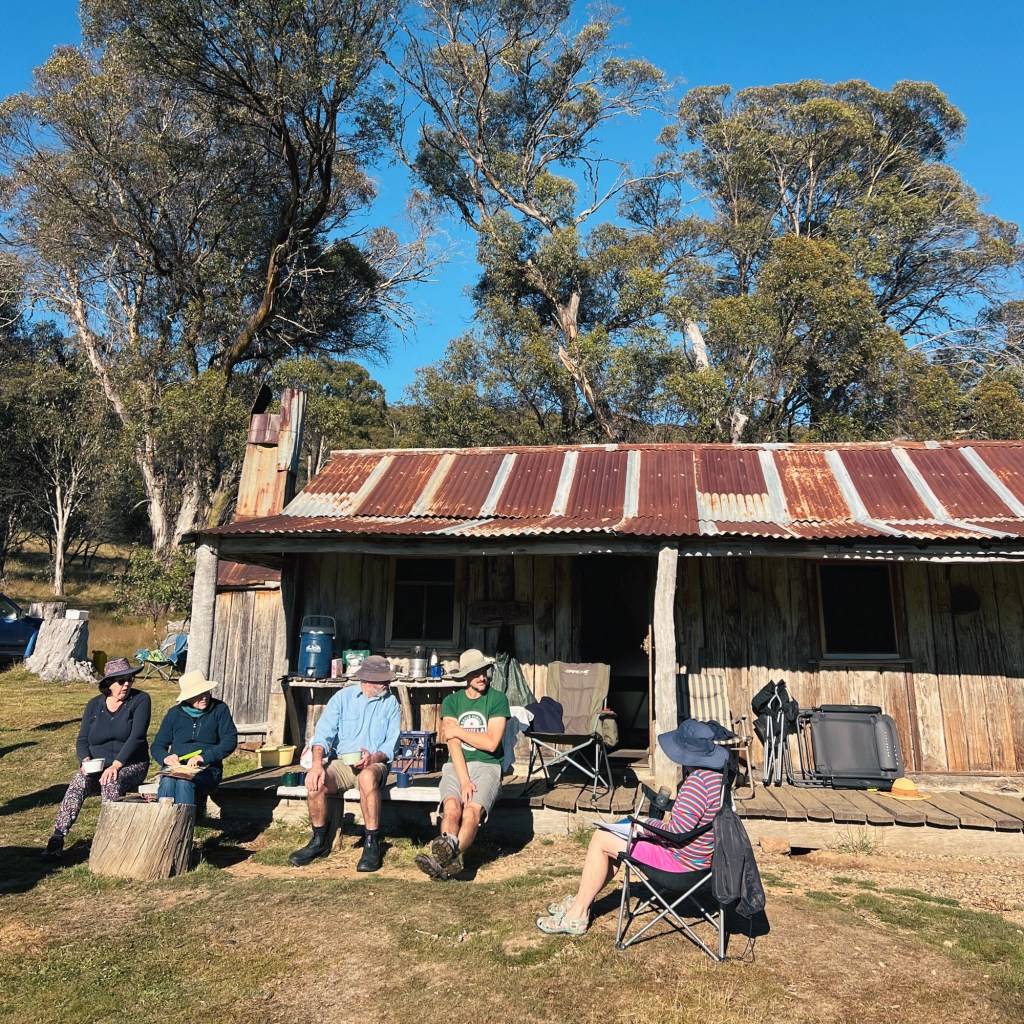
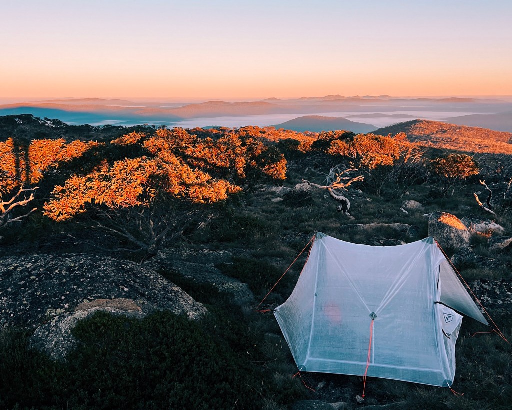
Eventually, we rejoined Murray Gap Trail and rattled down a short, janky descent to Oldfields Hut. We arrived just before sunset and was surprised to find a couple of vehicles out front. Turned out the Kosciuszko Huts Association (KHA) volunteers were doing hut repairs and had been granted vehicle access. We joined them around the fire, scored some snacks, and witnessed the resident possum emerge from a saucepan at night fall.
Day 2: 30km, 882m elevation gain
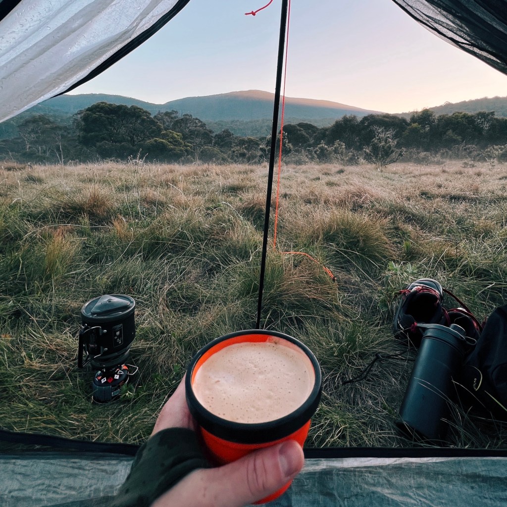
Instead of retracing our steps, we turned the route into a proper loop and took the easy way home. With fresh legs and a strong coffee, we rolled out from Oldfields, headed up Murray Gap Road, and hit the morning climb through the gums.
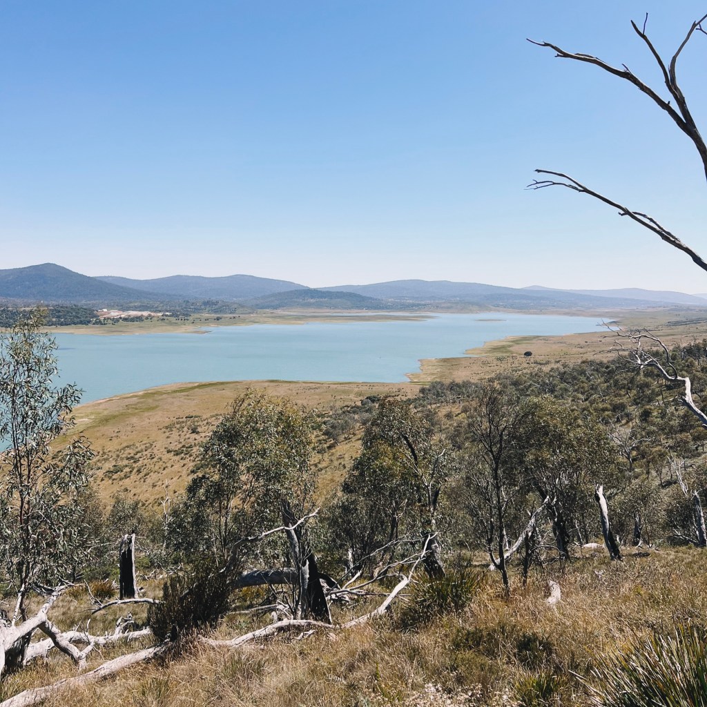
Rolling back down to Pockets Saddle Road, through the gate and onto Tantangara Road the climb continues gradually, but nothing too offensive. Eventually, the trees opened up to reveal Tantangara Dam and the Snowy Hydro 2.0 village (a sign the descent was about to begin).What followed was tight switchbacks, loose gravel, and the smell of my brakes cooking by the bottom. A fun downhill, but one to take slow. Cars use this road and there’s not much visibility around bends.
At the bottom, we pulled up at the Murrumbidgee River and sat on the old bridge for lunch. Sun on our backs, legs dangling over the water, and gorging on whatever snacks we had left before the home stretch.
The final stretch followed Tantangara Road around the dam. It was easy riding, but once we passed the Snowy camp, the traffic picked up. A few utes and even a big rig or two. The last few kilometres rolled through open country, and eventually Schofields Trail came back into view. Dusty, hungry, and already thinking about my post-ride meal.
Tips for Bikepacking Tantangara Plains
Phone Service: There’s none for the whole loop (I’m with optus). Bring some form of emergency comms like a PLB or sat phone, especially if riding solo.
River Crossings: There’s one major river crossing that could be tricky or even dangerous if the Murrumbidgee is running high. If that’s the case, turn back and reroute via Tantangara Road, crossing over the bridge.
Closures: Always check for trail closures before heading out. This area is occasionally shut due to feral animal control or Snowy Hydro 2.0 works.
Wildlife: Give all animals plenty of space. I’ve seen snakes, funnel web spiders, alpine dingos/wild dogs, possums, feral pigs & horses and horses out here (and that was just on this trip).
Toilets: There are a couple of drop toilets on the loop, including one at Oldfields and another at Circuits Hut.
Water: Streams, rivers, and creeks are spaced roughly every 10km. Just make sure to treat it due to the contamination by wildlife in the area.
Disclaimer: Content on Path & Pedal is for general information and inspiration only. All route guides and trip reports are based on personal experience and research at the time of writing. Conditions, access, weather, and regulations can change. Always check official sources and use your own judgment. Outdoor adventures carry risk, and Path & Pedal accepts no liability for injury, loss, or damage.

Leave a comment