When the most common reaction is “You’re going where?”, it’s usually a sign you’re headed someplace good!
The red dirt starts creeping into the car around hour eight. As the bitumen gives way to gravel, the reception drops out and the landscape stretches wide and dry on the horizon. That’s when you know Mutawintji National Park is getting close.
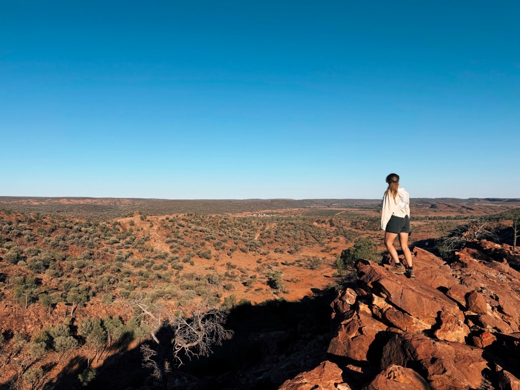
Tucked deep in the outback of Far West New South Wales, Mutawintji is a place of dramatic gorges, weathered rock formations, ancient Aboriginal carvings, and more emus than you can count. After spending three days here, hiking every single trail, I can honestly say it’s one of the most unique national parks in the state.
Skip to:
- About Mutawintji National Park
- How to Get to Mutawintji National Park
- Where to Stay in Mutawintji National Park
- Best Time to Visit Mutawintji
- Wildlife in Mutawintji National Park
- Walking Tracks in Mutawintji National Park
- Final Thoughts
About Mutawintji National Park
For over 40,000 years, the area has been the traditional land of Paakantji, Malyankapa, Wilyakali, and Malyangapa Peoples. Mutawintji National Park is one of the most significant cultural heritage sites in New South Wales with some of the best-preserved Aboriginal art. In 1998, it became the first national park in NSW to be returned to its Traditional Owners. Today, it’s jointly managed by the Mutawintji Local Aboriginal Land Council and the NSW National Parks and Wildlife Service.
How to Get to Mutawintji National Park
Although located in NSW, at 8-hours drive, Adelaide is it’s closest city. It’s just under 12-hours west from Canberra and Sydney, or about 13.5-hours north from Melbourne. It’s a long drive from anywhere, but completely worth it.
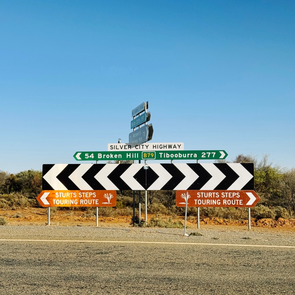
The park sits roughly 130 kilometres northeast of Broken Hill. The final stretch is unsealed and gets rough in patches. While 2WD access is possible, a 4WD or AWD makes for a much smoother ride.
If it rains, all roads into the park are closed, and I mean completely shut. So be prepared for last-minute cancellations, checking the National Parks alerts and weather forecast before leaving home. There’s no fuel or resupply options in the park, so fill up in Broken Hill or White Cliffs before heading in.
Where to Stay in Mutawintji National Park
We stayed at the one and only official campground in the park: Homestead Creek Campground. It’s right on the dry riverbed, with views of the red cliffs out the tent door. Facilities are basic but better than expected with flushing toilets, tank water (bring a filter), and cold showers that occasionally run warm. There are no bins, so pack out everything brought in. There’s also no phone reception or power, so come ready to be completely off grid.
Wild camping isn’t mentioned explicitly on the NSW Parks website. We spotted a few potential hike-in spots along the trails, but decided to stick with the designated campground just to be on the safe side.

Best Time to Visit Mutawintji
The best time to visit Mutawintji is in Autumn or Spring. Summer can be brutal, with temperatures soaring above 40˚ C and almost zero shade on the trails. Winter nights can dip below freezing, so 4-season gear is a must. We went in April and scored warm, sunny days in the high 20s to low 30s. It was gorgeous hiking weather, but after a dry summer, the water levels in the gorges were pretty low.
Wildlife in Mutawintji National Park
We saw more animals than people during our time in Mutawintji. The road into park is packed with wildlife, especially at dusk and dawn. Emus, kangaroos, and wallaby’s were everywhere, including quite a bit of roadkill, so drive carefully and to the conditions.
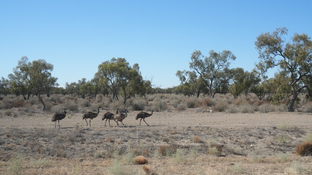
Photo by @courtneyevewhite
Feral goats are a growing issue, and their impact on the landscape is obvious. On one trail, we spotted six dead goats in a single waterhole. It’s a grim reminder of how invasive species can take over a place, but the park is actively working to reduce their numbers. While we were there, some areas were closed at night for culling operations, so check the NSW National Park website for any alerts.

Photo by @courtneyevewhite
For keen bird watches, Mutawintji is one of the best places in NSW to see pink cockatoos (Major Mitchell’s). They’re usually in the park from July through to January. I was desperate to see one and scanned every gum tree I passed. We think we saw two flying overhead with their pink and yellow undersides flashing in the sun, but they were too far to really tell. Wishful thinking, maybe?
Walking Tracks in Mutawintji National Park
We walked every marked trail in the park (yep, all four of them), and they each offered something completely different. Some wandered past aboriginal illustrations, some had us scrambling through gorges, and others opened up to sweeping outback views. All of them were worth the effort. Here’s a breakdown of the walks, what to expect, and a few trail notes from our trip.
Byanguano Range Walking Track (9km loop)
Best For: A bit of everything- views, waterholes, cultural sites
Let’s start with the best trail in the park (in my humble opinion). This one loop combines four tracks: the Thaaklatjika Mingkana (Wright’s Cave), the Rockholes Loop, Homestead Gorge, and the Bynguano Range Walking Track.
Thaaklatjika Mingkana Walking Track
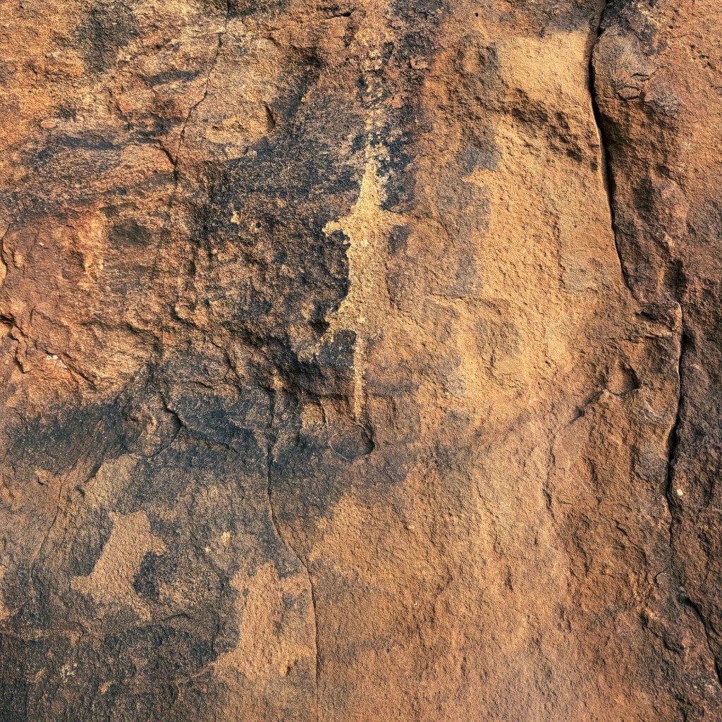
It starts at the very back of the campground, on a gentle (wheelchair-friendly) track following the dry bed of Homestead Creek to a shallow cave where Aboriginal hand stencils and drawings cover the rock. Some were sadly stamped over by pastoralist W. Wright.

Rockholes Loop Walking Track
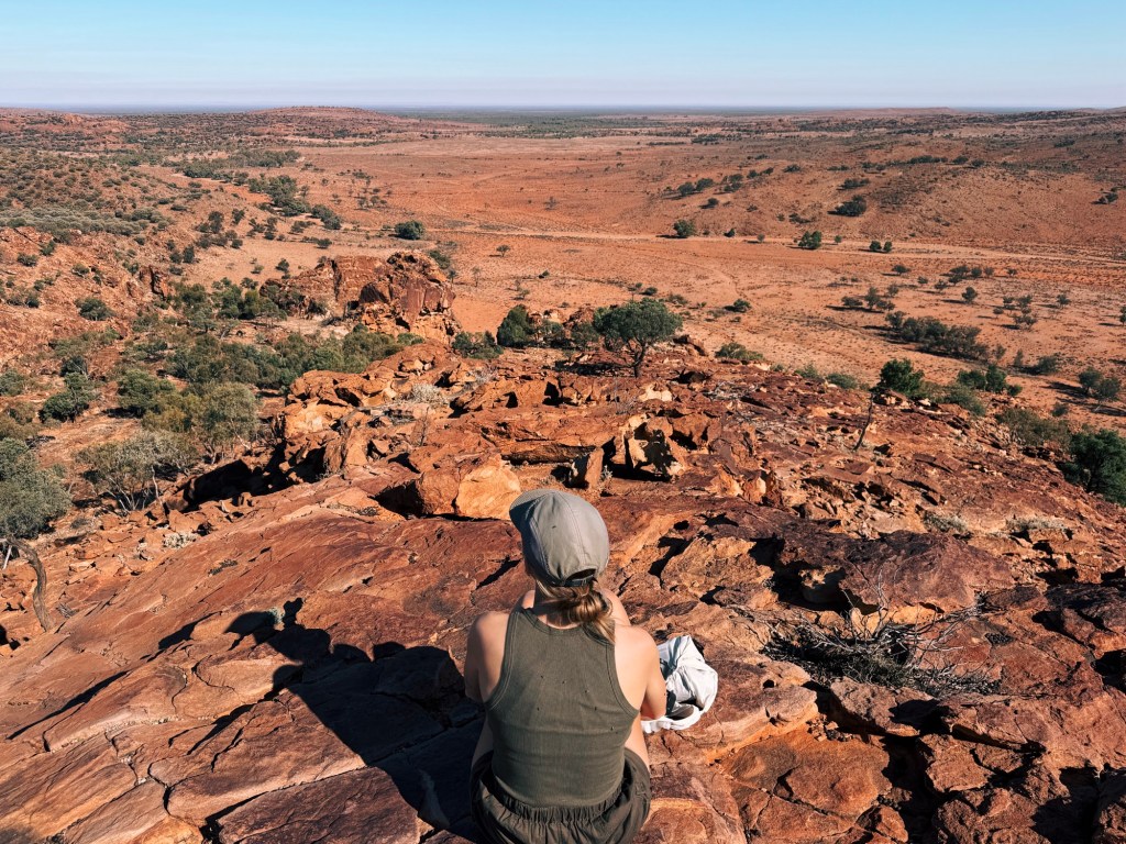
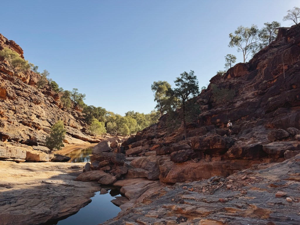
From the cave, the trail drops into the rocky creek bed and becomes the Homestead Gorge Walk. Markers zigzag across the stones until the Rockholes Loop turn-off. This one’s short but steep, climbing past rock carvings and a wooden step-ladder to a weir and three pools of glassy, oil-slick water. If you continue to the top of the track, the views are worth every bit of effort. We even spotted an emu making its way along the gorge below.

Homestead Gorge Walking Track
Back on the main track, we pushed on to Homestead Gorge. It’s one of the most peaceful spots in the park. The red rock walls tower quietly above, and there’s this stillness that makes everything feel ancient. It’s easy to see how important this place is for sustaining the wildlife that call this place home. We lingered here for a while, letting the silence settle in.
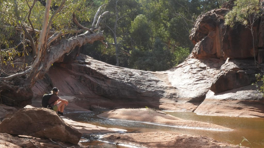
Photo by @courtneyevewhite
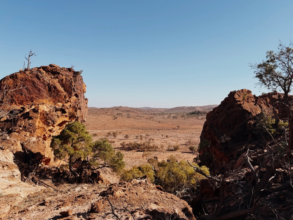
Bynguana Range Walking Track
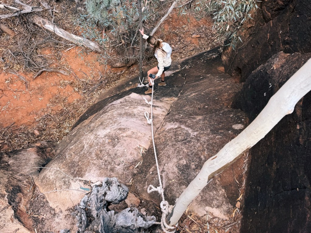
The trail backtracks slightly before climbing out of creek bed on the Bynguano Range Walking Track. The landscape changes with open ridgelines, and low hills. We crossed a few dry creeks, scrambled down boulders with the help of a fixed rope, and squeezed through a narrow slot that made me question if I could even fit.
Somewhere along the way, a flash of colour caught my eye. A blue and orange lizard darted between the rocks. Later I learned it was a Barrier Range Dragon, an endangered species. I wasn’t quick enough to get a photo, but the moment made my day.
Eventually, we looped back to the Thaaklatjika Mingkana Walking Track near the cave art, then followed the path back to the campground.

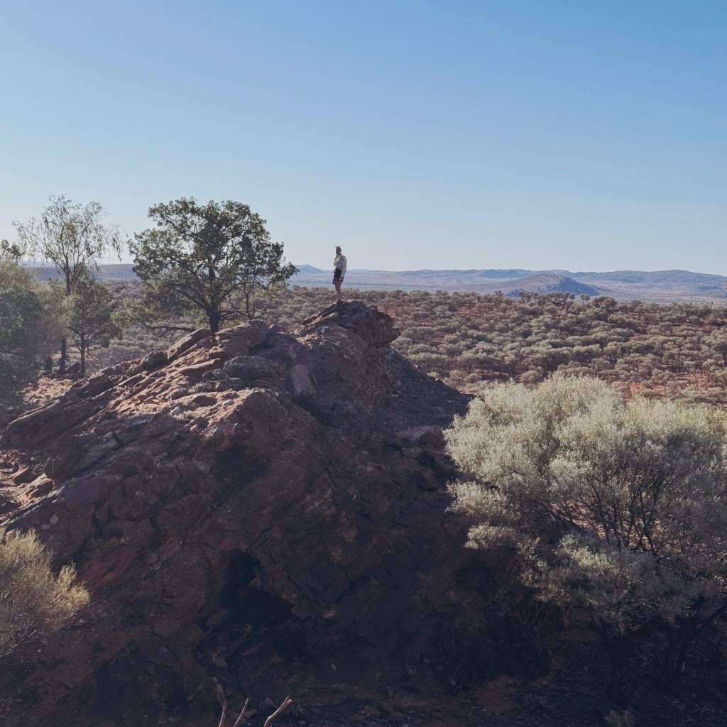
Western Ridge Walking Track (6km loop)
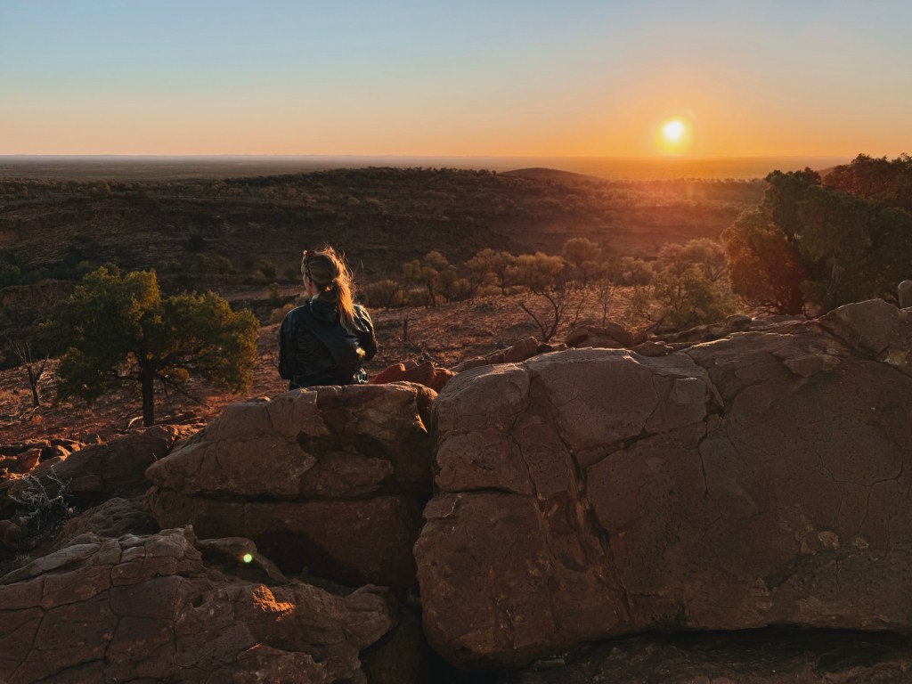
Best for: Sunset and sunrise views
We started this one near the campground entrance and walked it clockwise. The trail runs beside the road, crosses over, and through a fence into the open scrub. It climbs steadily up a spur, passing a few Aboriginal drawings carved into a rock along the way. About halfway up, there’s a west-facing lookout that would absolutely hit at golden hour.
There’s no real summit. The ridge just rolls into a long stretch of low bush and rocky ledges. We found a perfect little cliff to perch on, watching the shadows grow long across the valley. Eventually, the trail drops down sharply, winds around the base of the walls, and out onto the flats near the campground.
Hot tip: for sunset missions, I recommend walking it anti-clockwise. That way, the technical climb is done in daylight, arriving right at that open lookout on the descent as the sky changes colour. Plus, it makes for a shorter walk down the spur and along the road as the light fades. Just don’t forget a head torch.
Split Rock Walking Track (6km return)
Best for: Aboriginal sites and huge rock features
This trail isn’t marked on many of the park signs, but it’s well worth hiking. Start at the day-use picnic area at the end of the Old Coach Road scenic drive.
The walk follows a dirt road past Wana Karnu, a massive rock formation rising from the plain. Then it curves around a dam (dry when we visited). After the bend, Split Rock looms ahead. The trail crosses a dry creek, and this is where we messed up. We kept following the 4WD track beside the creek bed. Don’t do that. There’s a faint foot track cutting across the plain, that’s the right way to go.

There are lots of large rocks in the area, but one stands out. A massive boulder split straight down the middle like a cracked egg. Beneath here, there is a handful of Aboriginal handprints, including a smaller one that looks like it belonged to a child. We scrambled to the top for a snack and a view, then wandered back the way we came.
Important note: Split Rock is a women’s sacred site. Men are not permitted within 100 metres. Please respect this cultural boundary.
Mutawintji Gorge Walking Track (6km return)
Best for: Waterholes and dramatic gorge scenery
This is the park’s most popular walk. While the gorge itself is undeniably beautiful, it wasn’t my top pick.
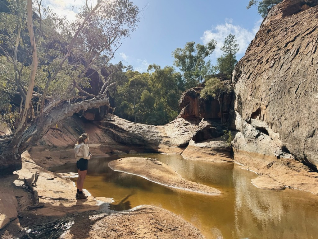
The trail starts out mellow, following a 4WD track before dropping into a dry creek. As the gorge walls close in, the scenery turns it up a notch. Towering walls rise on either side, there’s a bit of rock scrambling, and scattered pools begin to appear. Eventually, the trail leads to a narrow crack in the gorge where a large waterhole sits at the base of the amphitheatre.
When we visited, the water was low and murky, and the smell was horrendous. We counted six dead goats in the gorge pool, which was pretty grim. On a wetter year, I imagine this would be an amazing spot to swim deeper into the canyon.

Mutawintji Cultural Tour
The Mutawintji Historic Site, which includes ceremonial places, engravings, and ancient art galleries, can only be accessed with an Aboriginal guide. Tours must be booked in advance via NSW National Park (prices vary), and only run on certain days. We didn’t organise a tour before we left home, and that’s my biggest regret of the trip. Everyone we spoke to who joined one absolutely raved about it.
Final Thoughts
Mutawintji National Park is the most special place I’ve visited in New South Wales. It’s raw, remote, and full of ancient Australian history. The walking trails are adventurous, the native wildlife is abundant (surprisingly in such a dry place), and the silence is something else entirely.
Disclaimer: Content on Path & Pedal is for general information and inspiration only. All route guides and trip reports are based on personal experience and research at the time of writing. Conditions, access, weather, and regulations can change. Always check official sources and use your own judgment. Outdoor adventures carry risk, and Path & Pedal accepts no liability for injury, loss, or damage.

Leave a comment