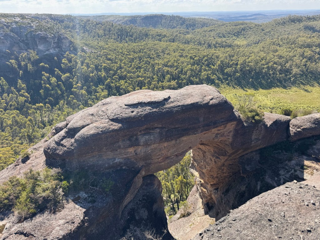
The first time I hiked to Corang Arch, I almost walked straight past it. A barely noticeable, mossy stone arrow on the ground pointed to a faint footpad that vanished off the plateau. And there it was: a sandstone arch the size of a two-storey house, holding its place impressively at the cliff’s edge. No signs. No fences. No crowds.
This trail winds through part of the Budawangs, past towering rock features, across open slabs, and deep into one of the most beautiful corners of Morton National Park. Yet somehow, this remote overnight hike is less than a two-hour drive from Canberra.

Skip to:
- Quick Look
- About Budawang National Park & Corang Arch
- Skill Level Needed to Hike to Corang Arch
- Where to Start the Hike to Corang Arch
- Where to Stay Near the Hike to Corang Arch
- Best time to Hike to Corang Arch
- Trip Report
- Tips for Hiking to Corang Arch
Quick Look
Distance: 13.5km one-way
Elevation Gain: 382m one-way
Duration: 1-2 Days
Skill Level: Intermediate
Location: Morton National Park, NSW
GPX: https://www.strava.com/routes/3353506045881968626
About Morton National Park & Corang Arch
The Yuin people have lived along the South Coast of NSW for thousands of years. The Budawang area is the traditional land of three language groups: the Budawang people (between Conjola and Durras), the Wandandian people (north of Didthul, aka Pigeon House Mountain), and the Walbunja people (south of Didthul). The Budawang Range takes its name from the highest peak, Mount Budawang (1,129m). This high point was once used by First Nations people to light signal fires and monitor movement between the coast and high country.
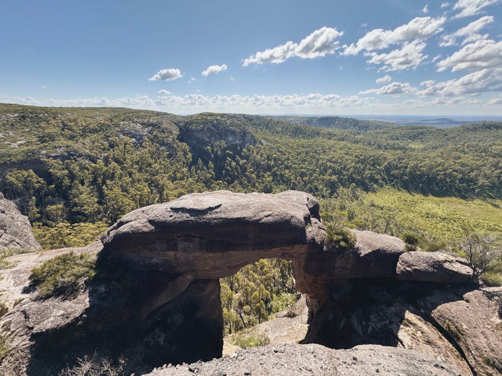
The Budawang Range was formed over millions of years, first shaped by underwater currents, then uplifted and sculpted by wind and water into the dramatic sandstone spires, valleys, and cliff lines we see today. Tucked into it all is my favourite feature: Corang Arch. Around 10 metres wide and 20 metres tall, it’s hard not to sit in awe of Mother Nature when you lay eyes on this wind-carved gateway.
Skill Level Needed to Hike to Corang Arch
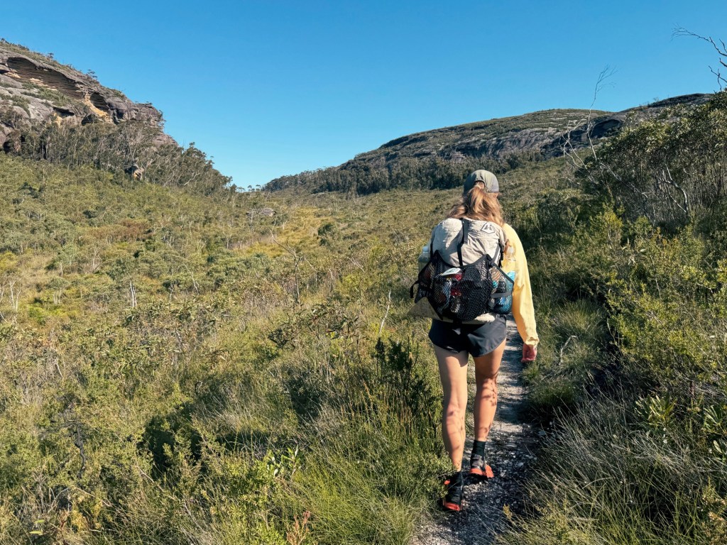
This hike can be done in a single day, but I reckon it’s best as an overnighter (the campsite is too good to miss). This section of the Wog Wog track is best for intermediate to advanced hikers. I’d rate it a solid Grade 3. The track is mostly well-worn, but it fades around rocky outcrops and across open slabs, so expect some light route-finding. We lost the trail briefly, bush-bashing through thick scrub before realising we were only two metres off. You’ll be fine if you’re confident with navigation, okay with steep sections, and don’t mind the occasional overgrown patch.
NB: If you plan on hiking past Burrumbeet Brook Campsite, Wog Wog track deteriorates quickly, becoming a Grade 5 hike (advanced hikers only).
Where to Start the Hike to Corang Arch
This out-and-back hike begins and ends at Wog Wog Campground, just over 1.5 hours north of Canberra and under 3 hours south of Sydney. Braidwood is 35-minutes south and has the essential stores like a supermarket, and bakery (I recommend grabbing a pie from Dojo Bread). Nerriga is 20 minutes north, it has a great pub, but not much else.
Where to Stay Near the Hike to Corang Arch
Wog Wog Campground has basic facilities including a drop toilet and fire pits. It’s a great place to camp the night before for an early start (bookings are required). Be sure to bring extra water if you want to avoid hiking down to Wog Wog Creek though.
Best time to Hike to Corang Arch
Corang Arch is open year-round, but autumn and spring are ideal with mild weather. Summer can be brutal (as we discovered) with the sun hammering down on exposed sections, while winter is likely to be icy cold as this area sits close to 1,000m in elevation.
Trip Report
Day 1
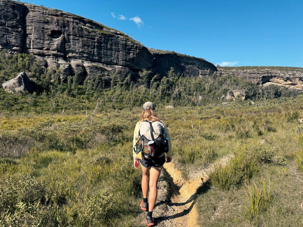
The trail begins between the toilet and info sign at Wog Wog Campground (not down the 4WD track, which leads to private property). Almost immediately, we were embraced by dry, scraggly eucalypt forest, the kind that feels quintessentially Australian.
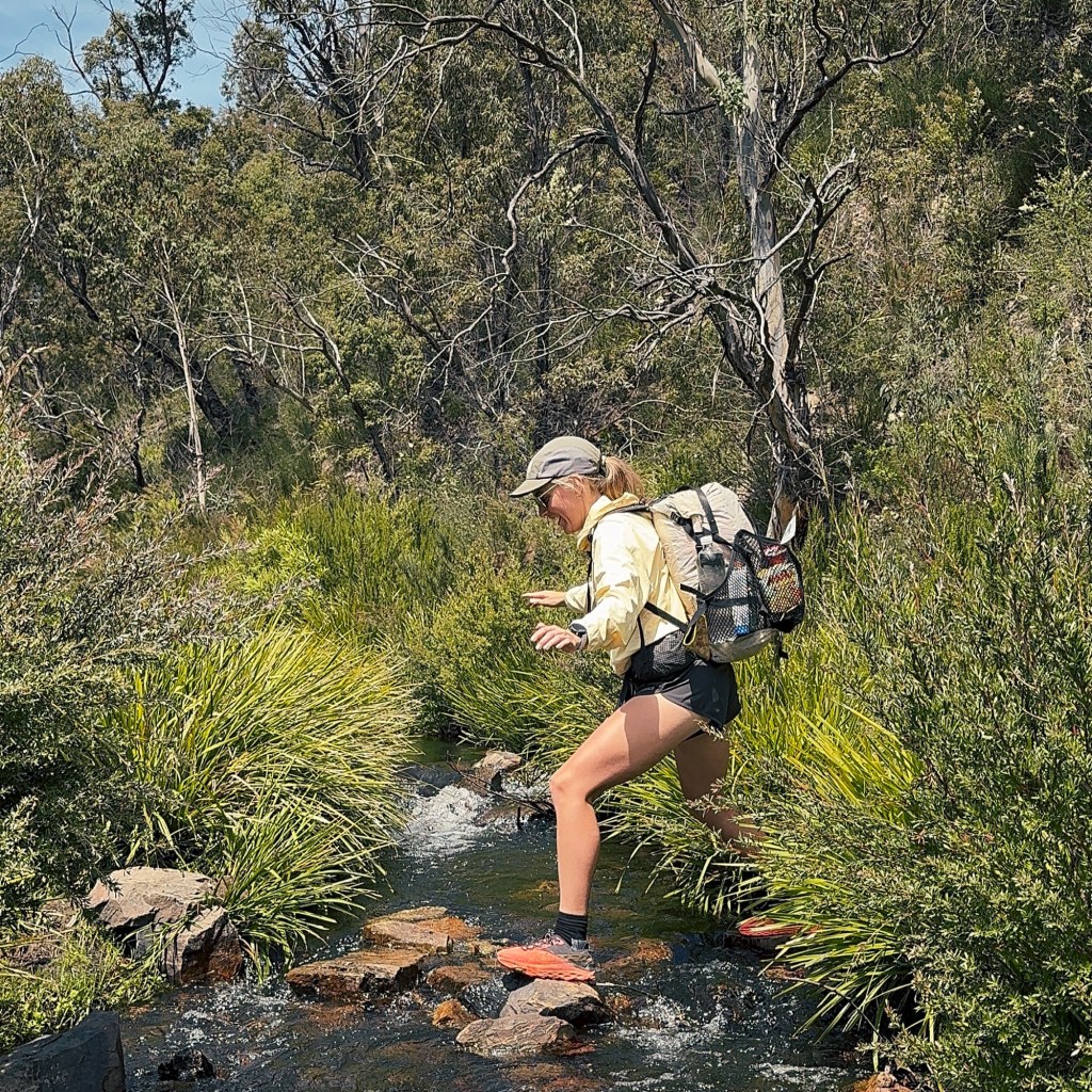
We soon came across a hefty monitor lizard sprawled across the trail, sunning itself with zero plans to move. It gave us a side-eye, and stubbornly dug its claws in, refusing to budge. We even found a little path worn around him, which made me think he does this a lot. Wog Wog Creek was running low, so the crossing was an easy rock-hop. From there, the trail climbed steadily along a mix of singletrack and old 4WD track.
Optional Side Trip: Six Towers & The Edge of Reason Lookout
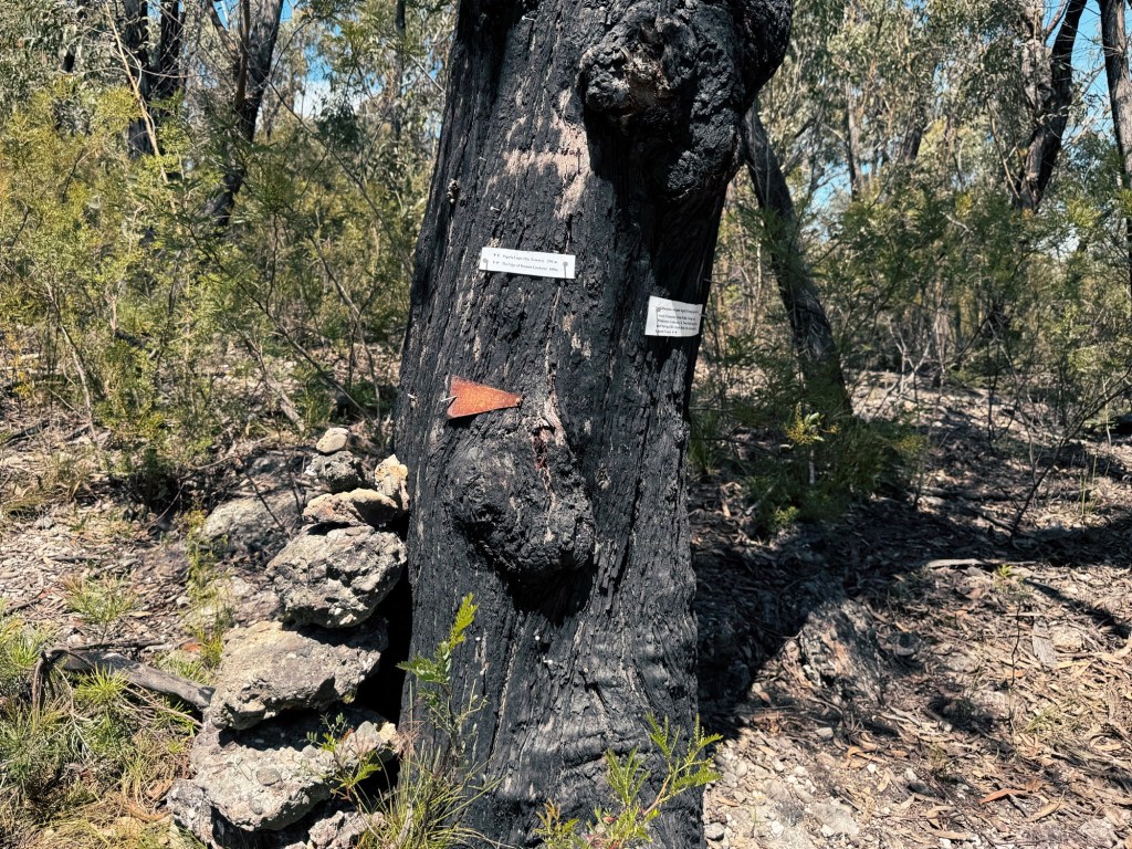
At a junction marked with flimsy laminated signs (I wouldn’t count on them surviving long), we took a short detour to Six Towers and The Edge of Reason Lookout, where rolling farmland suddenly gave way to wild bush. The contrast was stark, making a clear boundary between civilization and the rugged wilderness beyond.
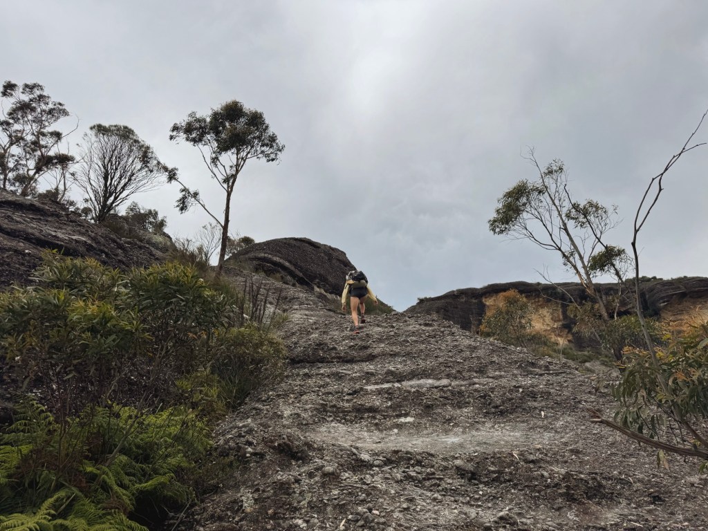
Back on the main trail, the climb steepened and the path all but vanished among rocky outcrops. GPS in hand, the little dot said we were right on track, so we pushed through scrub for a few steps. Turns out, we were about two metres off. Not exactly lost, but not on track either.
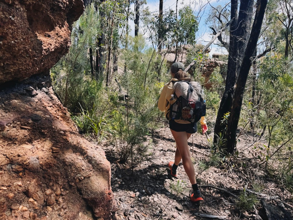
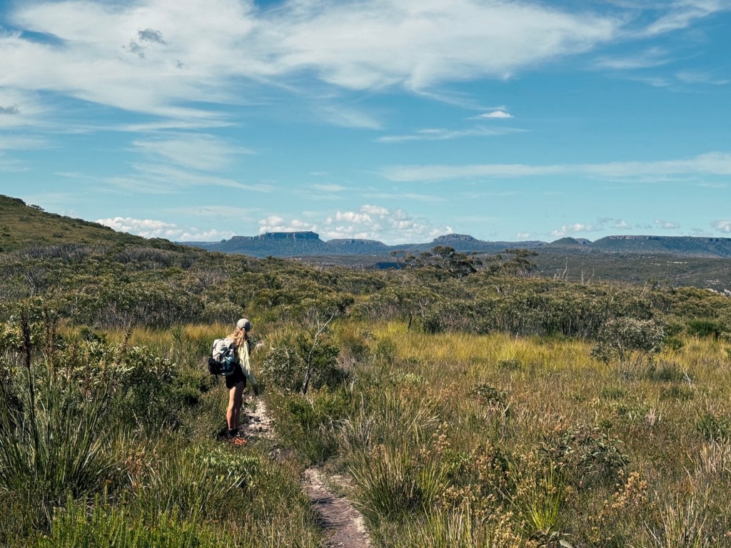
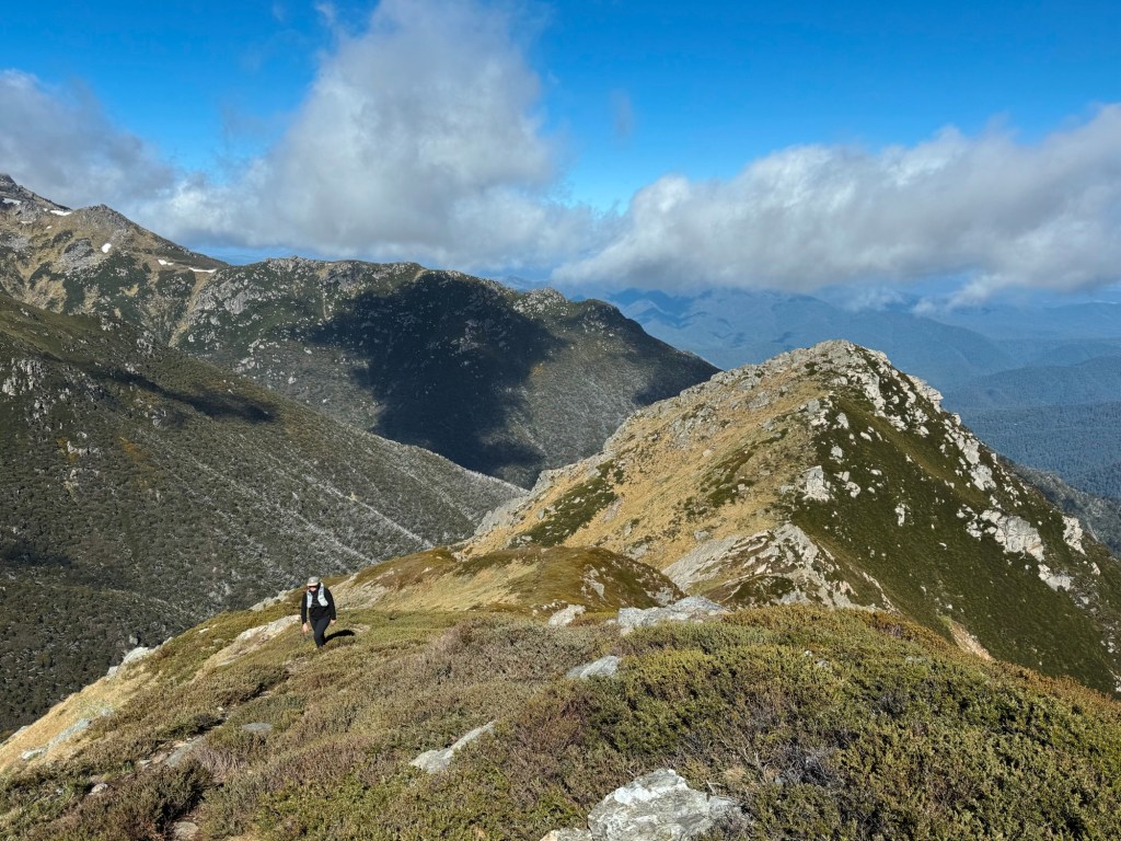
We emerged onto a high plateau with sheer drop-offs on either side and endless bushland ahead. The trail wove across smooth rock slabs, where navigation became a little tricky without a clear path but the views more than made up for it.

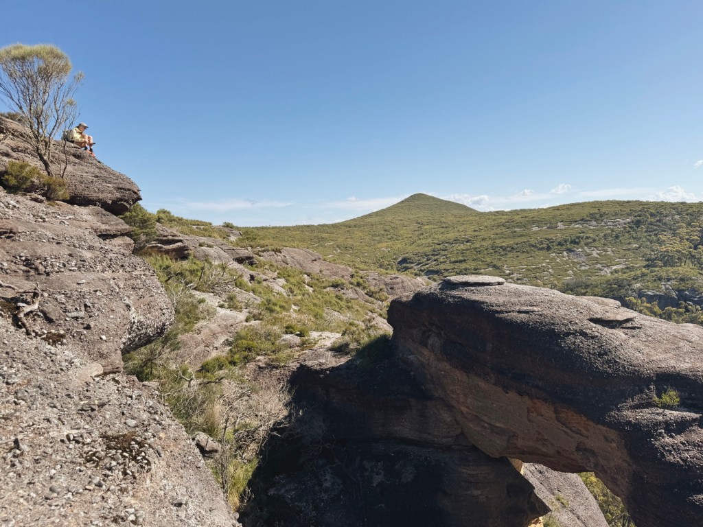
At a fork in the trail, we bypassed Corang Peak via the easier low route, which gave us our first proper view of Didthul (Pigeon House Mountain) in the distance. The trail rejoined the peak route, and not long after, a mossy arrow pointed us toward Corang Arch.

The track here was short but steep, with sheer edges, not exactly selfie territory. We sat for a while, soaking in the view of the sandstone arch, but neither of us felt brave enough to climb it (not like my younger, wilder self).
Back on the main trail, the descent began: loose, steep, and easy to lose. The track eventually veered left into dense bush and led us to Canowie Brook, where two wooden planks made for a solid crossing and a perfect refill stop. Dragonflies skimmed the water, catching the light in flashes of iridescent blue.
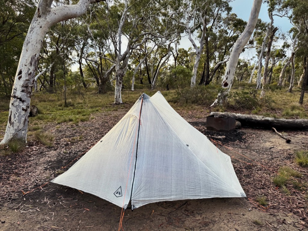
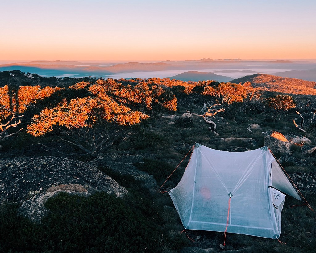
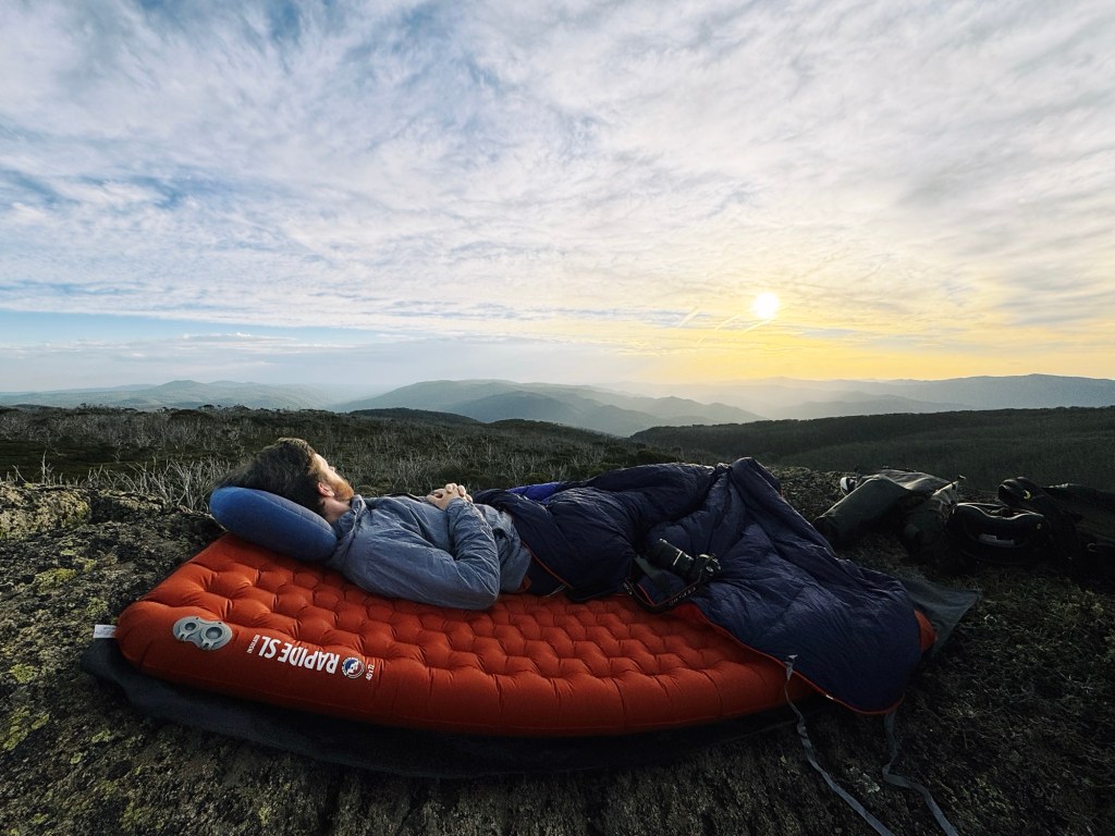
After a short climb, the trail opened into one of the most scenic sections yet, sandstone cliffs glowed in the afternoon light. One last creek crossing brought us to Burrumbeet Brook Campsite, a grassy site just off the track, with plenty of space to spread out. Below, Burrumbeet Brook trickled past, a crystal-clear water source and the perfect place to dunk our heads after a hot day on the trail.
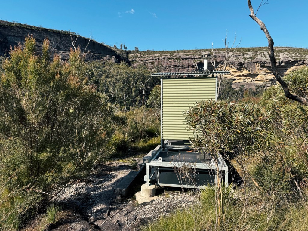
The toilet, as we discovered, wasn’t exactly close. Following the main track past the emergency helipad (no camping here), we eventually found a turnoff leading to a long-drop toilet. About 600m further along the Wog Wog walking track is Burrumbeet Cave Campsite, an approved cave camping site in the Budawangs. We didn’t check it out, but it’s a decent backup option if the weather turns and you need more shelter. It doesn’t have a toilet though, so plan accordingly.
Day 2
The return journey follows the same path, though the climb back out was just as steep as we remembered. The sandstone slabs radiated heat, and the trail felt easier to follow this time (now that we knew what was coming).
By the time we hit Wog Wog Creek, we didn’t hesitate, we walked straight in, shoes and all, soaking in the cool water.
When we finally made it back to the car, there was only one thing left on our minds: Braidwood Bakery for a cold drink and a hot pie.
Tips for Hiking to Corang Arch
- Bikes: Bikes are not allowed on any of these trails (nor would you want to try), this one’s for hikers only.
- Phone Service: Patchy. Some reception along high ridgelines (I’m with Optus), but don’t rely on it. Bring a PLB or sat phone.
- Closures: Always check for trail closures and fire bans. The Budawang Wilderness has a couple of strict camping guidelines (read here).
- Water: Wog Wog Creek is the first water source, and there’s nothing reliable again until after Corang Arch at Canowie Brook. The is water available at Burrumbeet Brook Camp but not at the Burrumbeet Cave Campsite. Carry enough to get through.
- Wildlife: Keep an eye out for snakes: we met a solid-sized tiger snake on the trail. Always carry a snake bandage and know how to use it. The Budawang Wilderness is also notorious for leeches.We didn’t get any on us in this section, but that doesn’t mean they won’t be around.
- Toilets: There’s one at Wog Wog Campground and another at Burrumbeet Brook Camp. If nature calls elsewhere, follow Leave No Trace principles.
Disclaimer: Content on Path & Pedal is for general information and inspiration only. All route guides and trip reports are based on personal experience and research at the time of writing. Conditions, access, weather, and regulations can change. Always check official sources and use your own judgment. Outdoor adventures carry risk, and Path & Pedal accepts no liability for injury, loss, or damage.

Leave a reply to Jon Harris Cancel reply